Home
States
Colorado
Connecticut
Maine
Massachusetts
New Hampshire
New York
Rhode Island
Utah
Vermont
View All
Lists
NE 4,000 Footers
NE 100 Highest
NH 4,000 Footers
NH 100 Highest
NH 52 With A View
NH Belknap Range
NH Ossipee 10
Links
Trail Conditions
Trip Log
Sunrises
Sunsets
About
|
Mt. Israel
Sandwich, NH
Trailheads, measurements, times, distances, and maps are all approximate and relative to the hike(s) as shown below.

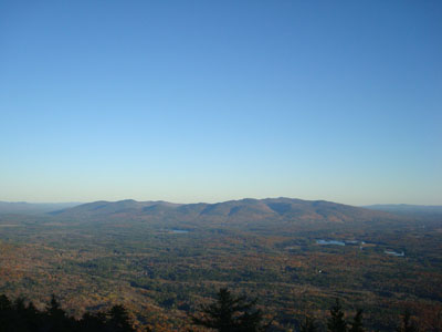
Looking down the Wentworth Trail
Route: Wentworth Trail
I decided to stay relatively local for an afternoon hike - Mt. Israel was exactly what I wanted.
While many of the leaves in the upper elevations are gone, there were still decent colors down low on the Wentworth Trail. The ascent was dry, as the high elevation snow the previous day appeared to be limited to areas a few hundred feet higher than Mt. Israel.
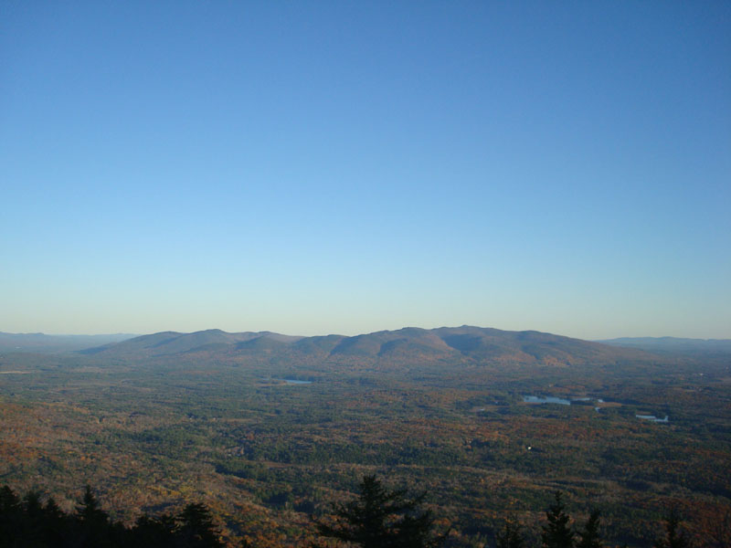
The views from the summit were tremendous as usual. Having read the White Mountain Guide before hiking, I saw a mention of a herd path to another view point (from the summit cairn, walk toward Mt. Whiteface, then toward the Ossipees). While it was a bit obscure at first, I was able to pick it up and follow it to another set of ledges that, in my opinion, had superior views - ranging from the Sandwich Dome to the Ossipees to points west of Belknap Mountain. My guess is this herd path is the remnants of the trail that ascended Mt. Israel in the first part of the twentieth century.
What a tremendous 'new' viewpoint - I think I'll be back again soon!
| Hike Ratings |
|
Getting To Trailhead: |
Easy |
| Destination: |
Mt. Israel |
|
Length: |
Moderate |
|
Steepness: |
Moderate |
|
Navigation: |
Easy |
|
Views: |
Excellent |
|
Crowds: |
Minimal |
|
| Hike Stats |
|
Date Hiked: |
Thursday, October 23, 2008 |
| Hike Commenced: |
3:42 PM |
| Parking Elevation: |
940' |
| Destination: |
Mt. Israel |
| Ascent Commenced: |
3:45 PM |
| Summit Reached: |
4:45 PM |
| Time Elapsed: |
01:00 |
| Trailhead Elevation: |
950' |
| Summit Elevation: |
2,630' |
| Distance: |
2.1 miles |
| Vertical Gain: |
1,780' |
|
|
| Hike Ended: |
6:05 PM |
| Hike Time Elapsed: |
02:23 |
| Hike Vertical Gain: |
1,920' |
|
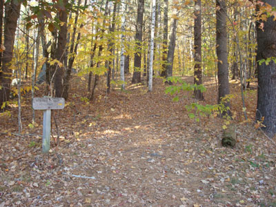
Wentworth Trail trailhead at the Mead Base Camp
The Ossipees as seen from near the Mt. Israel summit


Directions to trailhead: Take Route 109 into Center Sandwich. Route 113 will enter on your right and bear left shortly thereafter. Go straight onto Grove Street instead, bear left onto Diamond Ledge Road. Parking at the Mead Camp.
Back to Mt. Israel Profile
|