Home
States
Colorado
Connecticut
Maine
Massachusetts
New Hampshire
New York
Rhode Island
Utah
Vermont
View All
Lists
NE 4,000 Footers
NE 100 Highest
NH 4,000 Footers
NH 100 Highest
NH 52 With A View
NH Belknap Range
NH Ossipee 10
Links
Trail Conditions
Trip Log
Sunrises
Sunsets
About
|
Mt. Israel
Sandwich, NH
Trailheads, measurements, times, distances, and maps are all approximate and relative to the hike(s) as shown below.
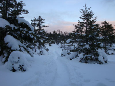
Looking up the Wentworth Trail
Route: Wentworth Trail
Now that the afternoon light (not to be confused with Afternoon Delight) is getting longer, my after work hiking options are expanding. Wanting to get in some decent vertical while perhaps catching a sunset, I decided to head over to Mt. Israel.
Arriving at the smaller than normal parking area (due to the snow), I was happy to see the trail was broken out and well packed. As such, I was able to make fairly decent time, despite making numerous short pauses to take photos of the low angle sunlight hitting the trail.
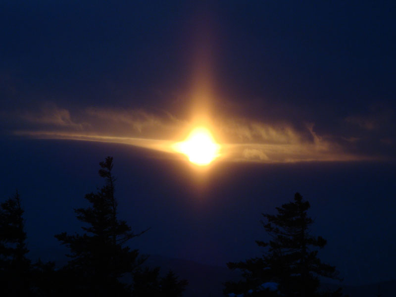
Nearing the false summit, I suspected I wouldn't be seeing any sunset colours, as the west was filling in with storm clouds. To my surprise, I caught a glimpse of the sun breaking through a thick cloud a few minutes before the sunset time.
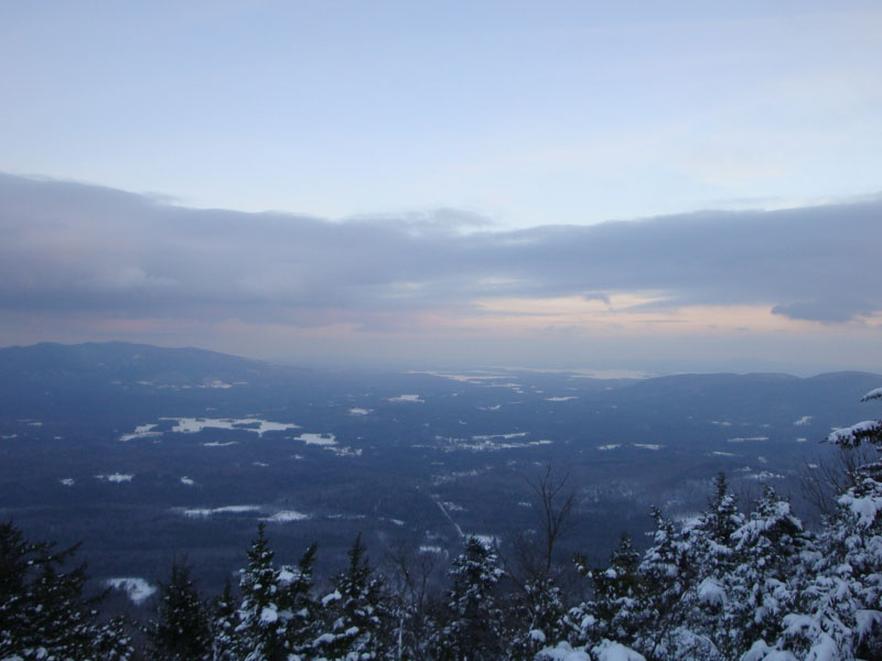
As I neared the true summit, the clouds to the east took on a bit of colour, making for a neat final stretch. Arriving at the cairn, the views were fairly good to the west (as far southwest as Tenney Mountain), but not too strong to the north (much of the Sandwich Range looked to be in some sort of snowstorm.
In my opinion, the best views from Mt. Israel are from a northeastern ledge. Though not broken out, it was fairly easy going to reach it. Though the Sandwich Range was mostly obscured, there were still decent views of the Ossipees, Lake Winnipesaukee, and Red Hill from the various northeastern ledges.
Back at the summit, I could see the actual sunset would not be on display tonight, so I continued past the cairn and back down the Wentworth Trail. Despite the lack of actual sunset, there were some nice colors to the south throughout most of the descent, ranging from pinks to oranges. Though there was no moonlight, the snow provided enough light for me to make it back without using a headlamp.
| Hike Ratings |
|
Getting To Trailhead: |
Easy |
| Destination: |
Mt. Israel |
|
Length: |
Moderate |
|
Steepness: |
Moderate |
|
Navigation: |
Easy |
|
Views: |
Excellent |
|
Crowds: |
Minimal |
|
| Hike Stats |
|
Date Hiked: |
Thursday, January 22, 2009 |
| Parking Elevation: |
940' |
| Destination: |
Mt. Israel |
| Time Elapsed: |
01:01 |
| Trailhead Elevation: |
950' |
| Summit Elevation: |
2,630' |
| Distance: |
2.1 miles |
| Vertical Gain: |
1,780' |
|
|
| Hike Time Elapsed: |
02:04 |
| Hike Vertical Gain: |
1,920' |
|
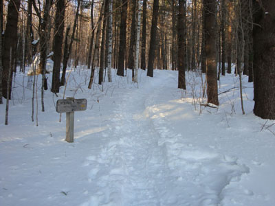
Wentworth Trail trailhead at the Mead Base Camp
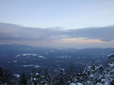
The Ossipees, Lake Winnipesaukee, and Red Hill as seen from near the Mt. Israel summit
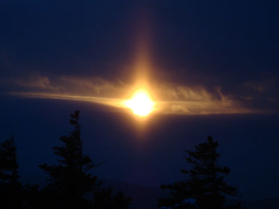
The early stages of the sunset as seen from near the Mt. Israel summit
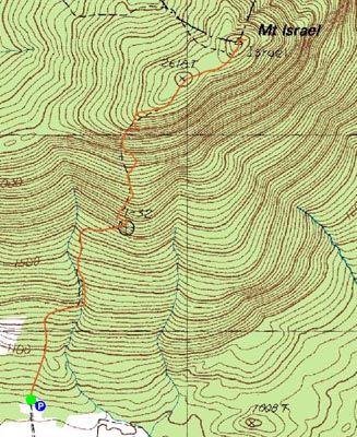

Directions to trailhead: Take Route 109 into Center Sandwich. Route 113 will enter on your right and bear left shortly thereafter. Go straight onto Grove Street instead, bear left onto Diamond Ledge Road. Parking at the Mead Camp.
Back to Mt. Israel Profile
|