Home
States
Colorado
Connecticut
Maine
Massachusetts
New Hampshire
New York
Rhode Island
Utah
Vermont
View All
Lists
NE 4,000 Footers
NE 100 Highest
NH 4,000 Footers
NH 100 Highest
NH 52 With A View
NH Belknap Range
NH Ossipee 10
Links
Trail Conditions
Trip Log
Sunrises
Sunsets
About
|
Mt. Israel
Sandwich, NH
Trailheads, measurements, times, distances, and maps are all approximate and relative to the hike(s) as shown below.
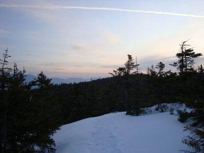
Looking up the Wentworth Trail
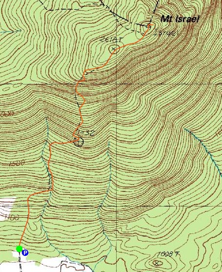
Route: Wentworth Trail
It was finally time for a Mt. Israel sunrise hike. Ever since finding the northeast ledges, I had wanted to see the sunrise from that vista. I had planned to do it a few times, however weather and sleep tended to interfere. Not today.
I was a bit vexed to see the Mead Base Camp access road wasn't completely plowed - it had been plowed earlier in the winter, however at this point there was a snowbank in my way, adding about 5 minutes to the beginning of the hike.
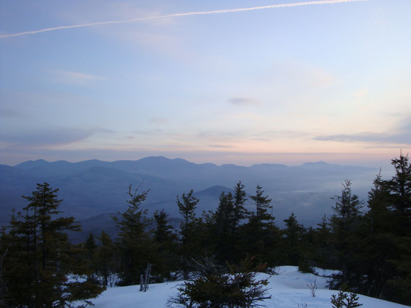
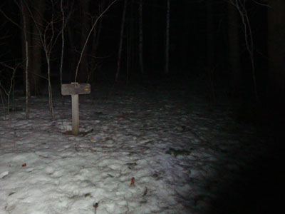
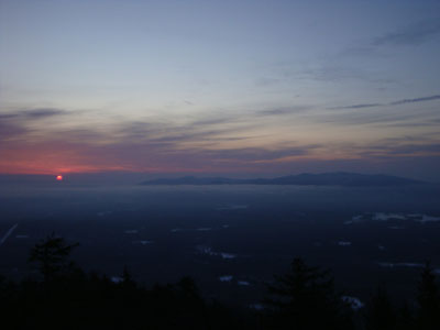
After passing the water crossings, I turned off my headlamp and continued my ascent by moonlight. As I climbed, I noted what seemed to be fresh moose tracks. Reaching the false summit, I heard some walking ahead of me - the crunching of my snowshoes on the frozen granular snow must have woken him (or her) up. As I neared the summit, I noted the tracks descended down the Mead Trail - smart moose! Reaching the summit, I could see some great colors in the horizon. Reaching my favorite northeast view ledge, I was pleased to see an undercast had settled in the valley, making the Ossipee Mountains appear like an island.
The best colors of the sunrise were early on, with deep pinks and purples. Nonetheless, there were great colors for over half an hour - in fact, I ran out viewing time!
The descent was pleasant, as temperatures continued to warm and the sunlight started to creep out. What a nice morning!
| Hike Ratings |
|
Getting To Trailhead: |
Moderate |
| Destination: |
Mt. Israel |
|
Length: |
Moderate |
|
Steepness: |
Moderate |
|
Navigation: |
Easy |
|
Views: |
Excellent |
|
Crowds: |
Minimal |
|
| Hike Stats |
|
Date Hiked: |
Tuesday, March 17, 2009 |
| Hike Commenced: |
5:29 AM |
| Parking Elevation: |
940' |
| Destination: |
Mt. Israel |
| Ascent Commenced: |
5:34 AM |
| Summit Reached: |
6:29 AM |
| Time Elapsed: |
00:55 |
| Trailhead Elevation: |
950' |
| Summit Elevation: |
2,630' |
| Distance: |
2.1 miles |
| Vertical Gain: |
1,780' |
|
|
| Hike Ended: |
7:56 AM |
| Hike Time Elapsed: |
02:27 |
| Hike Vertical Gain: |
1,970' |
|
Wentworth Trail trailhead at the Mead Base Camp

The Sandwich Range as seen from the Mt. Israel summit

The sunrise as seen from near the Mt. Israel summit
Undercast and the Ossipees as seen from near the Mt. Israel summit


Directions to trailhead: Take Route 109 into Center Sandwich. Route 113 will enter on your right and bear left shortly thereafter. Go straight onto Grove Street instead, bear left onto Diamond Ledge Road. Parking at the Mead Camp.
Back to Mt. Israel Profile
|