Home
States
Colorado
Connecticut
Maine
Massachusetts
New Hampshire
New York
Rhode Island
Utah
Vermont
View All
Lists
NE 4,000 Footers
NE 100 Highest
NH 4,000 Footers
NH 100 Highest
NH 52 With A View
NH Belknap Range
NH Ossipee 10
Links
Trail Conditions
Trip Log
Sunrises
Sunsets
About
|
Mt. Israel
Sandwich, NH
Trailheads, measurements, times, distances, and maps are all approximate and relative to the hike(s) as shown below.
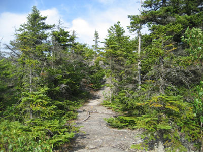
Looking up the Wentworth Trail near the summit
Route: Wentworth Trail
With another day of warm temperatures and possible thunderstorms, I decided to stay local and head up to Mt. Israel.
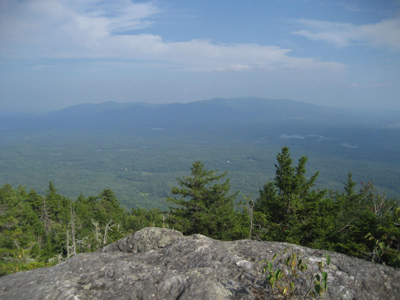
While I was able to jog up past the brook section, the heat and a lack of conditioning overtook me, pushing me into hiking mode thereafter. Upon reaching the summit, I followed a herd path to the northeastern ledges (from the summit cairn walk toward Mt. Chocorua, then curve right, drop down a slight scramble, then emerge at the ledges), where I had hazy views of the Sandwich and Ossipee Ranges.
While I was tempted to jog back down, I ended up walking most of it due to being a bit fatigued from the warm temperatures and other assorted excuses. Nonetheless, it was nice to get out for a few hours.
| Hike Ratings |
|
Getting To Trailhead: |
Easy |
| Destination: |
Mt. Israel |
|
Length: |
Moderate |
|
Steepness: |
Moderate |
|
Navigation: |
Easy |
|
Views: |
Excellent |
|
Crowds: |
Minimal |
|
| Hike Stats |
|
Date Hiked: |
Wednesday, August 4, 2010 |
| Hike Commenced: |
3:59 PM |
| Parking Elevation: |
940' |
| Destination: |
Mt. Israel |
| Ascent Commenced: |
4:00 PM |
| Summit Reached: |
4:47 PM |
| Time Elapsed: |
00:47 |
| Trailhead Elevation: |
950' |
| Summit Elevation: |
2,630' |
| Distance: |
2.1 miles |
| Vertical Gain: |
1,780' |
|
|
| Hike Ended: |
5:56 PM |
| Hike Time Elapsed: |
01:57 |
| Hike Vertical Gain: |
1,920' |
|
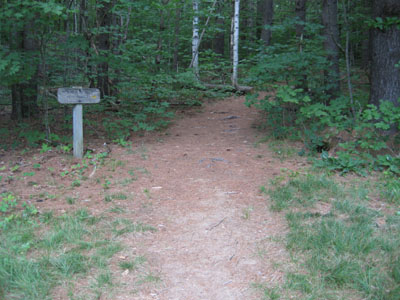
Wentworth Trail trailhead at the Mead Base Camp

Hazy views of the Ossipees from the northeastern ledges near the Mt. Israel summit
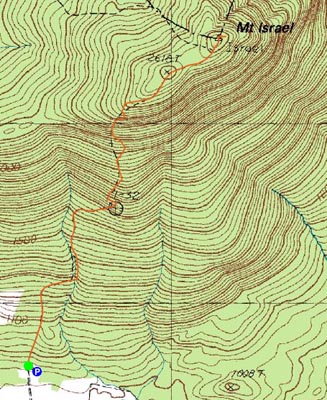

Directions to trailhead: Take Route 109 into Center Sandwich. Route 113 will enter on your right and bear left shortly thereafter. Go straight onto Grove Street instead, bear left onto Diamond Ledge Road. Parking at the Mead Camp.
Back to Mt. Israel Profile
|