Home
States
Colorado
Connecticut
Maine
Massachusetts
New Hampshire
New York
Rhode Island
Utah
Vermont
View All
Lists
NE 4,000 Footers
NE 100 Highest
NH 4,000 Footers
NH 100 Highest
NH 52 With A View
NH Belknap Range
NH Ossipee 10
Links
Trail Conditions
Trip Log
Sunrises
Sunsets
About
|
Mt. Jefferson
Thompson and Meserve's Purchase, NH
Trailheads, measurements, times, distances, and maps are all approximate and relative to the hike(s) as shown below.
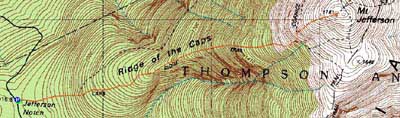
The Caps Ridge Trail
Route: Caps Ridge Trail
After days of fair to poor weather, a nice forecast pushed me toward the Presidentials.
As I worked my way up the Caps Ridge Trail, I was a bit worried about some dark clouds looming overhead. As I climbed, these seemed to move out a bit.
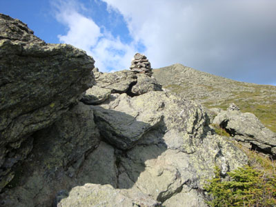
Reaching treeline, I was slowed a bit due to my achilles. Pushing my way up the scrambles, I could hear a chopper moving in. As I neared the traprock portion of the trail, a search and rescue chopper flew over the horizon at a very low altitude. I could not help but watch it as it worked its way along the Gulfside Trail down past Mt. Washington.
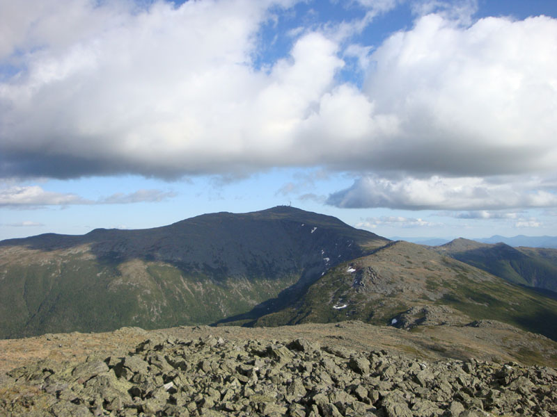
Reaching the summit, I had pretty good views in all directions, though the higher summits were darkened by overhead clouds.
The descent took a bit longer than I would have hoped, however I was able to make it back to the trailhead well before sunset. In addition to seeing some alpine flowers in bloom, another positive thing was that bugs were not an issue.
| Hike Ratings |
|
Getting To Trailhead: |
Easy |
| Destination: |
Mt. Jefferson |
|
Length: |
Moderate |
|
Steepness: |
Very Difficult |
|
Navigation: |
Moderate |
|
Views: |
Excellent |
|
Crowds: |
Heavy |
|
| Hike Stats |
|
Date Hiked: |
Tuesday, June 16, 2009 |
| Hike Commenced: |
4:25 PM |
| Parking Elevation: |
3,009' |
| Destination: |
Mt. Jefferson |
| Ascent Commenced: |
4:25 PM |
| Summit Reached: |
5:57 PM |
| Time Elapsed: |
01:32 |
| Trailhead Elevation: |
3,009' |
| Summit Elevation: |
5,712' |
| Distance: |
2.5 miles |
| Vertical Gain: |
2,768' |
|
|
| Hike Ended: |
7:38 PM |
| Hike Time Elapsed: |
03:13 |
| Hike Distance: |
5 miles |
| Hike Vertical Gain: |
2,833' |
|
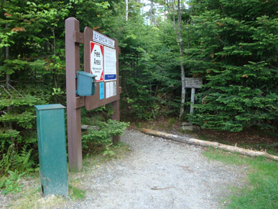
Caps Ridge Trail trailhead at Jefferson Notch
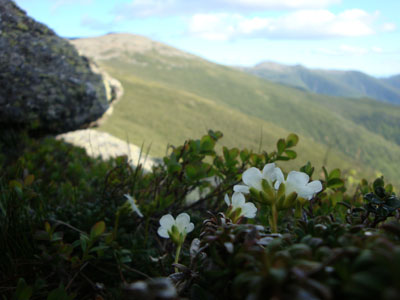
Diapensia along the Caps Ridge Trail

Looking at Mt. Adams from Mt. Jefferson

Directions to trailhead: Take Route 302 West from Bartlett into Carroll. Just after Saco Lake, take a right onto Mt. Clinton Road. Cross over Base Road and continue on Jefferson Notch Road. At the high point of the road, the WMNF fee parking lot will be on the right. The Caps Ridge Trail trailhead is at the back of the parking lot.
Back to Mt. Jefferson Profile
|