Home
States
Colorado
Connecticut
Maine
Massachusetts
New Hampshire
New York
Rhode Island
Utah
Vermont
View All
Lists
NE 4,000 Footers
NE 100 Highest
NH 4,000 Footers
NH 100 Highest
NH 52 With A View
NH Belknap Range
NH Ossipee 10
Links
Trail Conditions
Trip Log
Sunrises
Sunsets
About
|
Mt. Kancamagus
Livemore, NH
Trailheads, measurements, times, distances, and maps are all approximate and relative to the hike(s) as shown below.
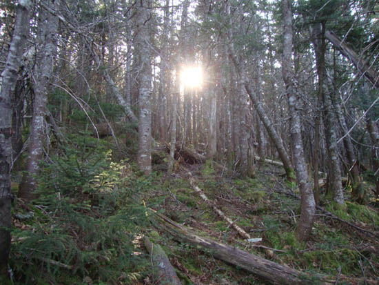
One of the more open areas on the way up Mt. Kancamagus
Route: Bushwhack
With the afternoon still available after a morning hike up Eagle Cliff, we headed up the Kanacamagus to hike Mt. Kancamagus.
We cheated and used a GPS to find a decent place to start the bushwhack - we opted for starting at one of the curves east of the overlook, parking on a grassy shoulder of the road (we soon found there was a dirt pulloff just around the curve on the other side of the road, oh well). After crossing over a brook while walking on the road, we entered the woods and started to climb the shoulder of a subpeak of Mt. Kanacamagus. We found the woods to be sprucy with less than optimal footing in places (ie postholing in dirt or moss). Shortly after crossing a brook, we angled a bit more toward the ridge of the subpeak, then headed up the falline proper toward the summit.
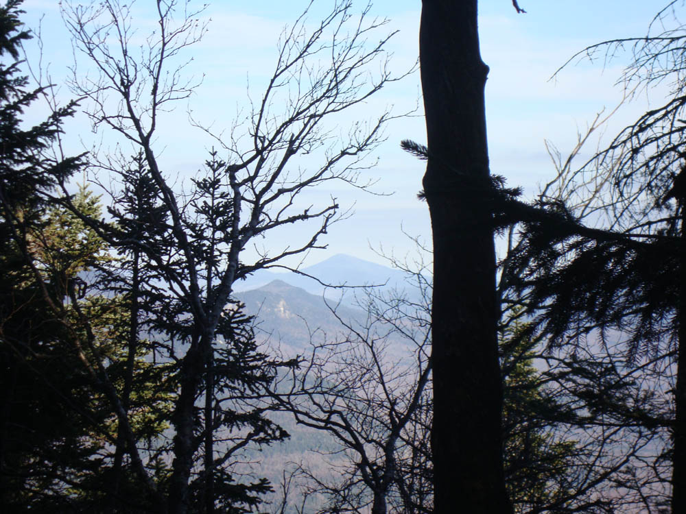
While we hit on occasional patch of open area (usually a very small hobblebush glade or mossy area), the woods tended to generally be spruce with a few hardwoods mixed in. Reaching the top of the ridge, we wound up on a herd path to the recognized summit. Though pretty well forested, I was able to get very restricted views to the east.
We went a bit west of our ascent line for the descent at first, hitting thick spruce. Eventually correcting our course back east a bit, we hit the mediocre woods for the balance of the descent.
| Hike Ratings |
|
Getting To Trailhead: |
Moderate |
| Destination: |
Mt. Kancamagus |
|
Length: |
Moderate |
|
Steepness: |
Moderate |
|
Navigation: |
Difficult |
|
Views: |
Minimal |
|
Crowds: |
Minimal |
|
| Hike Stats |
|
Date Hiked: |
Sunday, November 14, 2010 |
| Hike Commenced: |
12:32 PM |
| Parking Elevation: |
2,600' |
| Destination: |
Mt. Kancamagus |
| Ascent Commenced: |
12:34 PM |
| Summit Reached: |
1:35 PM |
| Time Elapsed: |
01:01 |
| Trailhead Elevation: |
2,580' |
| Summit Elevation: |
3,763' |
| Vertical Gain: |
1,183' |
|
|
| Hike Ended: |
2:59 PM |
| Hike Time Elapsed: |
02:27 |
| Hike Vertical Gain: |
1,203' |
|
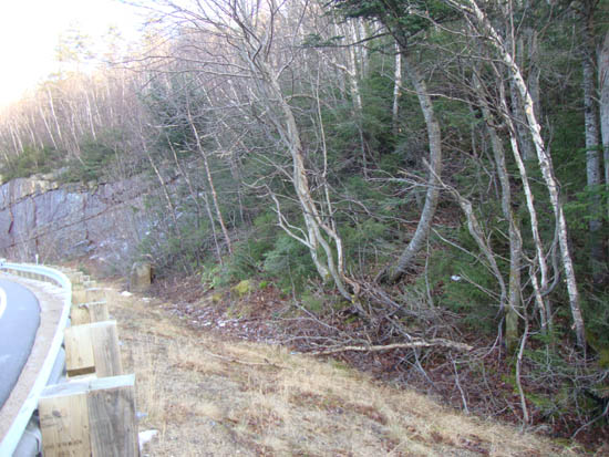
Entering the woods on a curve east of Kancamagus Pass on Route 112

Slight views toward Kearsarge North Mountain from Mt. Kancamagus
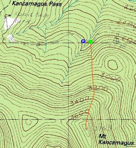

Directions to trailhead: Of the many ways to approach Mt. Kancamagus, one can drive east on Route 112 from Kanacamgus Pass and park roadside, hiking south to the peak.
Back to Mt. Kancamagus Profile
|