Home
States
Colorado
Connecticut
Maine
Massachusetts
New Hampshire
New York
Rhode Island
Utah
Vermont
View All
Lists
NE 4,000 Footers
NE 100 Highest
NH 4,000 Footers
NH 100 Highest
NH 52 With A View
NH Belknap Range
NH Ossipee 10
Links
Trail Conditions
Trip Log
Sunrises
Sunsets
About
|
Mt. Kancamagus
Livemore, NH
Trailheads, measurements, times, distances, and maps are all approximate and relative to the hike(s) as shown below.
Bushwhacking to Mt. Kancamagus
Route: Livermore Trail, bushwhack
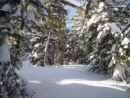
The first few tenths of the Livermore Trail was plowed due to an active logging project. Thereafter, the sum of the recent storms resulted in breaking trail in about 18-24" of powder. We broke up to the last water crossing (where the trail climbs steeply to the left), the headed up into the birch glade and worked our way around the false peak (staying south of the ridge to avoid blowdown and thicker spruce) to the recognized summit, generally in good woods.
| Hike Ratings |
|
Getting To Trailhead: |
Easy |
| Destination: |
Mt. Kancamagus |
|
Length: |
Moderate |
|
Steepness: |
Difficult |
|
Navigation: |
Difficult |
|
Views: |
Minimal |
|
Crowds: |
Minimal |
|
| Hike Stats |
|
Date Hiked: |
Saturday, January 4, 2014 |
| Parking Elevation: |
2,600' |
| Destination: |
Mt. Kancamagus |
| Time Elapsed: |
03:13 |
| Trailhead Elevation: |
2,060' |
| Summit Elevation: |
3,763' |
| Vertical Gain: |
1,753' |
|
|
| Hike Time Elapsed: |
05:17 |
| Hike Vertical Gain: |
1,803' |
|
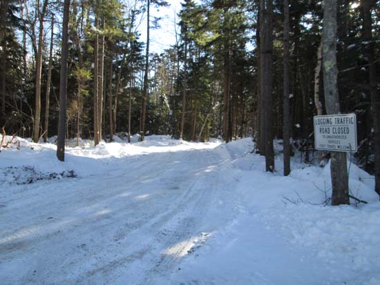
The Livermore Trail trailhead on Route 112
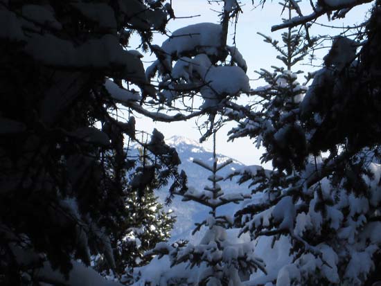
Slight views toward Mt. Chocorua from Mt. Kancamagus
Directions to trailhead: The Livermore Trail trailhead is located east of Lincoln and the Kancamagus height of land, across from Lily Pond. There is limited room to park roadside next to Lily Pond.
Back to Mt. Kancamagus Profile
|

