Home
States
Colorado
Connecticut
Maine
Massachusetts
New Hampshire
New York
Rhode Island
Utah
Vermont
View All
Lists
NE 4,000 Footers
NE 100 Highest
NH 4,000 Footers
NH 100 Highest
NH 52 With A View
NH Belknap Range
NH Ossipee 10
Links
Trail Conditions
Trip Log
Sunrises
Sunsets
About
|
Mt. Katherine
Tamworth, NH, Sandwich, NH
Trailheads, measurements, times, distances, and maps are all approximate and relative to the hike(s) as shown below.
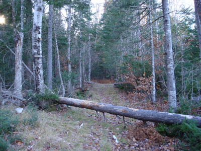
Looking up the Mount Katherine Trail
Route: Red Path, (unknown private road), Red Path, Mt. Katherine Trail, unknown summit herd path, Mt. Katherine Trail, Red Path
I had been intending to visit Mt. Katherine for over a month, since seeing there were trails to this tiny "mountain" while hiking back from Mt. Whiteface.
Parking near the Wonalancet Church, I walked down the "Red Path" road...and became stupidly confused by some tiny orange blazes and a spray painted number and "Red Path" sign. I followed this for a good fraction of a mile, before deciding to head back to the dirt road and go straight (I knew I could simply follow some logging roads to it, but I didn't know what was private property and what wasn't.
I definitely looked too much into this, as all I had needed to do was go straight - there are some small "Trail" signs to follow, but again just go straight down the dirt road through the fields!
After passing just to the left of a house next to a second large field, I continued slightly to the left and finally hit the woodline.
The steepest portion of the trail starts here - and continues up to the Mt. Katherine Trail junction. Not that steep or long.
The Mt. Katherine Trail is pretty close to flat - with a nice view back at Mt. Whiteface along the way - continuing to the summit. I'm not sure where the summit technically is, but I assume it's pretty close to the ledges (just to the left of the trail before it starts to drop downhill again).
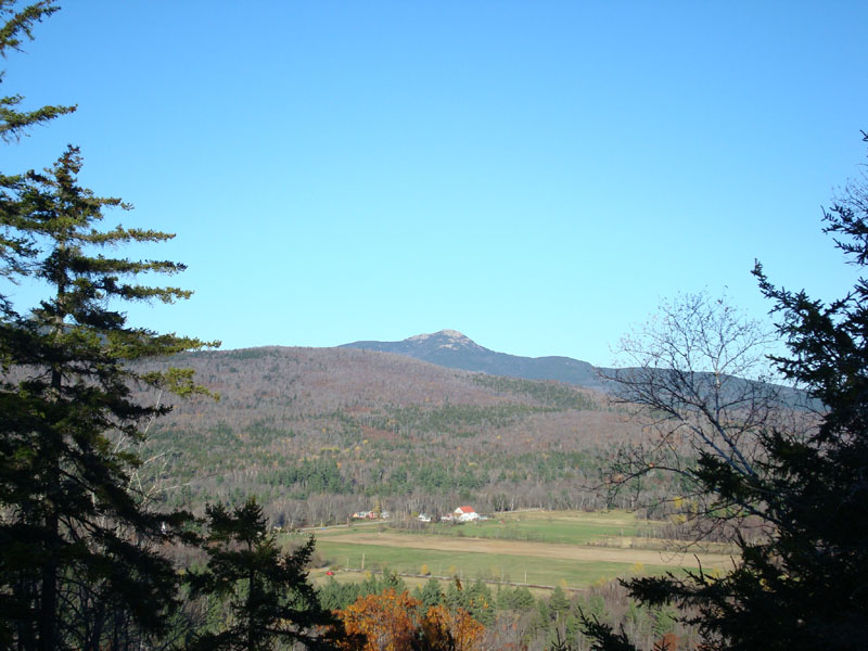
The views from this hill are nice - especially for the minimal effort to get there - a nice look over Wonalancet at Mt. Chocorua and some views of the Sandwich Range mountains west of it.
All in all, a nice easy hike. Just a bit under 2.5 miles roundtrip without my messup at the beginning.
| Hike Ratings |
|
Getting To Trailhead: |
Easy |
| Destination: |
Mt. Katherine |
|
Length: |
Easy |
|
Steepness: |
Easy |
|
Navigation: |
Easy |
|
Views: |
Excellent |
|
Crowds: |
Minimal |
|
| Hike Stats |
|
Date Hiked: |
Friday, November 2, 2007 |
| Hike Commenced: |
3:27 PM |
| Parking Elevation: |
1,105' |
| Destination: |
Mt. Katherine |
| Ascent Commenced: |
3:45 PM |
| Summit Reached: |
3:59 PM |
| Time Elapsed: |
00:14 |
| Trailhead Elevation: |
1,120' |
| Summit Elevation: |
1,400' |
| Vertical Gain: |
285' |
|
|
| Hike Ended: |
4:28 PM |
| Hike Time Elapsed: |
01:01 |
| Hike Vertical Gain: |
320' |
|
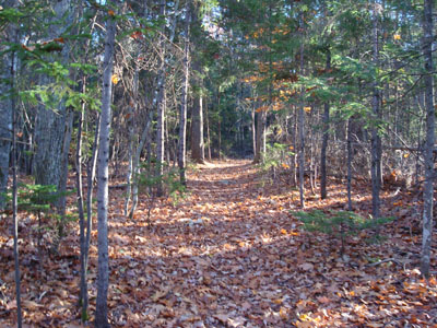
The start of the Red Path after passing through the roads/fields

Looking northeast at Mt. Chocorua from the ledges near the summit of Mt. Katherine
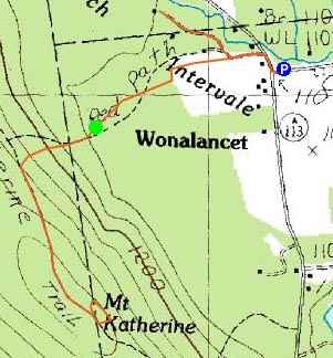

Directions to trailhead: Take Route 113A West from Tamworth to Wonalancet. There is no parking available on the Red Path, however there is room to park near the church on 113A. Walk up Ferncroft Road and take the first left after the mailbox area. Continue straight down this private dirt road, past the end of the field and continue straight (to the left) of a house in a second field. Continue down this field, tilting a bit to the left (there are some blazes and 'Trail' signs along the way) to the tree line, where there is another 'Trail' sign pointing at the woods trail.
Back to Mt. Katherine Profile
|