Home
States
Colorado
Connecticut
Maine
Massachusetts
New Hampshire
New York
Rhode Island
Utah
Vermont
View All
Lists
NE 4,000 Footers
NE 100 Highest
NH 4,000 Footers
NH 100 Highest
NH 52 With A View
NH Belknap Range
NH Ossipee 10
Links
Trail Conditions
Trip Log
Sunrises
Sunsets
About
|
Mt. Klem, Mt. Mack
Gilford, NH
Trailheads, measurements, times, distances, and maps are all approximate and relative to the hike(s) as shown below.
The Round Pond Trail
Route: Fire Road, Round Pond Trail, Round Pond-Piper Link, Red Trail, Red-Orange Trail, Orange Trail
Trails were generally dry with some leaf obscured minor mud and puddles. Some wet ledges that could ice up overnight, but probably not significant enough to warrant light traction in the morning.
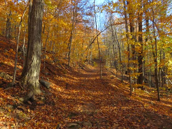
With the exception of a short portion of rebuilt logging road near the start of the Fire Road, this is a nice, scenic 6.5 mile loop that's generally pretty nice to trail run. Still some nice late fall foliage colors as well.
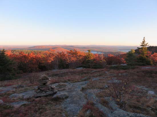
Decent sunset from Mack. Annoyed a beaver near the shore of Round Pond while descending in the dark. Also heard either a coyote or bear above the Round Pond Trail-Fire Road junction while descending.
| Hike Ratings |
|
Getting To Trailhead: |
Easy |
| Destination: |
Mt. Klem |
|
Length: |
Moderate |
|
Steepness: |
Moderate |
|
Navigation: |
Easy |
|
Views: |
Excellent |
|
Crowds: |
Minimal |
| Destination: |
Mt. Mack |
|
Length: |
Moderate |
|
Steepness: |
Difficult |
|
Navigation: |
Easy |
|
Views: |
Excellent |
|
Crowds: |
Minimal |
|
| Hike Stats |
|
Date Hiked: |
Friday, October 30, 2015 |
| Parking Elevation: |
1,100' |
| Destination: |
Mt. Klem |
| Trailhead Elevation: |
1,100' |
| Summit Elevation: |
2,001' |
| Time Elapsed: |
00:46 |
| Vertical Gain: |
1,061' |
| Destination: |
Mt. Mack |
| Trailhead Elevation: |
2,001' |
| Summit Elevation: |
1,945' |
| Time Elapsed: |
00:20 |
| Vertical Gain: |
216' |
|
|
| Hike Time Elapsed: |
02:04 |
| Hike Vertical Gain: |
1,427' |
|
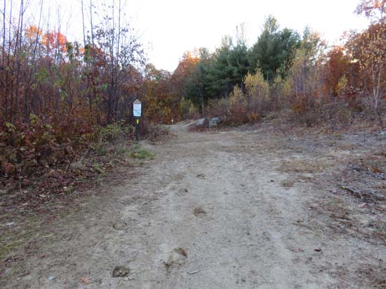
The East Gilford-Fire Road trailhead at the end of Wood Road
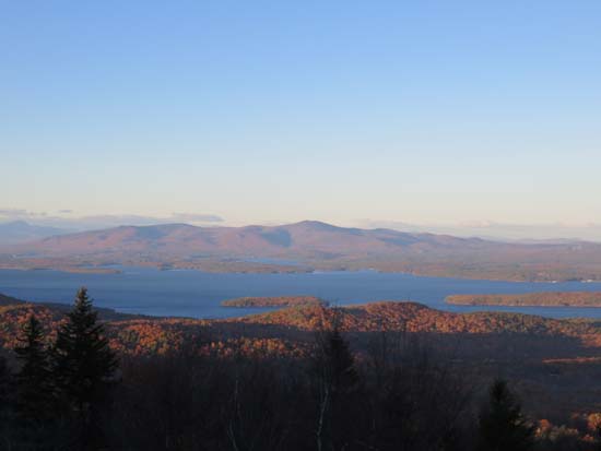
Looking at the Ossipees from near the Mt. Klem summit
The trail between the peaks
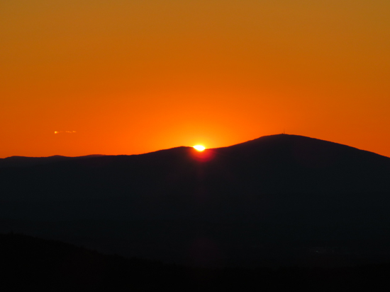
The sunset from Mt. Mack
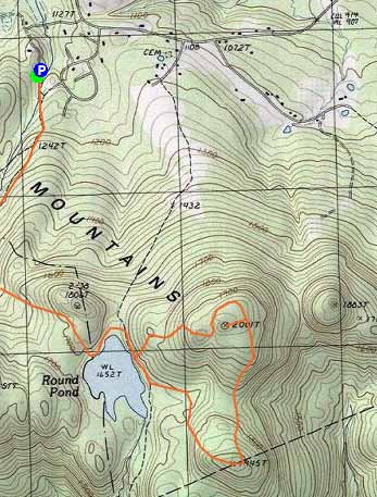

Directions to trailhead: From Route 11A East past Gunstock, then take a right onto Bickford Road, then take a left onto Wood Road, soon bearing left to go uphill around the last house. The Fire Road-East Gilford Trail trailhead will be at the back of the 5 car parking lot at the end of the road.
Back to Mt. Klem Profile
Back to Mt. Mack Profile
|


