Home
States
Colorado
Connecticut
Maine
Massachusetts
New Hampshire
New York
Rhode Island
Utah
Vermont
View All
Lists
NE 4,000 Footers
NE 100 Highest
NH 4,000 Footers
NH 100 Highest
NH 52 With A View
NH Belknap Range
NH Ossipee 10
Links
Trail Conditions
Trip Log
Sunrises
Sunsets
About
|
Mt. Lafayette, Mt. Truman, Mt. Lincoln
Franconia, NH, Lincoln, NH
Trailheads, measurements, times, distances, and maps are all approximate and relative to the hike(s) as shown below.
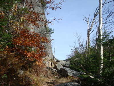
Looking up the Greenleaf Trail at Eagle Pass
Route: Greenleaf Trail, (Mt. Lafayette), Franconia Ridge Trail, (Mt. Truman), Franconia Ridge Trail, (Mt. Lincoln), Franconia Ridge Trail, (Mt. Truman), Franconia Ridge Trail, (Mt. Lafayette), Greenleaf Trail
After a cloudy day, I decided to take a half day and head up to Franconia Notch. Since I had previously hiked the traditional OBP-FW loop in both directions, I decided to check out the Greenleaf Trail.
After parking at the Cannon Mountain Tramway parking area, I walked under the highway and to the trailhead. The first portion of the trail was a noisy, fairly level highway parallel. After the previous exit's parking area was visible through the trees, the trail soon started to climb via some traverses. As it climbed, the views through the trees were quite nice of the surrounding area.
Eagle Pass was really neat, as the trail walks literally at the foot of Eagle Cliff. Soon thereafter, the trail wraps around the back of the ridge and the noise of the highway disappears.
From there, the trail was a bit of a due slog, though there were some nice views across to the next ridge through the trees. After awhile, the trail passed through a mossy area and soon became flat as it reached the hut.
Not long after this, my energy dropped (perhaps because I was more than ready to eat some lunch). Once I made it to the summit, I took a break to enjoy the views and a sandwich.
My next stop was Mt. Lincoln, via Mt. Truman. Though a bit busy, it was a nice ridge walk.
On Mt. Lincoln I had another snack and took in the scenery. Though there was a decent cloud layer nearby, the blue skies in the immediate area made for great views.
Since I was parked at the Tramway area, I retraced my steps. By the time I reached the parking area, clouds had overtaken the sky far above. Not bad timing!
| Hike Ratings |
|
Getting To Trailhead: |
Easy |
| Destination: |
Mt. Lafayette |
|
Length: |
Moderate |
|
Steepness: |
Difficult |
|
Navigation: |
Easy |
|
Views: |
Excellent |
|
Crowds: |
Heavy |
| Destination: |
Mt. Truman |
|
Length: |
Moderate |
|
Steepness: |
Moderate |
|
Navigation: |
Easy |
|
Views: |
Excellent |
|
Crowds: |
Moderate |
| Destination: |
Mt. Lincoln |
|
Length: |
Moderate |
|
Steepness: |
Very Difficult |
|
Navigation: |
Easy |
|
Views: |
Excellent |
|
Crowds: |
Heavy |
|
| Hike Stats |
|
Date Hiked: |
Wednesday, October 15, 2008 |
| Hike Commenced: |
12:35 PM |
| Parking Elevation: |
1,965' |
| Destination: |
Mt. Lafayette |
| Ascent Commenced: |
12:37 PM |
| Summit Reached: |
3:01 PM |
| Time Elapsed: |
02:24 |
| Trailhead Elevation: |
1,980' |
| Summit Elevation: |
5,260' |
| Distance: |
3.7 miles |
| Vertical Gain: |
3,450' |
| Destination: |
Mt. Truman |
| Ascent Commenced: |
3:10 PM |
| Summit Reached: |
3:30 PM |
| Time Elapsed: |
00:20 |
| Trailhead Elevation: |
5,260' |
| Summit Elevation: |
5,000' |
| Vertical Gain: |
120' |
| Destination: |
Mt. Lincoln |
| Ascent Commenced: |
3:31 PM |
| Summit Reached: |
3:46 PM |
| Time Elapsed: |
00:15 |
| Trailhead Elevation: |
5,000' |
| Summit Elevation: |
5,089' |
| Vertical Gain: |
219' |
|
|
| Hike Ended: |
5:49 PM |
| Hike Time Elapsed: |
05:14 |
| Hike Vertical Gain: |
4,484' |
|
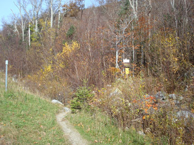
The Greenleaf Trail trailhead on the I-93 onramp
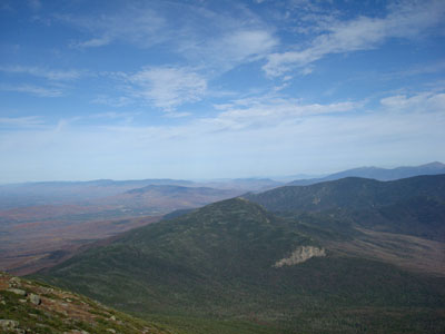
Looking Mt. Garfield from the Mt. Lafayette summit

The Appalachian/Franconia Ridge Trail between Mt. Lafayette and Mt. Truman

Looking at Owl's Head from the Mt. Truman summit
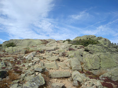
Appalachian/Franconia Ridge Trail between Mt. Lincoln and Mt. Truman
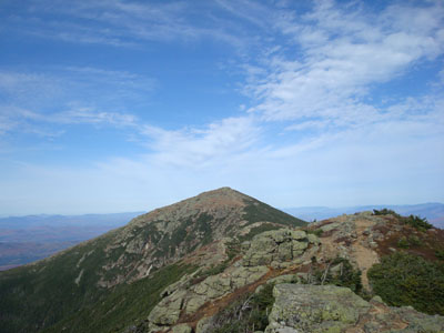
Looking at Mt. Lafayette from Mt. Lincoln
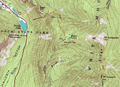

Directions to trailhead: Take I-93 North to the Cannon Mountain Tramway exit, parking in the Tramway parking area. Walk back under the overpass, taking a left and walking partway up the onramp. The Greenleaf Trail trailhead will be on the right.
Back to Mt. Lafayette Profile
Back to Mt. Truman Profile
Back to Mt. Lincoln Profile
|