Home
States
Colorado
Connecticut
Maine
Massachusetts
New Hampshire
New York
Rhode Island
Utah
Vermont
View All
Lists
NE 4,000 Footers
NE 100 Highest
NH 4,000 Footers
NH 100 Highest
NH 52 With A View
NH Belknap Range
NH Ossipee 10
Links
Trail Conditions
Trip Log
Sunrises
Sunsets
About
|
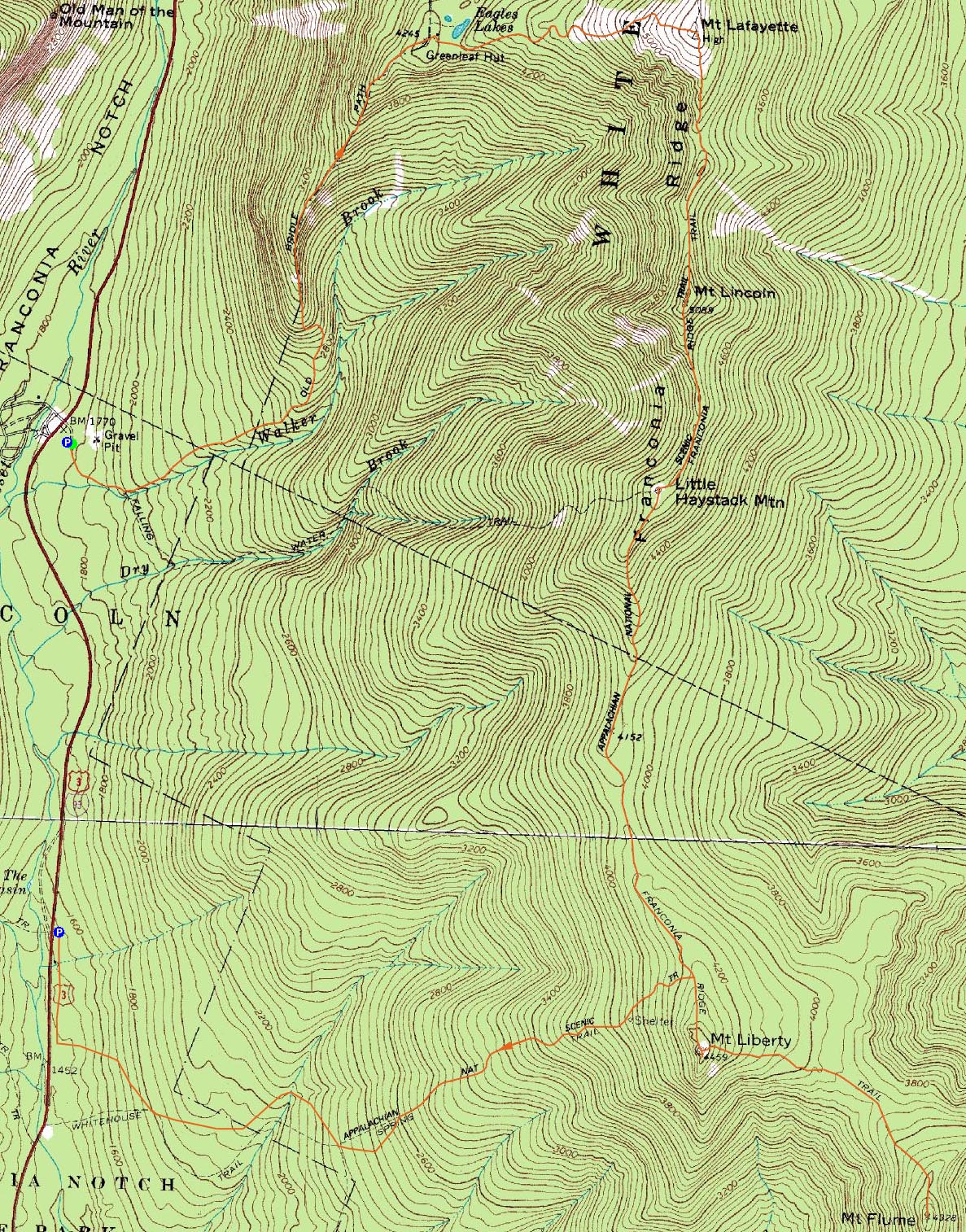
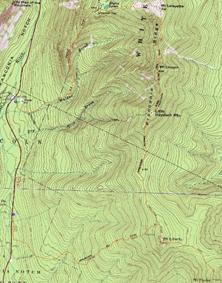
Mt. Lafayette, Mt. Truman, Mt. Lincoln, Little Haystack Mountain, Mt. Liberty, Mt. Flume
Franconia, NH, Lincoln, NH
Trailheads, measurements, times, distances, and maps are all approximate and relative to the hike(s) as shown below.
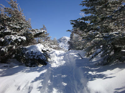
Looking up the Old Bridle Path
Route: Old Bridle Path, (Mt. Lafayette), Franconia Ridge Trail, (Mt. Truman), Franconia Ridge Trail, (Mt. Lincoln), Franconia Ridge Trail, (Little Haystack Mountain), Franconia Ridge Trail, (Mt. Liberty), Franconia Ridge Trail, (Mt. Flume), Franconia Ridge Trail, (Mt. Liberty), Franconia Ridge Trail, Liberty Spring Trail, bushwhack, bikepath
Though I had hiked the main peaks of the Franconia Ridge many times before, I had never done a sizable traverse of the ridge. After spotting a car at the Basin, we pulled into a windy and cloudy Lafayette Place - not exactly welcoming for a long hike! Nonetheless, we geared up and were off.
As we climbed the hard packed Old Bridle Path, we could see the clouds overhead starting to move out. While the winds were howling, the forecast showed them diminishing as the day continued - no need to rush to the summit! Arriving at the hut, Mt. Lafayette was just starting to come into the clear. Since it was cold and the winds were whipping, we took our time gearing up for bitter winter conditions.
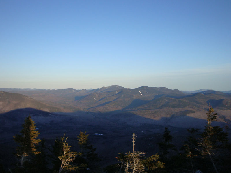
Clearing treeline, we were hit by somewhat strong winds - fairly cold, however not powerful enough to knock one over. As we neared the summit, the wind speeds became more tolerable. The views from the top were tremendous - the Presidentials were in the clear, the sky was blue, and the Green Mountains and their ski areas were visible to the naked eye to the west.
Our next stop was Mt. Truman. Perhaps the strongest winds of the day were felt as we neared the peak - it was certainly a balancing act! While we were wearing snowshoes, crampons probably would have been a better option for the combination of ice and rocks we were often dealing with.
After passing over a particularly icy little scramble, we were soon on Mt. Lincoln. Unlike the previous two peaks, the winds on the top weren't too bad. With lunch on the mind, we continued south, stopping behind a nice rock formation for food.
After lunch, we reached Little Haystack and were soon on the next leg of the hike - the below treeline stretch of the Franconia Ridge Trail. While the trail was broken out, dealing with spruce branches in the face grew a bit old after awhile. Nonetheless, we continued on and were eventually at the Liberty Spring junction.
After passing the junction, we soon emerged from the trees on Mt. Liberty - due to the change in wind speeds and the lower elevation, it was a rather pleasant place to be. The views were excellent as well - the Vermont peaks were still easily seen, while the Pemi peaks were starting to cast late afternoon shadows.
Our second to last peak of the day was Mt. Flume. The ascent from the col was certainly a bit of a workout at the end of the day, but the views were once again worth it. Since we were racing against time, we didn't loiter for long.
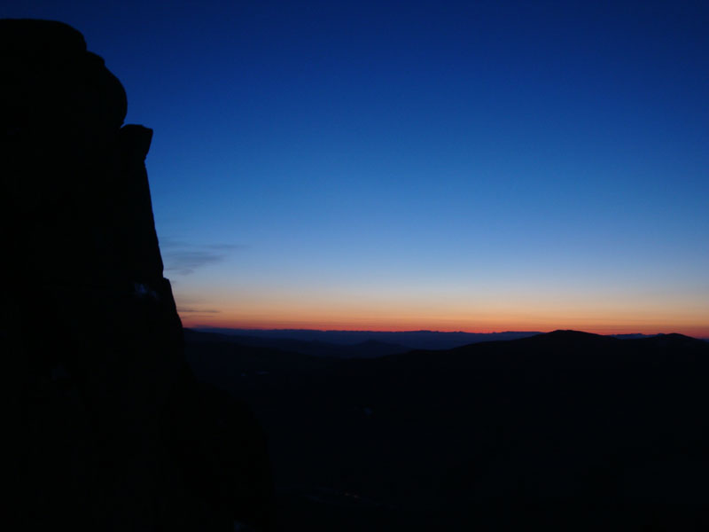
Our final peak of the day was a repeat of Mt. Liberty. After the taxing slog out of the col back to Liberty, we summitted just in time to see some beautiful sunset colors along the western horizon. Particularly interesting was an optical illusion of sorts - one of the peaks in Vermont looked like it had a large, flat object floating on it - likely a function of pressure, moisture, and some other meteorological stuff I know nothing about.
The descent went smoothly - though the moon was very much crescent, it provided enough light for us to reach the Flume Slide junction without using headlamps.
Reaching the sharp turn below the Flume Slide Trail junction, we bushwhacked down to the bike path, thus saving some time and distance. As we neared the Basin parking lot, we saw flashing lights approaching - apparently it was snowmobile trail grooming time! Rather than jump off the path into the deep snow, we raced ahead, reaching the parking lot just before the snowcat caught up.
A long but very rewarding day!
| Hike Ratings |
|
Getting To Trailhead: |
Easy |
| Destination: |
Mt. Lafayette |
|
Length: |
Moderate |
|
Steepness: |
Difficult |
|
Navigation: |
Moderate |
|
Views: |
Excellent |
|
Crowds: |
Moderate |
| Destination: |
Mt. Truman |
|
Length: |
Moderate |
|
Steepness: |
Moderate |
|
Navigation: |
Moderate |
|
Views: |
Excellent |
|
Crowds: |
Moderate |
| Destination: |
Mt. Lincoln |
|
Length: |
Difficult |
|
Steepness: |
Very Difficult |
|
Navigation: |
Easy |
|
Views: |
Excellent |
|
Crowds: |
Moderate |
| Destination: |
Little Haystack Mountain |
|
Length: |
Difficult |
|
Steepness: |
Very Difficult |
|
Navigation: |
Easy |
|
Views: |
Excellent |
|
Crowds: |
Moderate |
| Destination: |
Mt. Liberty |
|
Length: |
Very Difficult |
|
Steepness: |
Difficult |
|
Navigation: |
Moderate |
|
Views: |
Excellent |
|
Crowds: |
Minimal |
| Destination: |
Mt. Flume |
|
Length: |
Very Difficult |
|
Steepness: |
Difficult |
|
Navigation: |
Easy |
|
Views: |
Excellent |
|
Crowds: |
Minimal |
|
| Hike Stats |
|
Date Hiked: |
Wednesday, February 28, 2009 |
| Hike Commenced: |
8:02 AM |
| Parking Elevation: |
1,770' |
| Destination: |
Mt. Lafayette |
| Ascent Commenced: |
8:08 AM |
| Summit Reached: |
12:20 PM |
| Time Elapsed: |
04:12 |
| Trailhead Elevation: |
1,785' |
| Summit Elevation: |
5,260' |
| Distance: |
4 miles |
| Vertical Gain: |
3,650' |
| Destination: |
Mt. Truman |
| Ascent Commenced: |
12:26 PM |
| Summit Reached: |
12:48 PM |
| Time Elapsed: |
00:22 |
| Trailhead Elevation: |
5,260' |
| Summit Elevation: |
5,000' |
| Vertical Gain: |
120' |
| Destination: |
Mt. Lincoln |
| Ascent Commenced: |
12:49 PM |
| Summit Reached: |
1:16 PM |
| Time Elapsed: |
00:27 |
| Trailhead Elevation: |
5,000' |
| Summit Elevation: |
5,089' |
| Vertical Gain: |
219' |
| Destination: |
Little Haystack Mountain |
| Ascent Commenced: |
1:21 PM |
| Summit Reached: |
2:10 PM |
| Time Elapsed: |
00:49 |
| Trailhead Elevation: |
5,089' |
| Summit Elevation: |
4,780' |
| Vertical Gain: |
150' |
| Destination: |
Mt. Liberty |
| Ascent Commenced: |
2:15 PM |
| Summit Reached: |
4:18 PM |
| Time Elapsed: |
02:03 |
| Trailhead Elevation: |
4,780' |
| Summit Elevation: |
4,459' |
| Vertical Gain: |
459' |
| Destination: |
Mt. Flume |
| Ascent Commenced: |
4:19 PM |
| Summit Reached: |
4:58 PM |
| Time Elapsed: |
00:39 |
| Trailhead Elevation: |
4,459' |
| Summit Elevation: |
4,328' |
| Vertical Gain: |
438' |
|
|
| Hike Ended: |
7:49 PM |
| Hike Time Elapsed: |
11:47 |
| Hike Vertical Gain: |
5,820' |
|
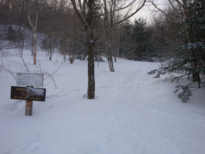
The Old Bridle Path trailhead at Lafayette Place
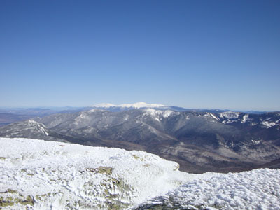
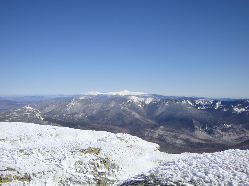
Looking at the Presidentials from the Mt. Lafayette summit

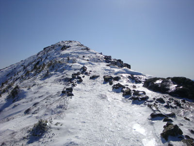
Looking down the Franconia Ridge Trail on the way to Mt. Truman

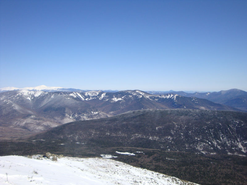
Looking at the Kinsman Ridge from the Mt. Truman summit
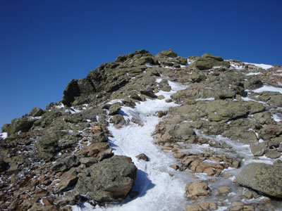
Looking up the Franconia Ridge Trail on the way to Mt. Lincoln

Looking at the Presidentials, Bonds, and Owl's Head from Mt. Lincoln
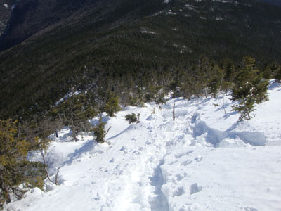
The Franconia Ridge Trail between Mt. Lincoln and Little Haystack

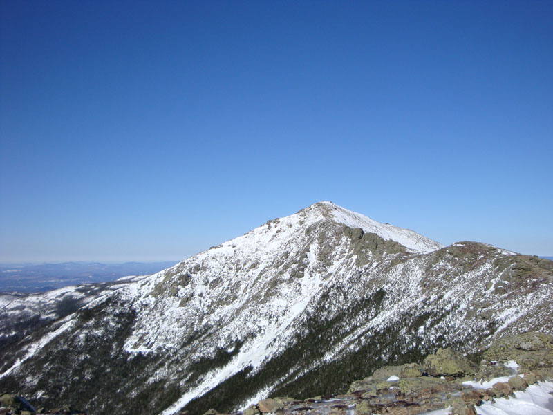
Looking at Mt. Lincoln from near the summit of Little Haystack Mountain
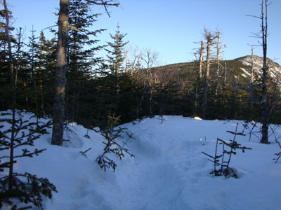
Looking down the Franconia Ridge Trail on the way to Mt. Liberty

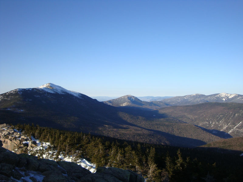
Looking at the Franconia Ridge, Mt. Garfield, and the Twins from Mt. Liberty
The Franconia Ridge Trail between Mt. Liberty and Mt. Flume

Looking at Mt. Carrigain from Mt. Flume

Sunset colors as seen from Mt. Liberty

Directions to trailhead: To reach the Basin, take Interstate 93 north from Lincoln to the Basin exit. To reach the Old Bridle Path, take Interstate 93 north from Lincoln to the Lafayette Place exit. The trailhead is above the parking lot, adjacent to the outhouses.
Back to Mt. Lafayette Profile
Back to Mt. Truman Profile
Back to Mt. Lincoln Profile
Back to Little Haystack Mountain Profile
Back to Mt. Liberty Profile
Back to Mt. Flume Profile
|