Home
States
Colorado
Connecticut
Maine
Massachusetts
New Hampshire
New York
Rhode Island
Utah
Vermont
View All
Lists
NE 4,000 Footers
NE 100 Highest
NH 4,000 Footers
NH 100 Highest
NH 52 With A View
NH Belknap Range
NH Ossipee 10
Links
Trail Conditions
Trip Log
Sunrises
Sunsets
About
|
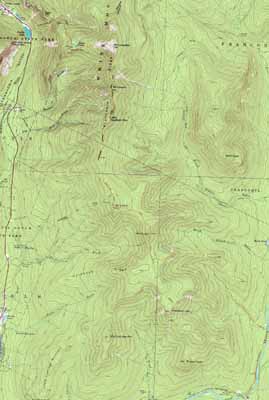
Mt. Lafayette, Mt. Truman, Mt. Lincoln, Little Haystack Mountain, Mt. Liberty, Mt. Flume
Franconia, NH, Lincoln, NH
Trailheads, measurements, times, distances, and maps are all approximate and relative to the hike(s) as shown below.
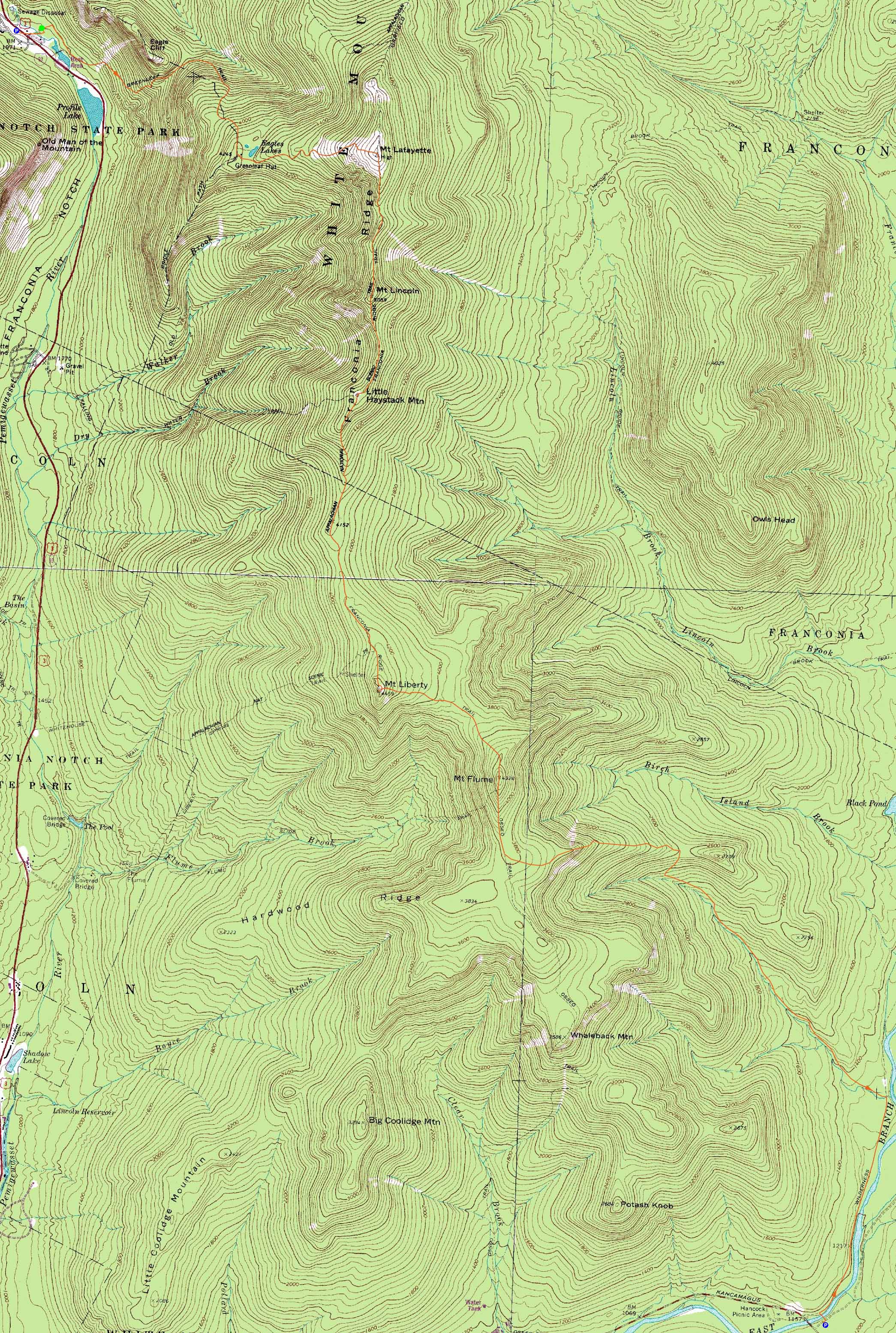
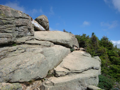
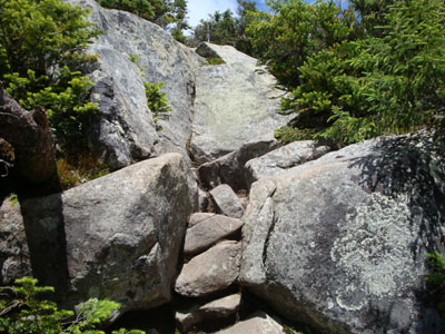
Looking up the Greenleaf Trail on the way to Mt. Lafayette
Route: Greenleaf Trail, (Mt. Lafayette), Franconia Ridge Trail, (Mt. Truman), Franconia Ridge Trail, (Mt. Lincoln), Franconia Ridge Trail, (Little Haystack Mountain), Franconia Ridge Trail, (Mt. Liberty), Franconia Ridge Trail, (Mt. Flume), Franconia Ridge Trail, Osseo Trail, Lincoln Woods Trail
Despite the expected weekend crowds, the weather forecast was tempting enough for a visit to the Franconias. To start the hike, I headed up the Greenleaf Trail, dragging at first. Reaching Eagle Pass, I started to book it a bit and was soon at the Greenleaf Hut. After topping off my water and having a snack, we headed up to Mt. Lafayette.
The views from the summit were quite good as some remaining morning fog had burned off. While the summit wasn't too crowded, a line of people was soon visible from Little Haystack.
After a brief stop at Mt. Truman, we reached Mt. Lincoln for some additional great views. Perhaps the largest crowds of the day were seen at Little Haystack, the end of the Falling Waters Trail.
Things were a bit quieter between Little Haystack and Mt. Liberty. My first time on that section of the Franconia Ridge Trail outside of winter, I found the footing to be generally pretty good - and one of the short scrambles fun. Mt. Liberty was once again a bit crowded - latter day clouds had obscured views a bit, however it was still a good 100-mile-view day.
The final peak of the day was Mt. Flume. Not quite as crowded as the other summits, there were still plenty of folks hanging around. After another short break, we headed down the Osseo Trail (nice footing at the end of the day), soon reaching the crowded Lincoln Woods Trail at the end of the day.
| Hike Ratings |
|
Getting To Trailhead: |
Easy |
| Destination: |
Mt. Lafayette |
|
Length: |
Moderate |
|
Steepness: |
Difficult |
|
Navigation: |
Moderate |
|
Views: |
Excellent |
|
Crowds: |
Heavy |
| Destination: |
Mt. Truman |
|
Length: |
Moderate |
|
Steepness: |
Moderate |
|
Navigation: |
Moderate |
|
Views: |
Excellent |
|
Crowds: |
Heavy |
| Destination: |
Mt. Lincoln |
|
Length: |
Moderate |
|
Steepness: |
Very Difficult |
|
Navigation: |
Easy |
|
Views: |
Excellent |
|
Crowds: |
Heavy |
| Destination: |
Little Haystack Mountain |
|
Length: |
Difficult |
|
Steepness: |
Very Difficult |
|
Navigation: |
Easy |
|
Views: |
Excellent |
|
Crowds: |
Heavy |
| Destination: |
Mt. Liberty |
|
Length: |
Difficult |
|
Steepness: |
Very Difficult |
|
Navigation: |
Moderate |
|
Views: |
Excellent |
|
Crowds: |
Heavy |
| Destination: |
Mt. Flume |
|
Length: |
Difficult |
|
Steepness: |
Difficult |
|
Navigation: |
Easy |
|
Views: |
Excellent |
|
Crowds: |
Heavy |
|
| Hike Stats |
|
Date Hiked: |
Saturday, August 8, 2009 |
| Hike Commenced: |
8:41 AM |
| Parking Elevation: |
1,965' |
| Destination: |
Mt. Lafayette |
| Ascent Commenced: |
8:45 AM |
| Summit Reached: |
10:51 AM |
| Time Elapsed: |
02:06 |
| Trailhead Elevation: |
1,980' |
| Summit Elevation: |
5,260' |
| Distance: |
3.7 miles |
| Vertical Gain: |
3,450' |
| Destination: |
Mt. Truman |
| Ascent Commenced: |
11:18 AM |
| Summit Reached: |
11:41 AM |
| Time Elapsed: |
00:23 |
| Trailhead Elevation: |
5,260' |
| Summit Elevation: |
5,000' |
| Vertical Gain: |
120' |
| Destination: |
Mt. Lincoln |
| Ascent Commenced: |
11:45 AM |
| Summit Reached: |
11:59 AM |
| Time Elapsed: |
00:14 |
| Trailhead Elevation: |
5,000' |
| Summit Elevation: |
5,089' |
| Vertical Gain: |
219' |
| Destination: |
Little Haystack Mountain |
| Ascent Commenced: |
12:10 PM |
| Summit Reached: |
12:30 PM |
| Time Elapsed: |
00:20 |
| Trailhead Elevation: |
5,089' |
| Summit Elevation: |
4,780' |
| Vertical Gain: |
150' |
| Destination: |
Mt. Liberty |
| Ascent Commenced: |
12:45 PM |
| Summit Reached: |
2:00 PM |
| Time Elapsed: |
01:15 |
| Trailhead Elevation: |
4,780' |
| Summit Elevation: |
4,459' |
| Vertical Gain: |
459' |
| Destination: |
Mt. Flume |
| Ascent Commenced: |
2:16 PM |
| Summit Reached: |
3:00 PM |
| Time Elapsed: |
00:44 |
| Trailhead Elevation: |
4,459' |
| Summit Elevation: |
4,328' |
| Vertical Gain: |
438' |
|
|
| Hike Ended: |
6:32 PM |
| Hike Time Elapsed: |
9:51 |
| Hike Vertical Gain: |
5,026' |
|
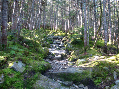
The Greenleaf Trail trailhead near I-93
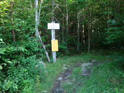
Flowers near the Greenleaf Trail trailhead

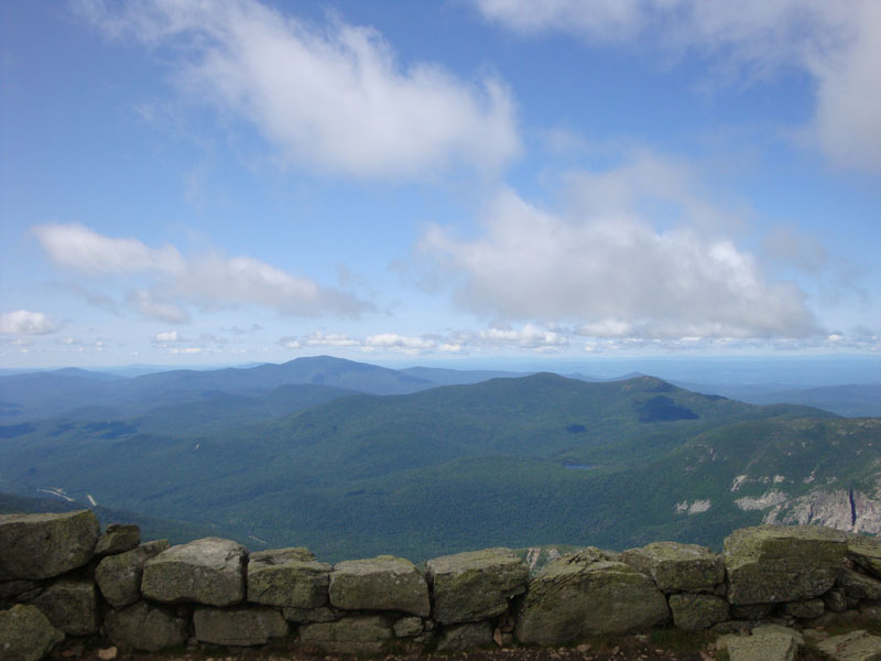
Looking at the Presidentials from the Mt. Lafayette summit

The Franconia Ridge Trail on the way to Mt. Truman

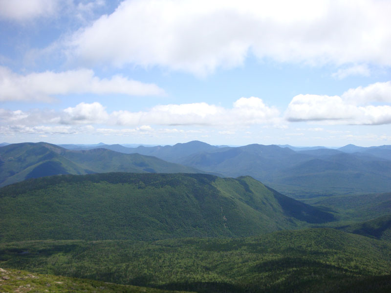
Looking at the Kinsman Ridge from Mt. Truman
The Franconia Ridge Trail on the way to Mt. Lincoln
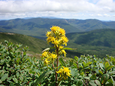
Wildflowers near Mt. Lincoln

Looking over Owl's Head toward Mt. Carrigain from Mt. Lincoln
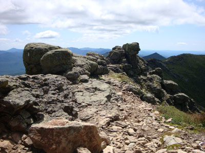
The Franconia Ridge Trail between Mt. Lincoln and Little Haystack
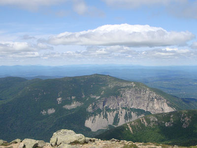
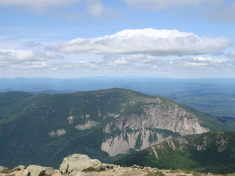
Looking at Cannon Mountain from near the summit of Little Haystack Mountain
The Franconia Ridge Trail on the way to Mt. Liberty
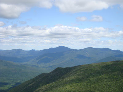
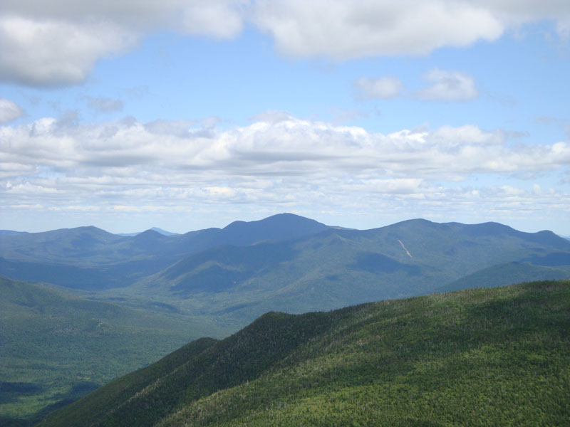
Looking at Mt. Carrigain from Mt. Liberty
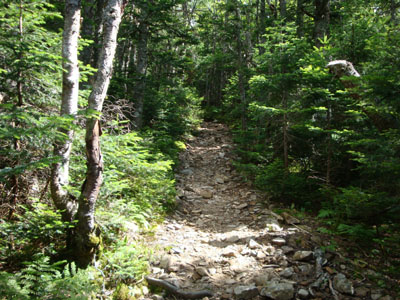
The Franconia Ridge Trail between Mt. Liberty and Mt. Flume
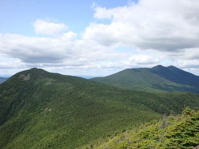
Looking up the Franconia Ridge from Mt. Flume

Directions to trailhead: Take I-93 North to the Cannon Mountain Tramway exit, parking in the Tramway parking area. Walk back under the overpass, taking a left and walking partway up the onramp. The Greenleaf Trail trailhead will be on the right. The Lincoln Woods WMNF fee parking area is located east of Loon ski area on Route 112.
Back to Mt. Lafayette Profile
Back to Mt. Truman Profile
Back to Mt. Lincoln Profile
Back to Little Haystack Mountain Profile
Back to Mt. Liberty Profile
Back to Mt. Flume Profile
|