Home
States
Colorado
Connecticut
Maine
Massachusetts
New Hampshire
New York
Rhode Island
Utah
Vermont
View All
Lists
NE 4,000 Footers
NE 100 Highest
NH 4,000 Footers
NH 100 Highest
NH 52 With A View
NH Belknap Range
NH Ossipee 10
Links
Trail Conditions
Trip Log
Sunrises
Sunsets
About
|
Mt. Lafayette, Mt. Truman, Mt. Lincoln, Owl's Head
Franconia, NH, Lincoln, NH
Trailheads, measurements, times, distances, and maps are all approximate and relative to the hike(s) as shown below.
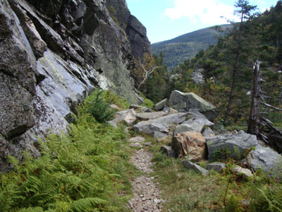
Looking up the Greenleaf Trail at Eagle Pass
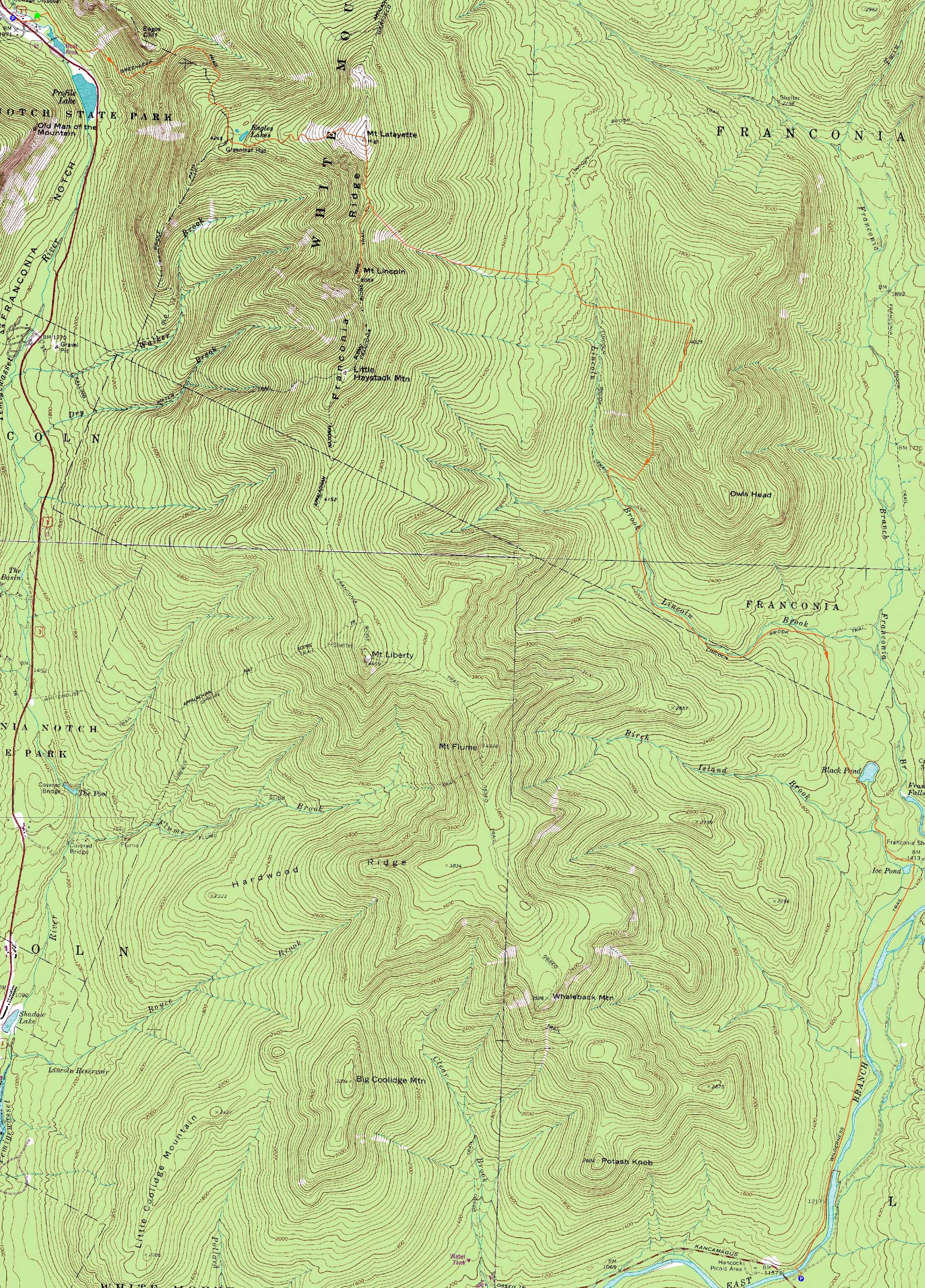
Route: Greenleaf Trail, (Mt. Lafayette), Franconia Ridge Trail, (Mt. Truman), Franconia Ridge Trail, (Mt. Lincoln), Franconia Ridge Trail, bushwhack, (Owl's Head), Owl's Head Path, bushwhack, Lincoln Brook Trail, bushwhack, Black Pond Trail, Lincoln Woods Trail
After spotting a vehicle at Lincoln Woods, we headed up to the Old Man Viewing Point parking area off I-93, hoping to take a herd path up to the Greenleaf Trail. Seeing a line of 10 minute parking signs, we decided not to violate the signs by 710 or so minutes and instead continued to the Tramway exit and the proper Greenleaf Trail trailhead on the on ramp.
The skies started to clear as we climbed up the steeps to Eagle Pass. Upon passing through the pass and leaving the sound of the highway, we could see a nice undercast in the valleys to the north. Reaching the hut, we had a nice view of a northern and western undercast as we resupplied.
Donning cold weather gear, we headed up into the fog to Lafayette. Though the fog generally lingered, we did get some brief nice views to the north and east.
After stepping back out of the fog and briefly stopping at Mt. Truman (North Lincoln), we continued to Mt. Lincoln, where we took a visual on our next plans. Back on Mt. Truman, we descended through some scrub to the northern side of the eastern Lincoln Slide.
The descent down this part of the slide was fairly good going at first - steep, but not overly so, and somewhat gravelly, making for relative smooth sailing. The scenery from it was superb.
Once at the lower portion, we took a snack break whilst checking out the views of our next objective - Owl's Head.
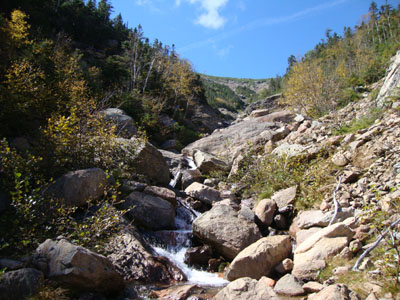
After continuing down the brook bed for a bit, we climbed up to the northern embankment and out, to avoid some gnarly sections. The woods tended to be decent, though there were some blowdown patches. After awhile, we neared some remote ponds that we were eyeing. From the sides of these ponds, we had tremendous views of the Franconia Ridge and Garfield.
Shortly thereafter, we pushed through a birch glade onto the Lincoln Brook Trail. Descending a bit to a tributary brook crossing (likely from the slide), we dropped down, crossed the Lincoln Brook, and headed up the west side of Owl's Head.
While the woods looked like full hardwood glades from above, they were in fact mixed woods. Nonetheless, they were generally open and good going all the way up to the ridge. From there, we navigated a few blowdown patches and soon reached the 'new' summit.
After a break, we headed over to the old summit, partway down the Owl's Head Path, and into the 'Brutus Bushwhack' area down to the Lincoln Brook Trail.
After bushwhacking to Black Pond, donned our headlamps and headed out to Lincoln Woods.
| Hike Ratings |
|
Getting To Trailhead: |
Easy |
| Destination: |
Mt. Lafayette |
|
Length: |
Moderate |
|
Steepness: |
Difficult |
|
Navigation: |
Easy |
|
Views: |
Excellent |
|
Crowds: |
Heavy |
| Destination: |
Mt. Truman |
|
Length: |
Moderate |
|
Steepness: |
Moderate |
|
Navigation: |
Easy |
|
Views: |
Excellent |
|
Crowds: |
Heavy |
| Destination: |
Mt. Lincoln |
|
Length: |
Moderate |
|
Steepness: |
Very Difficult |
|
Navigation: |
Easy |
|
Views: |
Excellent |
|
Crowds: |
Heavy |
| Destination: |
Mt. Truman |
|
Length: |
Difficult |
|
Steepness: |
Moderate |
|
Navigation: |
Easy |
|
Views: |
Excellent |
|
Crowds: |
Heavy |
| Destination: |
Owl's Head |
|
Length: |
Very Difficult |
|
Steepness: |
Very Difficult |
|
Navigation: |
Difficult |
|
Views: |
Minimal |
|
Crowds: |
Minimal |
|
| Hike Stats |
|
Date Hiked: |
Saturday, September 18, 2010 |
| Hike Commenced: |
8:00 AM |
| Parking Elevation: |
1,965' |
| Destination: |
Mt. Lafayette |
| Ascent Commenced: |
8:05 AM |
| Summit Reached: |
10:55 AM |
| Time Elapsed: |
02:50 |
| Trailhead Elevation: |
1,980' |
| Summit Elevation: |
5,260' |
| Distance: |
3.7 miles |
| Vertical Gain: |
3,450' |
| Destination: |
Mt. Truman |
| Ascent Commenced: |
11:10 AM |
| Summit Reached: |
11:38 AM |
| Time Elapsed: |
00:28 |
| Trailhead Elevation: |
5,260' |
| Summit Elevation: |
5,000' |
| Vertical Gain: |
120' |
| Destination: |
Mt. Lincoln |
| Ascent Commenced: |
11:38 AM |
| Summit Reached: |
11:54 AM |
| Time Elapsed: |
00:16 |
| Trailhead Elevation: |
5,000' |
| Summit Elevation: |
5,089' |
| Vertical Gain: |
219' |
| Destination: |
Mt. Truman |
| Ascent Commenced: |
11:56 AM |
| Summit Reached: |
12:10 PM |
| Time Elapsed: |
00:14 |
| Trailhead Elevation: |
5,089' |
| Summit Elevation: |
4,780' |
| Vertical Gain: |
130' |
| Destination: |
Owl's Head |
| Ascent Commenced: |
12:16 PM |
| Summit Reached: |
3:55 PM |
| Time Elapsed: |
03:39 |
| Trailhead Elevation: |
4,780' |
| Summit Elevation: |
4,025' |
| Vertical Gain: |
1,085' |
|
|
| Hike Ended: |
8:19 PM |
| Hike Time Elapsed: |
12:19 |
| Hike Vertical Gain: |
5,319' |
|
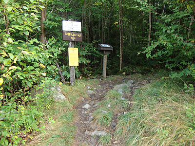
The Greenleaf Trail trailhead near I-93
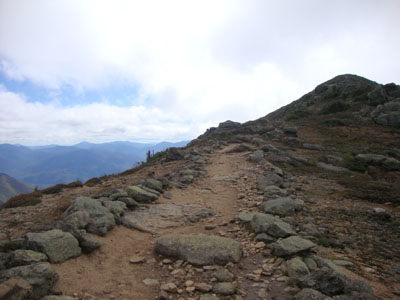
Looking down the Greenleaf Trail
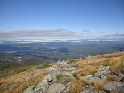
Looking at North Lafayette from Mt. Lafayette

The Franconia Ridge Trail on the way to Mt. Truman

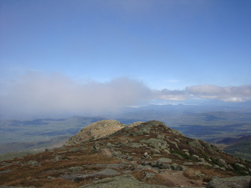
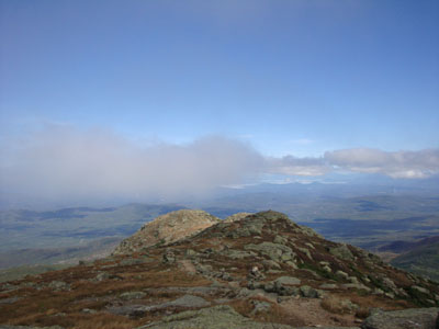
Looking at Owl's Head from Mt. Truman
The Franconia Ridge Trail on the way to Mt. Lincoln

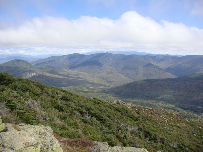
Looking at Mt. Garfield and the Twins from Mt. Lincoln
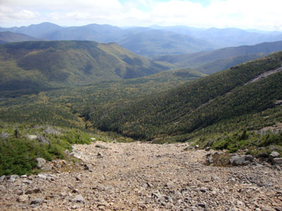
Looking down the Lincoln slide
Looking up the Lincoln slide
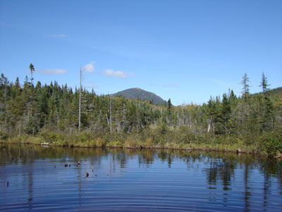
Mt. Garfield as seen from a backcountry pond
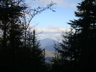
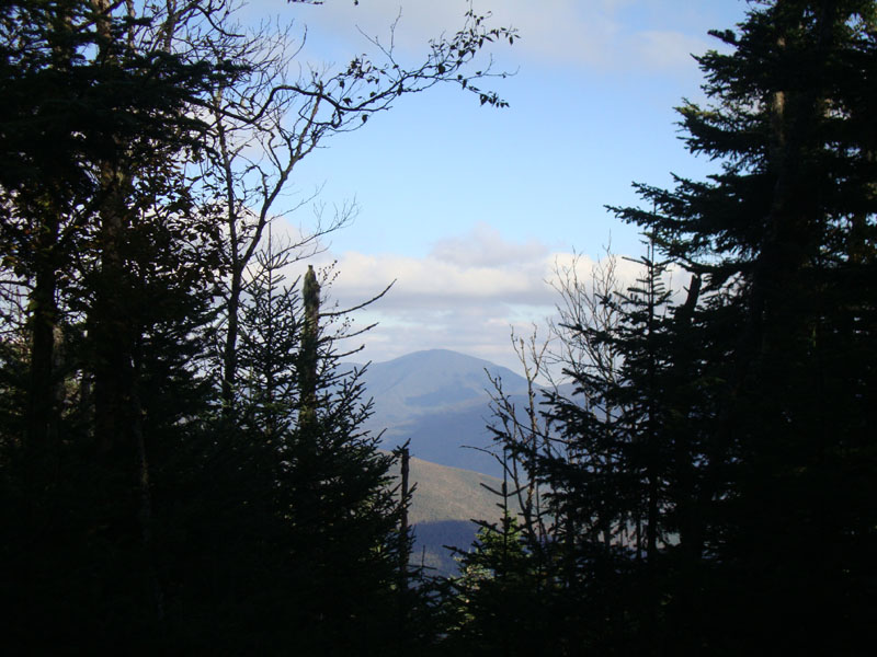
Slight views of Mt. Carrigain from near the summit of Owl's Head

Directions to trailhead: Take I-93 North to the Cannon Mountain Tramway exit, parking in the Tramway parking area. Walk back under the overpass, taking a left and walking partway up the onramp. The Greenleaf Trail trailhead will be on the right. The Lincoln Woods WMNF fee parking area is located east of Loon ski area on Route 112.
Back to Mt. Lafayette Profile
Back to Mt. Truman Profile
Back to Mt. Lincoln Profile
Back to Owls Head Profile
|