Home
States
Colorado
Connecticut
Maine
Massachusetts
New Hampshire
New York
Rhode Island
Utah
Vermont
View All
Lists
NE 4,000 Footers
NE 100 Highest
NH 4,000 Footers
NH 100 Highest
NH 52 With A View
NH Belknap Range
NH Ossipee 10
Links
Trail Conditions
Trip Log
Sunrises
Sunsets
About
|
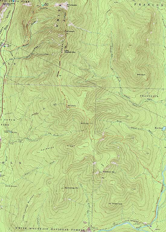
Mt. Lafayette, Mt. Truman, Mt. Lincoln, Little Haystack Mountain, Mt. Liberty, Mt. Flume
Franconia, NH, Lincoln, NH
Trailheads, measurements, times, distances, and maps are all approximate and relative to the hike(s) as shown below.
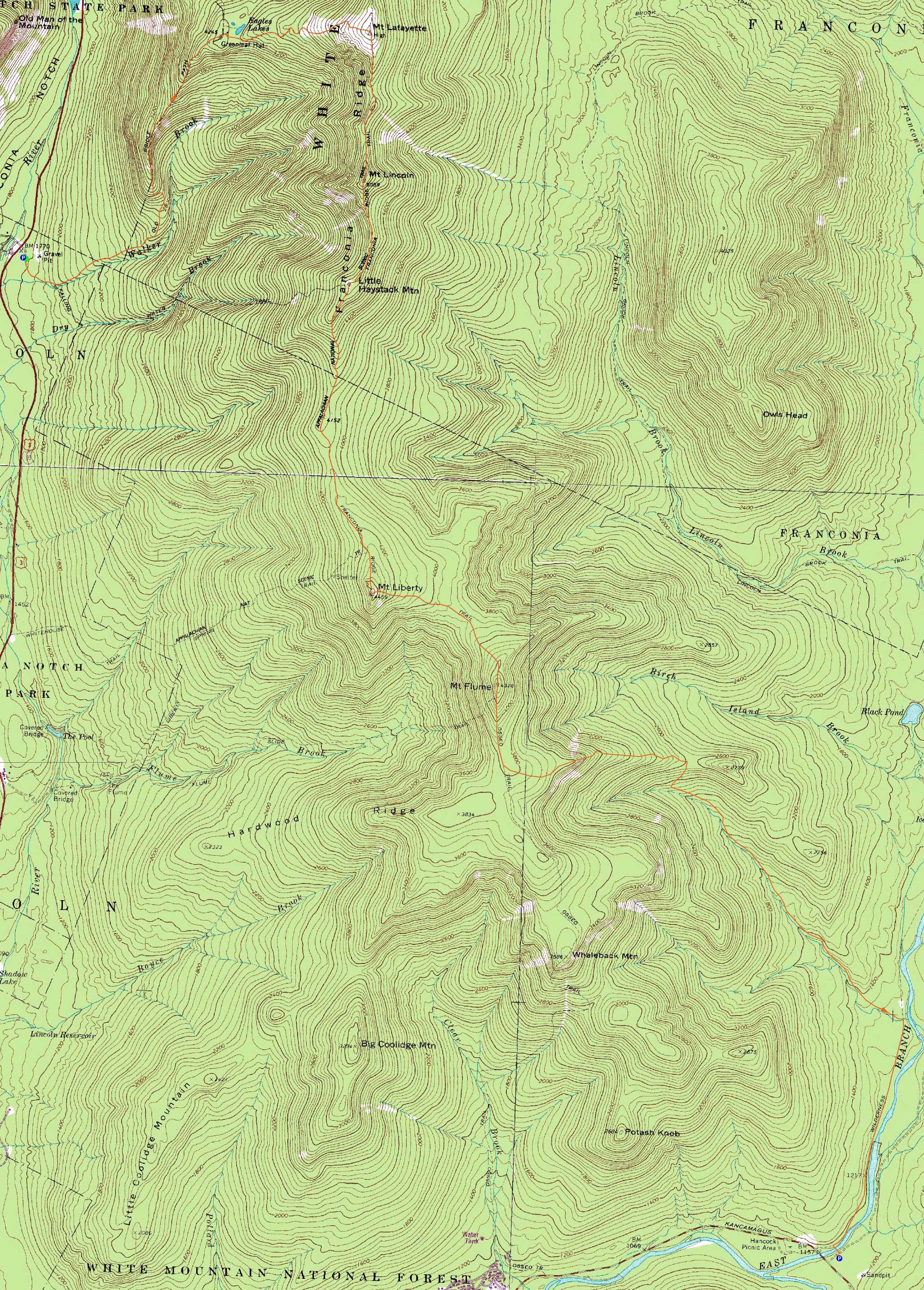
Looking up the icy Greenleaf Trail on the way to Mt. Lafayette
Route: Old Bridle Path, Greenleaf Trail, (Mt. Lafayette), Franconia Ridge Trail, (Mt. Truman), Franconia Ridge Trail, (Mt. Lincoln), Franconia Ridge Trail, (Little Haystack Mountain), Franconia Ridge Trail, (Mt. Liberty), Franconia Ridge Trail, (Mt. Flume), Franconia Ridge Trail, Osseo Trail, Lincoln Woods Trail
Though the forecast was mediocre, it was still conducive to above treeline hiking.
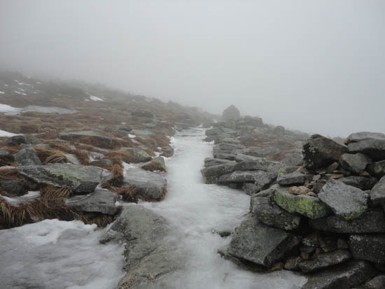
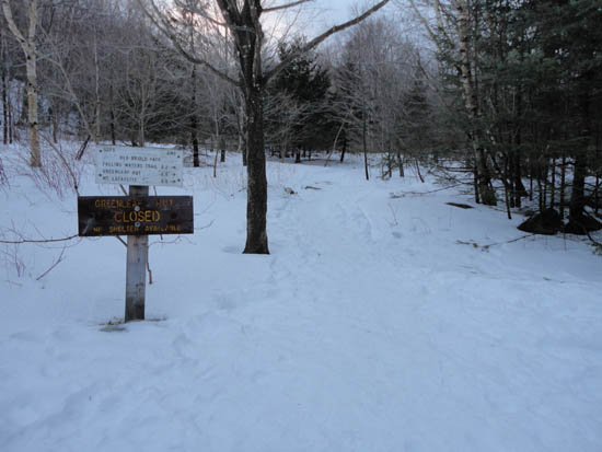
After spotting a vehicle at Lincoln Woods, we headed to Lafayette Place and ascended the Old Bridle Path. With warm temperatures (upper 30s to low 40s), the trail was a bit soft. Once out of the trees on the Greenleaf Trail, all that remained was patchy snow, slush, and lots of blue ice. Carefully picking our way up to the summit, we had no views due to fog. Thusly, we continued across the ridge pretty much nonstop, carefully negociating more-than-expected ice, considering the weather.
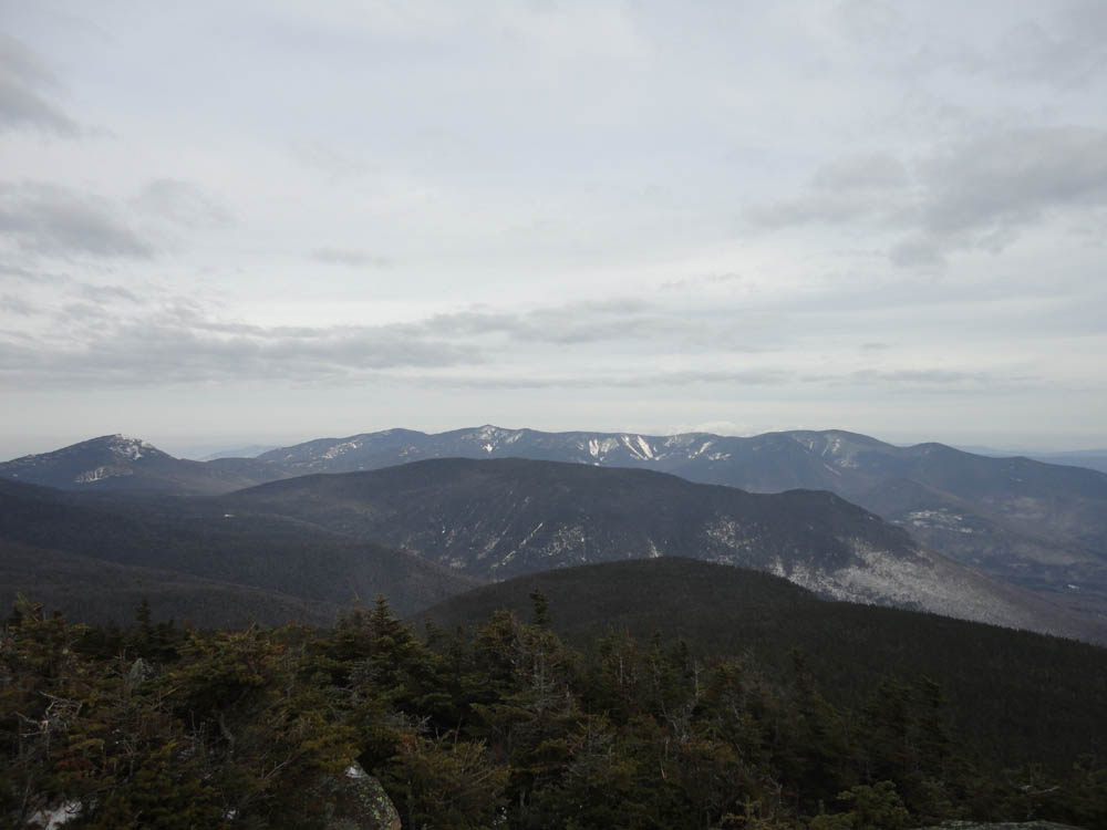
After a lunch break on the Gargoyles, we continued to Little Haystack, from where we had our first views of the day on the ridge.
Once in the woods, we had light trail breaking to the Liberty Springs junction. Eventually reaching Mt. Liberty, we had cloudy, but good views in all directions.
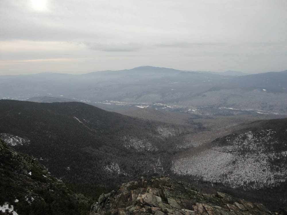
The final peak of the day was Mt. Flume, from where we once again had decent views. Continuing on snowshoes down the Osseo Trail, we slowly made our way down the exposed stairs, only to discover there was very little snow at the bottom of them. Thusly, we barebooted on patch to minimal snow depth all the way out to Lincoln Woods.
| Hike Ratings |
|
Getting To Trailhead: |
Easy |
| Destination: |
Mt. Lafayette |
|
Length: |
Moderate |
|
Steepness: |
Difficult |
|
Navigation: |
Moderate |
|
Views: |
Minimal (due to weather) |
|
Crowds: |
Minimal |
| Destination: |
Mt. Truman |
|
Length: |
Moderate |
|
Steepness: |
Moderate |
|
Navigation: |
Moderate |
|
Views: |
Minimal (due to weather) |
|
Crowds: |
Minimal |
| Destination: |
Mt. Lincoln |
|
Length: |
Moderate |
|
Steepness: |
Very Difficult |
|
Navigation: |
Easy |
|
Views: |
Excellent |
|
Crowds: |
Moderate |
| Destination: |
Little Haystack Mountain |
|
Length: |
Difficult |
|
Steepness: |
Very Difficult |
|
Navigation: |
Easy |
|
Views: |
Excellent |
|
Crowds: |
Minimal |
| Destination: |
Mt. Liberty |
|
Length: |
Difficult |
|
Steepness: |
Very Difficult |
|
Navigation: |
Moderate |
|
Views: |
Excellent |
|
Crowds: |
Minimal |
| Destination: |
Mt. Flume |
|
Length: |
Difficult |
|
Steepness: |
Difficult |
|
Navigation: |
Easy |
|
Views: |
Excellent |
|
Crowds: |
Minimal |
|
| Hike Stats |
|
Date Hiked: |
Saturday, January 1, 2011 |
| Hike Commenced: |
7:31 AM |
| Parking Elevation: |
1,965' |
| Destination: |
Mt. Lafayette |
| Ascent Commenced: |
7:32 AM |
| Summit Reached: |
10:40 AM |
| Time Elapsed: |
03:08 |
| Trailhead Elevation: |
1,980' |
| Summit Elevation: |
5,260' |
| Distance: |
4 miles |
| Vertical Gain: |
3,650' |
| Destination: |
Mt. Truman |
| Ascent Commenced: |
10:43 AM |
| Summit Reached: |
11:03 AM |
| Time Elapsed: |
00:20 |
| Trailhead Elevation: |
5,260' |
| Summit Elevation: |
5,000' |
| Vertical Gain: |
120' |
| Destination: |
Mt. Lincoln |
| Ascent Commenced: |
11:03 AM |
| Summit Reached: |
11:24 AM |
| Time Elapsed: |
00:21 |
| Trailhead Elevation: |
5,000' |
| Summit Elevation: |
5,089' |
| Vertical Gain: |
219' |
| Destination: |
Little Haystack Mountain |
| Ascent Commenced: |
11:25 AM |
| Summit Reached: |
12:01 PM |
| Time Elapsed: |
00:36 |
| Trailhead Elevation: |
5,089' |
| Summit Elevation: |
4,780' |
| Vertical Gain: |
150' |
| Destination: |
Mt. Liberty |
| Ascent Commenced: |
12:02 PM |
| Summit Reached: |
1:23 PM |
| Time Elapsed: |
01:21 |
| Trailhead Elevation: |
4,780' |
| Summit Elevation: |
4,459' |
| Vertical Gain: |
459' |
| Destination: |
Mt. Flume |
| Ascent Commenced: |
1:30 PM |
| Summit Reached: |
2:12 PM |
| Time Elapsed: |
00:42 |
| Trailhead Elevation: |
4,459' |
| Summit Elevation: |
4,328' |
| Vertical Gain: |
438' |
|
|
| Hike Ended: |
4:47 PM |
| Hike Time Elapsed: |
9:16 |
| Hike Vertical Gain: |
5,226' |
|
The Old Bridle Path trailhead near I-93

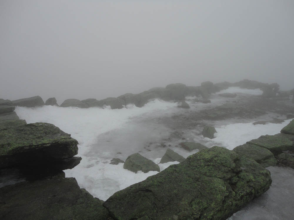
Looking at fog from the Mt. Lafayette summit

The icy Franconia Ridge Trail on the way to Mt. Truman

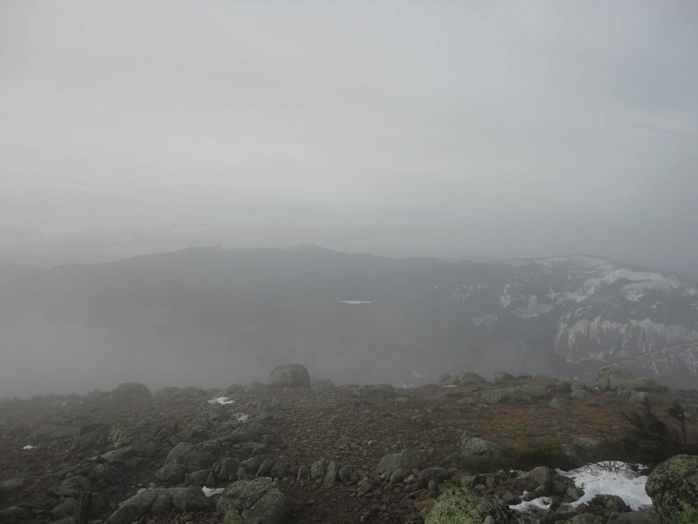
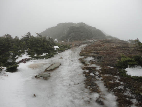
Looking at fog from Mt. Truman
The icy Franconia Ridge Trail on the way to Mt. Lincoln
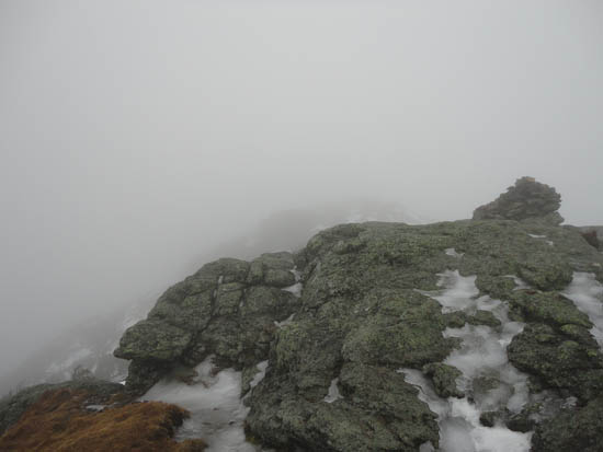
Fog as seen from Mt. Lincoln
The icy Franconia Ridge Trail between Mt. Lincoln and Little Haystack

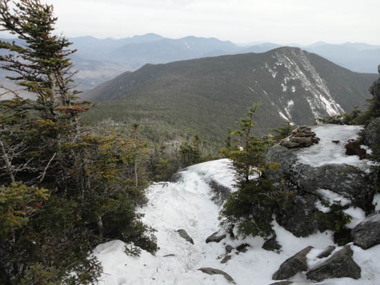
The Kinsmans and Cannon as seen from near the summit of Little Haystack Mountain
The Franconia Ridge Trail on the way to Mt. Liberty

Looking at Garfield, the Bonds, and Owl's Head from Mt. Liberty
The Franconia Ridge Trail between Mt. Liberty and Mt. Flume
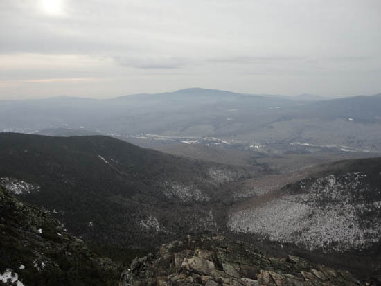
Looking at Mt. Moosilauke from Mt. Flume

Directions to trailhead: Take Interstate 93 north from Lincoln to the Lafayette Place exit. The Lincoln Woods WMNF fee parking area is located east of Loon ski area on Route 112.
Back to Mt. Lafayette Profile
Back to Mt. Truman Profile
Back to Mt. Lincoln Profile
Back to Little Haystack Mountain Profile
Back to Mt. Liberty Profile
Back to Mt. Flume Profile
|