Home
States
Colorado
Connecticut
Maine
Massachusetts
New Hampshire
New York
Rhode Island
Utah
Vermont
View All
Lists
NE 4,000 Footers
NE 100 Highest
NH 4,000 Footers
NH 100 Highest
NH 52 With A View
NH Belknap Range
NH Ossipee 10
Links
Trail Conditions
Trip Log
Sunrises
Sunsets
About
|
Mt. Lafayette, Mt. Truman, Mt. Lincoln, Little Haystack Mountain
Franconia, NH, Lincoln, NH
Trailheads, measurements, times, distances, and maps are all approximate and relative to the hike(s) as shown below.
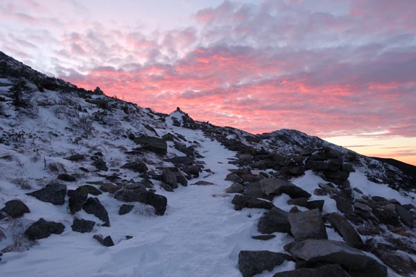
The Greenleaf Trail on the way to Mt. Lafayette
Route: Old Bridle Trail, Greenleaf Trail, Appalachian/Franconia Ridge Trail, Falling Waters Trail
Old Bridle Path was generally packed powder with a few icy chutes due to buttsliding damage. The footbed is a bit narrow from barebooters, so snowshoeing could be a little awkward. I left my snowshoes on my pack for this part and wore spikes.
Greenleaf Trail had some drifting in the scrubby areas. I almost went with snowshoes, but stayed in spikes with treeline approaching. The traditionally icy turn on upper Greenleaf has some hardpack over the top of the blue ice, so my spikes were able to get purchase.
The ridge was a mix of drifts, hard pack, and blue ice, with some bare rock as well. I kept my spikes on, but found some of the blue ice descending Lincoln to be a little much for them. A little more adhering snow and snowshoes could be more viable on the ridge.
I put on snowshoes as soon as I got into the trees on Falling Waters and was glad I had them. A decent portion of the upper trail had drifted overnight. There was adequate snowpack to wear them all the way back to the parking lot with only a few short icy stretches. Amazed to see that, with the hoards of ascending hikers, only one person appeared to be carrying snowshoes. Snow pack is 2-3 feet, so if experiencing a navigational or other emergency above treeline, barebooting isn't going to get you far. That, and it appears some barebooters prefer to go to the bathroom on the actual trail now, rather than posthole their way to a tree.
Nice sunrise on Lafayette and fairly mild winds/temps this morning.
| Hike Ratings |
|
Getting To Trailhead: |
Easy |
| Destination: |
Mt. Lafayette |
|
Length: |
Moderate |
|
Steepness: |
Difficult |
|
Navigation: |
Easy |
|
Views: |
Excellent |
|
Crowds: |
Minimal |
| Destination: |
Mt. Truman |
|
Length: |
Moderate |
|
Steepness: |
Moderate |
|
Navigation: |
Easy |
|
Views: |
Excellent |
|
Crowds: |
Minimal |
| Destination: |
Mt. Lincoln |
|
Length: |
Moderate |
|
Steepness: |
Very Difficult |
|
Navigation: |
Moderate |
|
Views: |
Excellent |
|
Crowds: |
Minimal |
| Destination: |
Little Haystack Mountain |
|
Length: |
Moderate |
|
Steepness: |
Difficult |
|
Navigation: |
Easy |
|
Views: |
Excellent |
|
Crowds: |
Minimal |
|
| Hike Stats |
|
Date Hiked: |
Monday, December 26, 2016 |
| Parking Elevation: |
1,770' |
| Destination: |
Mt. Lafayette |
| Time Elapsed: |
02:11 |
| Trailhead Elevation: |
1,785' |
| Summit Elevation: |
5,260' |
| Distance: |
4 miles |
| Vertical Gain: |
3,650' |
| Destination: |
Mt. Truman |
| Time Elapsed: |
00:15 |
| Trailhead Elevation: |
5,260' |
| Summit Elevation: |
5,000' |
| Vertical Gain: |
120' |
| Destination: |
Mt. Lincoln |
| Time Elapsed: |
00:15 |
| Trailhead Elevation: |
5,000' |
| Summit Elevation: |
5,089' |
| Vertical Gain: |
219' |
| Destination: |
Little Haystack Mountain |
| Time Elapsed: |
00:24 |
| Trailhead Elevation: |
5,089' |
| Summit Elevation: |
4,780' |
| Vertical Gain: |
150' |
|
|
| Hike Time Elapsed: |
05:02 |
| Hike Distance: |
9 miles |
| Hike Vertical Gain: |
4,354' |
|
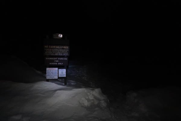
Old Bridle Path trailhead
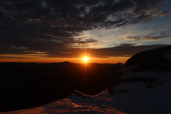
The sunrise from Mt. Lafayette

Appalachian/Franconia Ridge Trail to Mt. Truman

Mt. Lafayette as seen from Mt. Truman
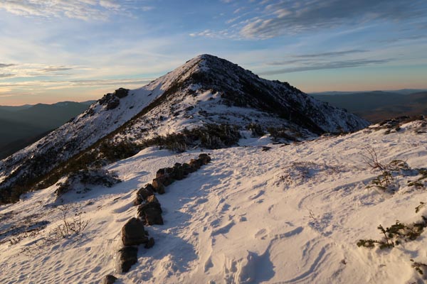
Appalachian/Franconia Ridge Trail to Mt. Lincoln
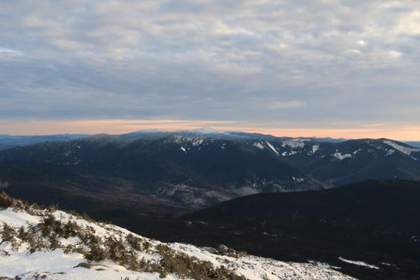
The Bonds and Presidentials as seen from Mt. Lincoln
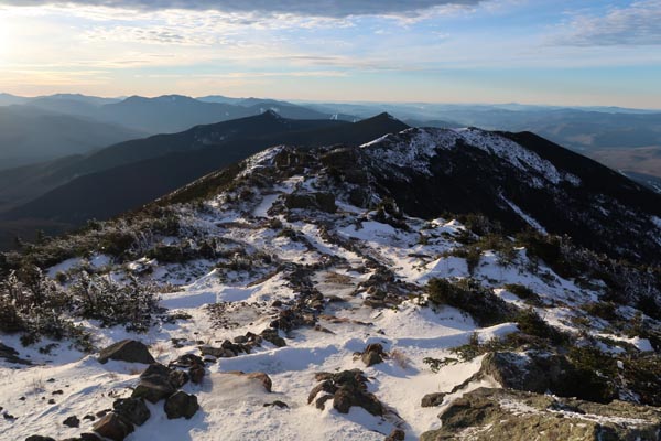
Appalachian/Franconia Ridge Trail to Little Haystack Mountain
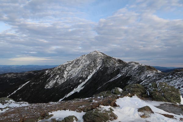
Mt. Lincoln as seen from Little Haystack Mountain
Directions to trailhead: Take Interstate 93 north from Lincoln to the Lafayette Place exit.
Back to Mt. Lafayette Profile
Back to Mt. Truman Profile
Back to Mt. Lincoln Profile
Back to Little Haystack Mountain Profile
|