Home
States
Colorado
Connecticut
Maine
Massachusetts
New Hampshire
New York
Rhode Island
Utah
Vermont
View All
Lists
NE 4,000 Footers
NE 100 Highest
NH 4,000 Footers
NH 100 Highest
NH 52 With A View
NH Belknap Range
NH Ossipee 10
Links
Trail Conditions
Trip Log
Sunrises
Sunsets
About
|
Mt. Lafayette, Mt. Truman, Mt. Lincoln, Little Haystack Mountain
Franconia, NH, Lincoln, NH
Trailheads, measurements, times, distances, and maps are all approximate and relative to the hike(s) as shown below.
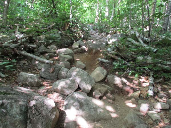
The eroded Old Bridle Path on the way to Mt. Lafayette
Route: Old Bridle Trail, Greenleaf Trail, Appalachian/Franconia Ridge Trail, Falling Waters Trail
Old Bridle Path was mostly dry. Greenleaf Trail had some muck in the usual spots. The ridge was dry. Falling Waters had some muck and areas of water running down the trail.
Erosion on Old Bridle/Greenleaf/Falling Waters just keeps getting worse, even with all of the work that was done years ago. Good to see continued efforts to keep folks on the trail on the ridge (scree walls, signs, string).
Extremely busy around 5 PM...passed a hundred or so descending hikers within the first few minutes, and maybe a hundred more thereafter. But, amazingly, I had the entire ridge to myself, as well as Falling Waters. Very peaceful with decent weather conditions despite the haze.
| Hike Ratings |
|
Getting To Trailhead: |
Easy |
| Destination: |
Mt. Lafayette |
|
Length: |
Moderate |
|
Steepness: |
Difficult |
|
Navigation: |
Easy |
|
Views: |
Excellent |
|
Crowds: |
Heavy |
| Destination: |
Mt. Truman |
|
Length: |
Moderate |
|
Steepness: |
Moderate |
|
Navigation: |
Easy |
|
Views: |
Excellent |
|
Crowds: |
Minimal |
| Destination: |
Mt. Lincoln |
|
Length: |
Moderate |
|
Steepness: |
Very Difficult |
|
Navigation: |
Moderate |
|
Views: |
Excellent |
|
Crowds: |
Minimal |
| Destination: |
Little Haystack Mountain |
|
Length: |
Moderate |
|
Steepness: |
Difficult |
|
Navigation: |
Easy |
|
Views: |
Excellent |
|
Crowds: |
Minimal |
|
| Hike Stats |
|
Date Hiked: |
Friday, July 13, 2018 |
| Parking Elevation: |
1,770' |
| Destination: |
Mt. Lafayette |
| Time Elapsed: |
01:35 |
| Trailhead Elevation: |
1,785' |
| Summit Elevation: |
5,260' |
| Distance: |
4 miles |
| Vertical Gain: |
3,650' |
| Destination: |
Mt. Truman |
| Time Elapsed: |
00:11 |
| Trailhead Elevation: |
5,260' |
| Summit Elevation: |
5,000' |
| Vertical Gain: |
120' |
| Destination: |
Mt. Lincoln |
| Time Elapsed: |
00:08 |
| Trailhead Elevation: |
5,000' |
| Summit Elevation: |
5,089' |
| Vertical Gain: |
219' |
| Destination: |
Little Haystack Mountain |
| Time Elapsed: |
00:15 |
| Trailhead Elevation: |
5,089' |
| Summit Elevation: |
4,780' |
| Vertical Gain: |
150' |
|
|
| Hike Time Elapsed: |
03:42 |
| Hike Distance: |
9 miles |
| Hike Vertical Gain: |
4,354' |
|
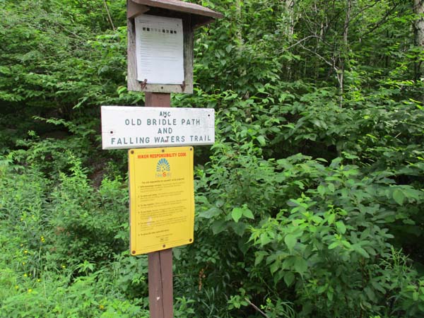
Old Bridle Path trailhead

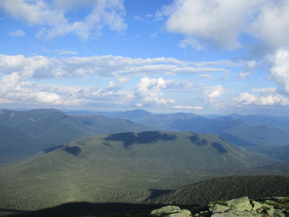
The Owl's Head as seen from Mt. Lafayette

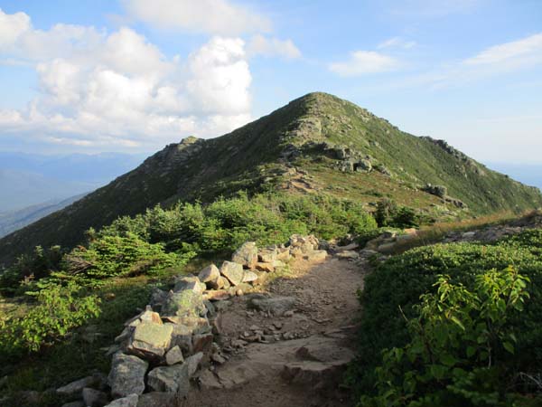
Appalachian/Franconia Ridge Trail to Mt. Truman

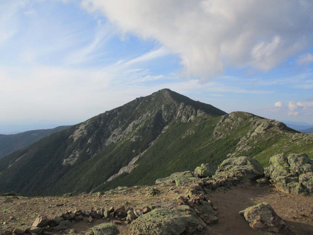
Mt. Lafayette as seen from Mt. Truman
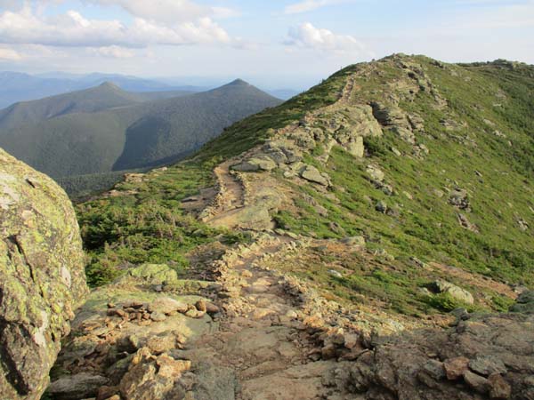
Appalachian/Franconia Ridge Trail to Mt. Lincoln
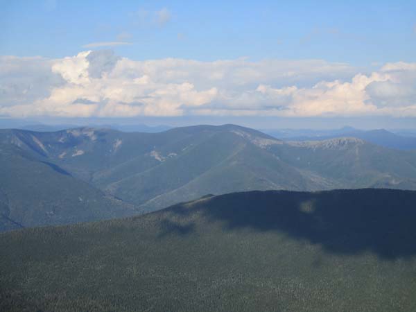
The Bonds as seen from Mt. Lincoln
Appalachian/Franconia Ridge Trail to Little Haystack Mountain
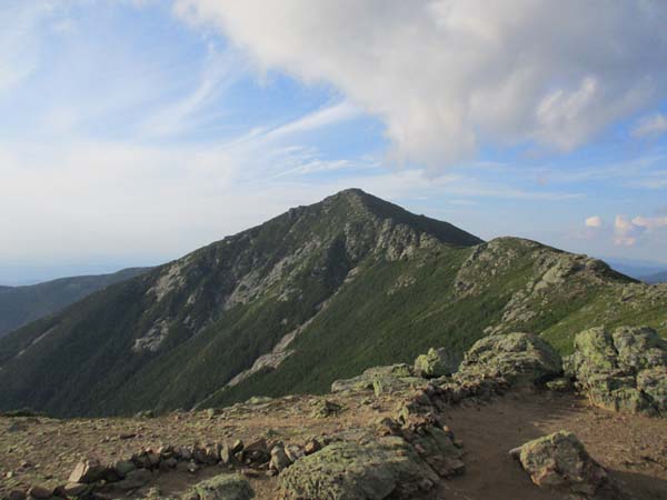
Mt. Lincoln as seen from Little Haystack Mountain
Directions to trailhead: Take Interstate 93 north from Lincoln to the Lafayette Place exit.
Back to Mt. Lafayette Profile
Back to Mt. Truman Profile
Back to Mt. Lincoln Profile
Back to Little Haystack Mountain Profile
|