Home
States
Colorado
Connecticut
Maine
Massachusetts
New Hampshire
New York
Rhode Island
Utah
Vermont
View All
Lists
NE 4,000 Footers
NE 100 Highest
NH 4,000 Footers
NH 100 Highest
NH 52 With A View
NH Belknap Range
NH Ossipee 10
Links
Trail Conditions
Trip Log
Sunrises
Sunsets
About
|
Mt. Lafayette, Mt. Truman, Mt. Lincoln, Owl's Head
Franconia, NH, Lincoln, NH
Trailheads, measurements, times, distances, and maps are all approximate and relative to the hike(s) as shown below.
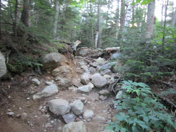
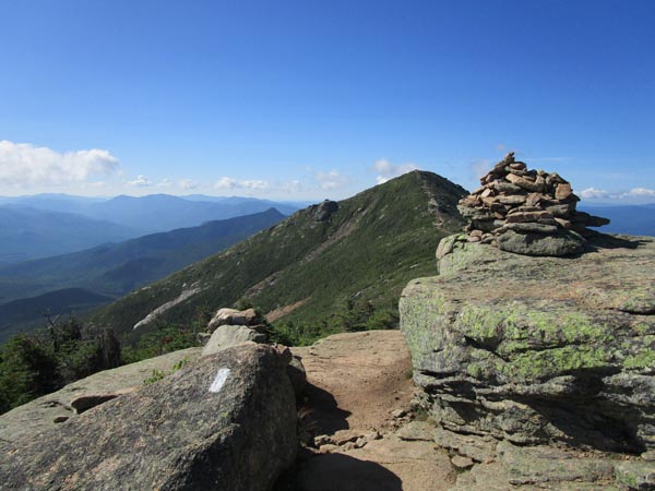
Looking up the heavily eroded Old Bridle Path
Route: Old Bridle Path, Greenleaf Trail, (Mt. Lafayette), Franconia Ridge Trail, (Mt. Truman), Franconia Ridge Trail, (Mt. Lincoln), Franconia Ridge Trail, bushwhack, (Owl's Head), Owl's Head Path, bushwhack, Lincoln Brook Trail, bushwhack, Black Pond Trail, Lincoln Woods Trail
Old Bridle Path was mostly dry. Hut was closed, but there was a spigot for water and there were restrooms available (around the back, not through the main entrance, and I think they required masks). Greenleaf Trail was crowded, as was the summit of Lafayette, despite the early start.
Franconia Ridge was also crowded and it was unfortunate to see people trampling around off trail on the alpine vegetation to "socially distance." I don't believe there's a recorded case of COVID transmission while hiking anywhere in the world. Yet, this trampling may cause permanent damage to the alpine growth.
After tagging the busy summit of Lincoln, we doubled back to Truman and took the herd path (mainly rock hopping to avoid stepping on alpine growth) to the top of that finger of the Lincoln Slide. The slide was dry and loose, but nothing worse than the Tripyramid South Slide under current conditions. We continued in the brook bed at the bottom for a little while, then climbed out of the drainage (initially in scrappy woods) and into decent woods down to the ponds/marshes. Great view from the eastern pond. Decent woods from there down to the trail.
We went back into the woods a little bit north of the outflow from the ponds and climbed up Owl's Head proper, again in generally decent woods (occasionally some moss postholing). We came across a well marked trail (no evidence of cutting) near the ridge. We yanked most of the flagging tape, but there's a fairly decent footbed at this point. On the plus side, it consolidates the traffic and avoids some blowdown.
After seeing no one since leaving Franconia Ridge, we encountered 110 people from the summit of Owl's Head to the Lincoln Woods bridge. Wow.
Owl's Head Path was its usual mess. Brutus is a full blown path at this point, which is causing issues now (particularly because the Owl's Head Path is not marked), as people were going down Brutus thinking it was the trail and getting separated from their groups. The drop out of the softwoods into the birch glade on Brutus is way too steep and will become an issue pretty soon. It's time to get a properly designed trail up this peak, to mitigate the environmental damage.
Lincoln Brook Trail was fairly smooth sailing with a few mud bogs in the usual places and the annoying sidehill from storms years ago. Much better hiking now than a few years ago, thanks to the removal of blowdowns and brushing by the volunteer maintainer.
Black Pond "bushwhack" is also a fairly well established footbed that should be redesigned a bit and turned into a formal trail to mitigate the environmental impact. Black Pond Trail was generally okay and Lincoln Woods Trail was a jam packed conga line.
Nice summer weather.
| Hike Ratings |
|
Getting To Trailhead: |
Easy |
| Destination: |
Mt. Lafayette |
|
Length: |
Moderate |
|
Steepness: |
Difficult |
|
Navigation: |
Easy |
|
Views: |
Excellent |
|
Crowds: |
Heavy |
| Destination: |
Mt. Truman |
|
Length: |
Moderate |
|
Steepness: |
Moderate |
|
Navigation: |
Easy |
|
Views: |
Excellent |
|
Crowds: |
Heavy |
| Destination: |
Mt. Lincoln |
|
Length: |
Moderate |
|
Steepness: |
Very Difficult |
|
Navigation: |
Easy |
|
Views: |
Excellent |
|
Crowds: |
Heavy |
| Destination: |
Mt. Truman |
|
Length: |
Difficult |
|
Steepness: |
Moderate |
|
Navigation: |
Easy |
|
Views: |
Excellent |
|
Crowds: |
Heavy |
| Destination: |
Owl's Head |
|
Length: |
Very Difficult |
|
Steepness: |
Very Difficult |
|
Navigation: |
Difficult |
|
Views: |
Minimal |
|
Crowds: |
Minimal |
|
| Hike Stats |
|
Date Hiked: |
Saturday, August 1, 2020 |
| Parking Elevation: |
1,770' |
| Destination: |
Mt. Lafayette |
| Time Elapsed: |
02:32 |
| Trailhead Elevation: |
1,785' |
| Summit Elevation: |
5,260' |
| Distance: |
4 miles |
| Vertical Gain: |
3,650' |
| Destination: |
Mt. Truman |
| Time Elapsed: |
00:15 |
| Trailhead Elevation: |
5,260' |
| Summit Elevation: |
5,000' |
| Vertical Gain: |
120' |
| Destination: |
Mt. Lincoln |
| Time Elapsed: |
00:11 |
| Trailhead Elevation: |
5,000' |
| Summit Elevation: |
5,089' |
| Vertical Gain: |
219' |
| Destination: |
Owl's Head |
| Time Elapsed: |
03:47 |
| Trailhead Elevation: |
4,780' |
| Summit Elevation: |
4,025' |
| Vertical Gain: |
1,085' |
|
|
| Hike Time Elapsed: |
10:46 |
| Hike Vertical Gain: |
5,519' |
|
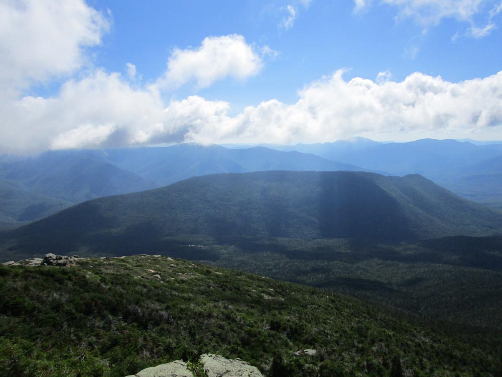
Looking south from Mt. Lafayette

The Franconia Ridge Trail on the way to Mt. Truman

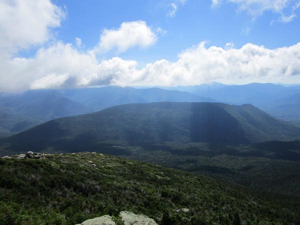
Looking at the Kinsman Ridge from Mt. Truman
The Franconia Ridge Trail on the way to Mt. Lincoln
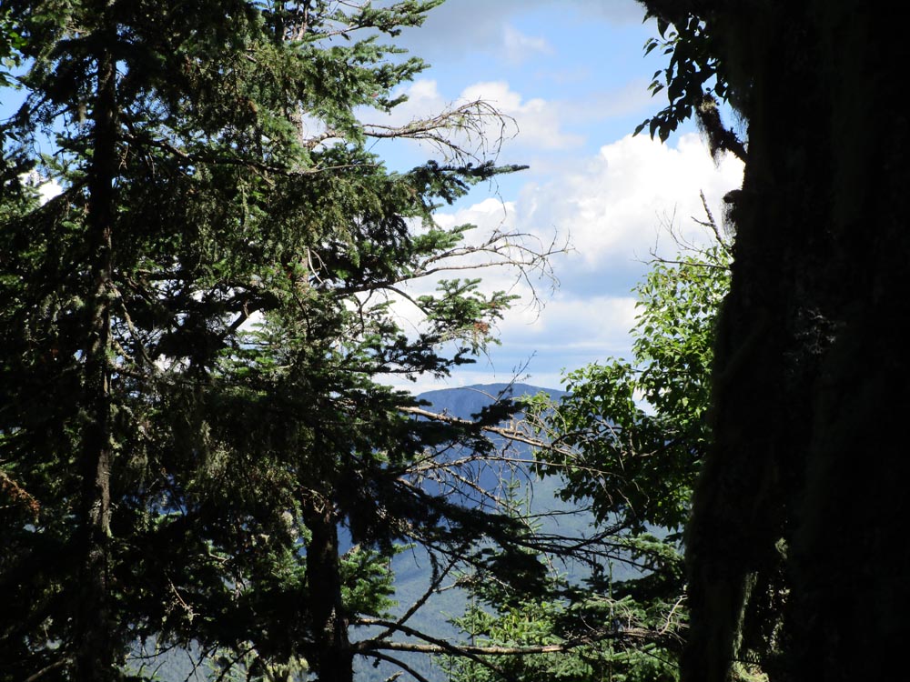
Looking at Owl's Head from Mt. Lincoln
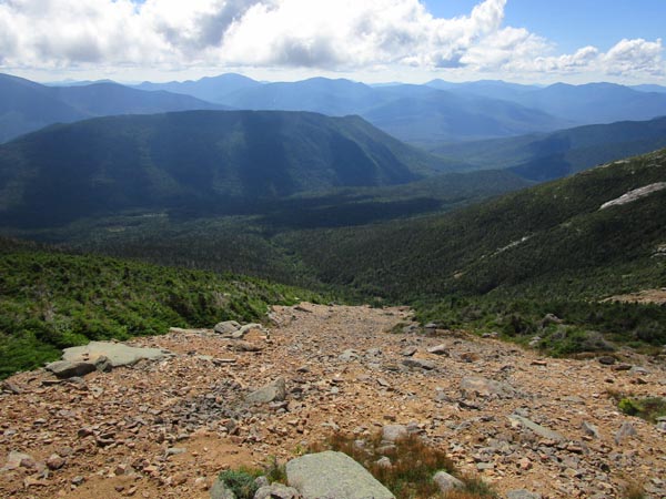
Looking down the Lincoln slide
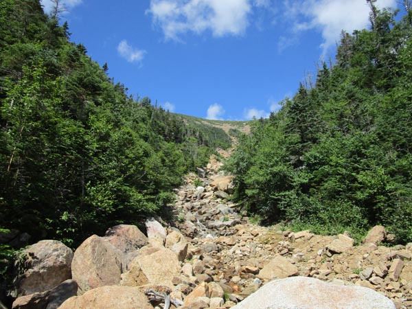
Looking up the Lincoln slide
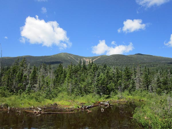
Looking at the Lincoln slide from a backcountry pond

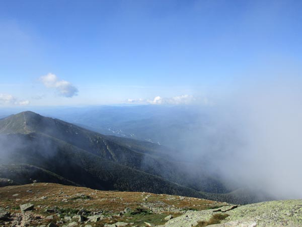
Minimal views from near the summit of Owl's Head
Directions to trailhead: Parking in the summer of 2020 was hard to come by. Early rise!
Back to Mt. Lafayette Profile
Back to Mt. Truman Profile
Back to Mt. Lincoln Profile
Back to Owls Head Profile
|