Home
States
Colorado
Connecticut
Maine
Massachusetts
New Hampshire
New York
Rhode Island
Utah
Vermont
View All
Lists
NE 4,000 Footers
NE 100 Highest
NH 4,000 Footers
NH 100 Highest
NH 52 With A View
NH Belknap Range
NH Ossipee 10
Links
Trail Conditions
Trip Log
Sunrises
Sunsets
About
|
Mt. Lafayette (North Peak), Mt. Lafayette, Mt. Truman, Mt. Lincoln
Fraconia, NH, Lincoln, NH
Trailheads, measurements, times, distances, and maps are all approximate and relative to the hike(s) as shown below.
Looking up the Skookumchuck Trail
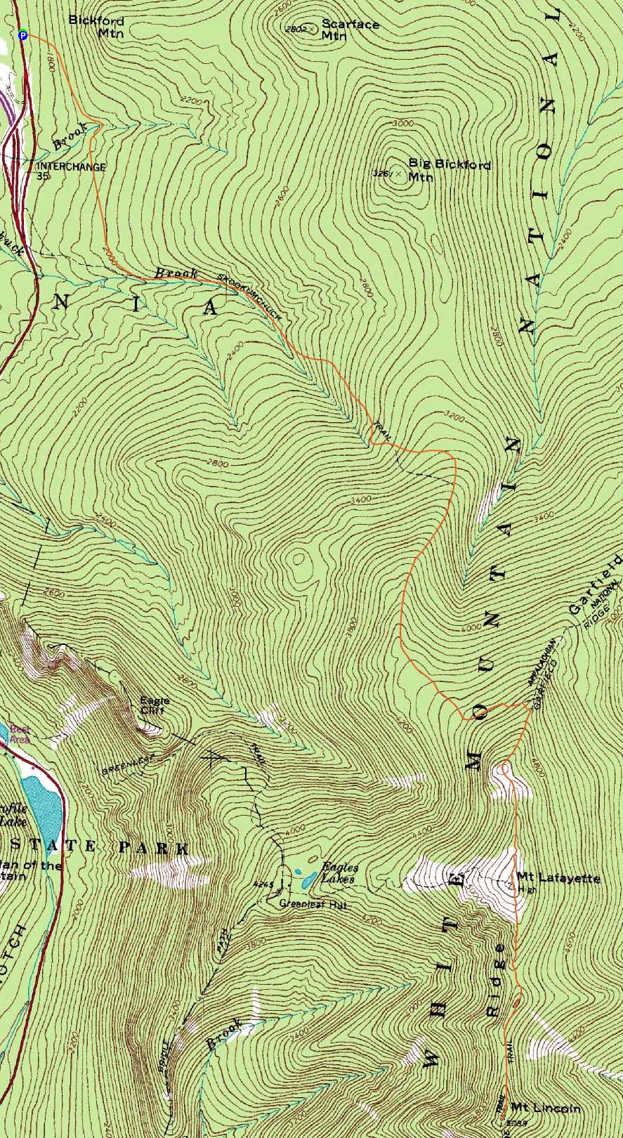
Route: Skookumchuck Trail, Garfield Ridge Trail, (Mt. Lafayette - North Peak), Garfield Ridge Trail, (Mt. Lafayette), Franconia Ridge Trail, (Mt. Truman), Franconia Ridge Trail, (Mt. Lincoln), Franconia Ridge Trail, (Mt. Truman), Franconia Ridge Trail, (Mt. Lafayette), Garfield Ridge Trail, (Mt. Lafayette - North Peak), Garfield Ridge Trail, Skookumchuck Trail
With rain in the forecast for the balance of the week, I decided to take a few hours off from work and use the sunny afternoon weather to my advantage.
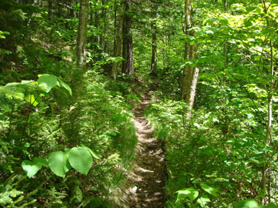
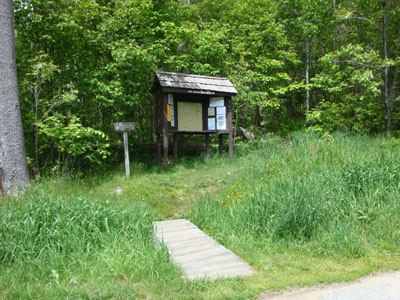
Reaching the trailhead, there were two well beaten paths without blazes - the one going directly uphill to the right is the trail. Though sparsely blazed, the trail was thereafter pretty much easy to follow.
The first part of the trail was fairly bland - the noise of the auto traffic took away from the wilderness feel. Reaching the brook and the old trail, however, things became much more interesting. Though generally gradual, there were a few steeper pitches.
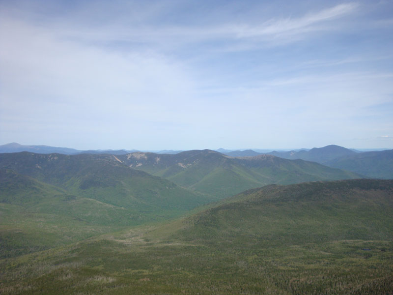
Reaching the Garfield Ridge Trail, the views opened up - the scenery from the north peak of Mt. Lafayette was tremendous. While the traditional loop had plenty of folks on it, there was perhaps better scenery from this peak with zero people.
Mt. Lafayette had the normal good-weather-sized crowds, however from there to Mt. Lincoln was pretty quiet. The alpine flowers, though probably not peak, were quite a sight as well.
The return trip was pretty uneventful, though I started to get a sore leg as I reached the Skookumchuck Trail. On the bright side, there were no mosquitoes or black flies!
| Hike Ratings |
|
Getting To Trailhead: |
Easy |
| Destination: |
Mt. Lafayette (North Peak) |
|
Length: |
Moderate |
|
Steepness: |
Difficult |
|
Navigation: |
Easy |
|
Views: |
Excellent |
|
Crowds: |
Minimal |
| Destination: |
Mt. Lafayette |
|
Length: |
Moderate |
|
Steepness: |
Difficult |
|
Navigation: |
Easy |
|
Views: |
Excellent |
|
Crowds: |
Heavy |
| Destination: |
Mt. Truman |
|
Length: |
Difficult |
|
Steepness: |
Moderate |
|
Navigation: |
Easy |
|
Views: |
Excellent |
|
Crowds: |
Minimal |
| Destination: |
Mt. Lincoln |
|
Length: |
Difficult |
|
Steepness: |
Difficult |
|
Navigation: |
Easy |
|
Views: |
Excellent |
|
Crowds: |
Minimal |
|
| Hike Stats |
|
Date Hiked: |
Monday, June 8, 2009 |
| Hike Commenced: |
1:34 PM |
| Parking Elevation: |
1,700' |
| Destination: |
Mt. Lafayette (North Peak) |
| Ascent Commenced: |
1:34 PM |
| Summit Reached: |
3:49 PM |
| Time Elapsed: |
02:15 |
| Trailhead Elevation: |
1,700' |
| Summit Elevation: |
5,060' |
| Vertical Gain: |
3,570' |
| Destination: |
Mt. Lafayette |
| Ascent Commenced: |
3:50 PM |
| Summit Reached: |
4:05 PM |
| Time Elapsed: |
00:15 |
| Trailhead Elevation: |
5,060' |
| Summit Elevation: |
5,260' |
| Vertical Gain: |
300' |
| Destination: |
Mt. Truman |
| Ascent Commenced: |
4:09 PM |
| Summit Reached: |
4:21 PM |
| Time Elapsed: |
00:12 |
| Trailhead Elevation: |
5,260' |
| Summit Elevation: |
5,000' |
| Vertical Gain: |
120' |
| Destination: |
Mt. Lincoln |
| Ascent Commenced: |
4:22 PM |
| Summit Reached: |
4:33 PM |
| Time Elapsed: |
00:11 |
| Trailhead Elevation: |
5,000' |
| Summit Elevation: |
5,089' |
| Vertical Gain: |
219' |
|
|
| Hike Ended: |
7:44 PM |
| Hike Time Elapsed: |
06:10 |
| Hike Distance: |
12 miles |
| Hike Vertical Gain: |
5,029' |
|
The Skookumchuck Trail trailhead off US 3
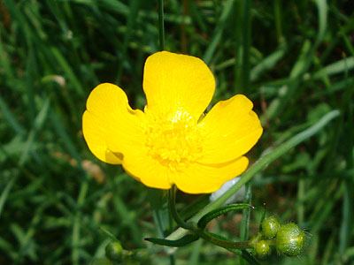
A buttercup at the beginning of the Skookumchuck Trail
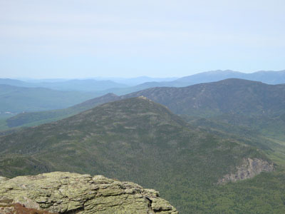
Looking Mt. Garfield from the North Peak of Mt. Lafayette
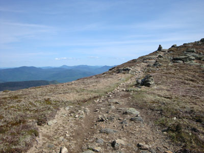
The Garfield Ridge Trail on the way to Mt. Lafayette
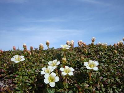
Diapensia near Mt. Lafayette
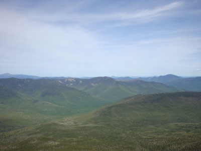
Looking at Mt. Guyot and the Bonds from Mt. Lafayette

The Franconia Ridge Trail between Mt. Lafayette and Mt. Truman

Looking at the Bonds from the Mt. Truman summit
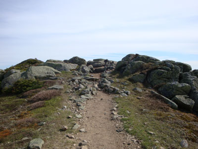
Franconia Ridge Trail between Mt. Lincoln and Mt. Truman
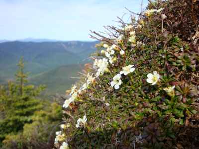
Diapensia near Mt. Lincoln
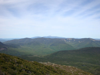
Looking over the Twins and Bonds at Mt. Washington from Mt. Lincoln


Directions to trailhead: Take I-93 North to exit 35 (US 3 North). The Skookumchuck Trail parking lot and trailhead will be on the right shortly thereafter
Back to Mt. Lafayette (North Peak) Profile
Back to Mt. Lafayette Profile
Back to Mt. Truman Profile
Back to Mt. Lincoln Profile
|