Home
States
Colorado
Connecticut
Maine
Massachusetts
New Hampshire
New York
Rhode Island
Utah
Vermont
View All
Lists
NE 4,000 Footers
NE 100 Highest
NH 4,000 Footers
NH 100 Highest
NH 52 With A View
NH Belknap Range
NH Ossipee 10
Links
Trail Conditions
Trip Log
Sunrises
Sunsets
About
|
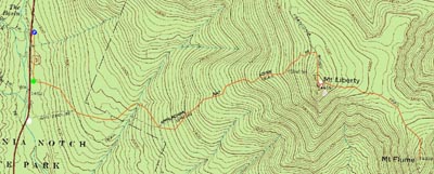
Mt. Liberty, Mt. Flume
Lincoln, NH
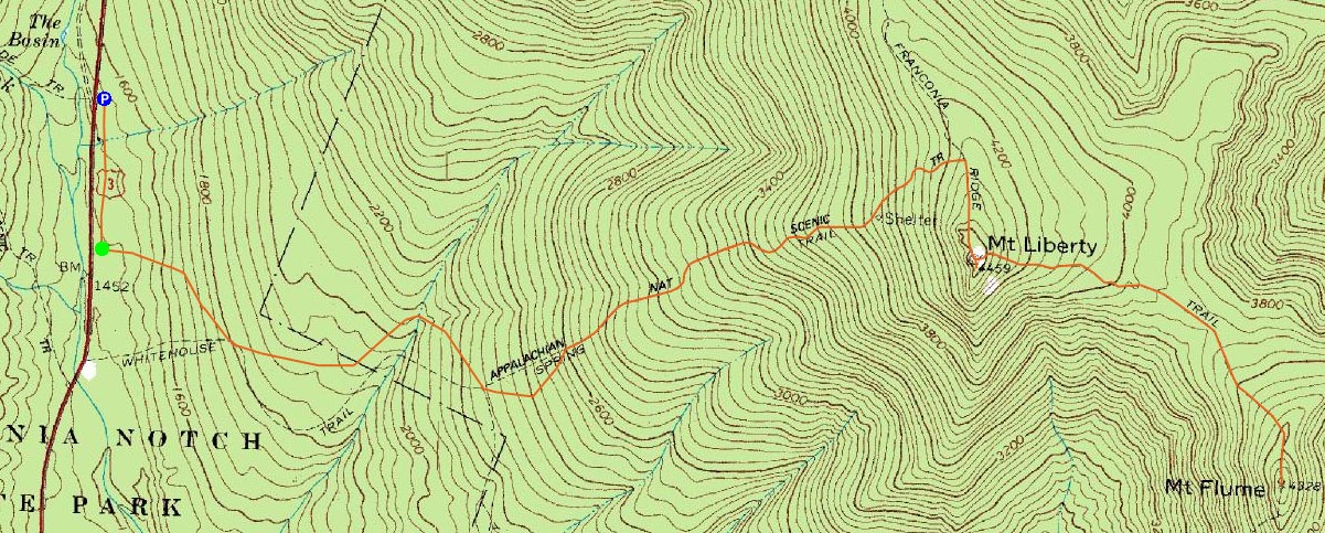
Trailheads, measurements, times, distances, and maps are all approximate and relative to the hike(s) as shown below.
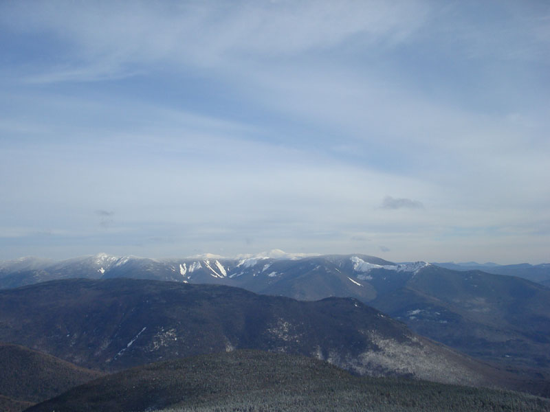
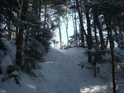
Looking down the Franconia Ridge Trail en route to Mt. Liberty
Route: Bike path, bushwhack, Liberty Spring Trail, Franconia Ridge Trail, (Mt. Liberty), Franconia Ridge Trail, (Mt. Flume) Franconia Ridge Trail, (Mt. Liberty), Franconia Ridge Trail, Liberty Spring Trail, bushwhack, bike path
For months I had been hoping to hike Mt. Flume and Mt. Liberty in the fall. Oddly enough, I would be able to technically climb both of them in the 'fall' today - in December with one to two feet of snow on the ridge. Go figure.
When it comes to hiking, I like shortcuts. Having been down the 'Basin Bushwhack' twice, I felt confident enough in finding the bottom of it for a shorter ascent. Heading down the bike path, which was covered in 1-2" of frozen crud, I soon arrived at the area I recognized from a previous 'bushwhack' - a grassy little corridor to the right of the bike path, just as it gets close to the highway. Knowing this was a few dozen feet past the entrance to the 'bushwhack,' I backtracked a bit and then headed into the woods. While I knew I needed to go a bit to the left to catch the faded old logging road, I decided to go uphill instead, as to ensure I wouldn't overshoot it, since there were no tracks and the vegetation was covered in 1-2" of crusty stuff. I ended up meeting the Liberty Springs Trail 15 feet away from where I was aiming for - not too bad.
The Liberty Springs Trail was fortunately well packed down - I was able to bareboot all the way to the summit without postholing or slipping, or for that matter, dealing with the rocky sections, as those were covered up by 6-12" of snow, which wasn't quite enough to cover up this run on sentence. The views from the summit were excellent, though the incoming cloud cover was quickly eating up blue sky. Though it was rather cold (it was about 17 degrees at the parking lot if I recall), the winds were minimal at this point, making things relatively pleasant.
My next stop was Mt. Flume. The Franconia Ridge Trail was also pretty well broken out, making things easier than I had hoped. The views on Mt. Flume weren't as great as those that I experienced earlier on Mt. Liberty - cloud cover was moving in and reducing visibility. Nonetheless, the views were still excellent. Since I was still wearing a tee shirt and the winds were starting to pick up a bit, I didn't loiter for long - it was time to get back into the trees.
Other than stopping to free my snowshoe (on pack) from being snagged on a tree and subsequently upgrading to a long sleeve shirt, I pretty much went nonestop back to the Liberty Spring campsite. Up until reaching Mt. Liberty again, I hadn't seen a single person all morning.
At the campsite, I quickly layered up and had a bite to eat. After stopping for a bit, the cold suddenly hit - having my hands exposed to eat my sandwich left me quite cold. Time to get moving!
The Liberty Spring Trail seemed to turn into a highway during the descent - I was glad I was able to get out early before the crowds hit!
| Hike Ratings |
|
Getting To Trailhead: |
Moderate |
| Destination: |
Mt. Liberty |
|
Length: |
Moderate |
|
Steepness: |
Difficult |
|
Navigation: |
Easy |
|
Views: |
Excellent |
|
Crowds: |
Minimal |
| Destination: |
Mt. Flume |
|
Length: |
Moderate |
|
Steepness: |
Difficult |
|
Navigation: |
Easy |
|
Views: |
Excellent |
|
Crowds: |
Minimal |
|
| Hike Stats |
|
Date Hiked: |
Saturday, December 6, 2008 |
| Hike Commenced: |
8:14 AM |
| Parking Elevation: |
1,520' |
| Destination: |
Mt. Liberty |
| Ascent Commenced: |
8:24 AM |
| Summit Reached: |
10:16 AM |
| Time Elapsed: |
01:52 |
| Trailhead Elevation: |
1,470' |
| Summit Elevation: |
4,459' |
| Vertical Gain: |
3,049' |
| Destination: |
Mt. Flume |
| Ascent Commenced: |
10:20 AM |
| Summit Reached: |
10:53 AM |
| Time Elapsed: |
00:33 |
| Trailhead Elevation: |
4,459' |
| Summit Elevation: |
4,328' |
| Vertical Gain: |
438' |
|
|
| Hike Ended: |
1:24 PM |
| Hike Time Elapsed: |
05:10 |
| Hike Vertical Gain: |
4,206' |
|
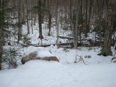
The start of the bushwhack to the Liberty Spring Trail from the bike path

Looking over the Bonds and Twins at the Presidentials from the Mt. Liberty summit
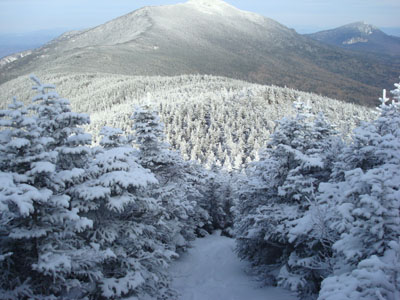
The Franconia Ridge Trail between Mt. Flume and Mt. Liberty
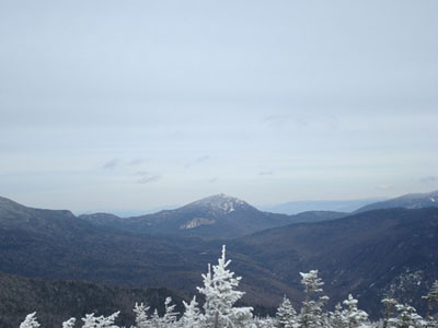
Looking at Mt. Garfield from the Mt. Flume summit

Directions to trailhead: Take Interstate 93 north from Lincoln to the Basin. Walk south down the bike path - just prior to reaching a grassy, old road on the right (where the bike path gets close to the highway), start the bushwhack on the left. After crossing a brook, an old logging road can be found a bit to the left, eventually meeting up with the hairpin turn in the Liberty Spring Trail
Back to Mt. Liberty Profile
Back to Mt. Flume Profile
|