Home
States
Colorado
Connecticut
Maine
Massachusetts
New Hampshire
New York
Rhode Island
Utah
Vermont
View All
Lists
NE 4,000 Footers
NE 100 Highest
NH 4,000 Footers
NH 100 Highest
NH 52 With A View
NH Belknap Range
NH Ossipee 10
Links
Trail Conditions
Trip Log
Sunrises
Sunsets
About
|
Mt. Liberty, Mt. Flume
Lincoln, NH
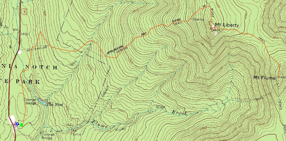
Trailheads, measurements, times, distances, and maps are all approximate and relative to the hike(s) as shown below.
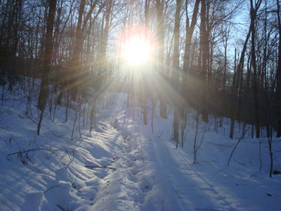
Looking up the Libery Spring Trail en route to Mt. Liberty
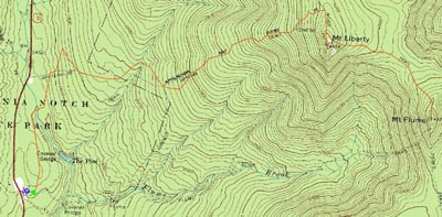
Route: Bushwhack, bike path, Liberty Spring Trail, Franconia Ridge Trail, (Mt. Liberty), Franconia Ridge Trail, (Mt. Flume) Franconia Ridge Trail, (Mt. Liberty), Franconia Ridge Trail, Liberty Spring Trail, bike path, bushwhack
Having just ascended Mt. Liberty and Mt. Flume three weeks earlier, it was time to rehike them. Previously, I had ascended Mt. Liberty via a variety of trailheads - this time, we decided to start at the Whitehouse Trail parking lot, bushwhack to the bike path/snowmobile, then head over to the Liberty Spring Trail.
The Liberty Spring Trail was fortunately broken out (other than some sinking due to recent weather and barebooters). We hit the lower part of the trail early enough to have the sun creep over the ridge and shine down the lower portion of the trail.
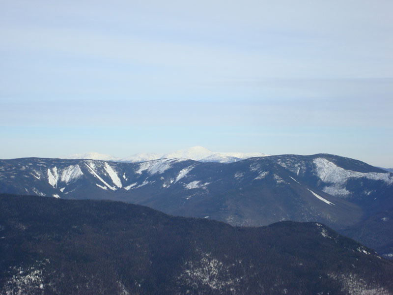
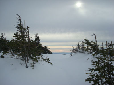
Mt. Liberty had great views and minimal winds. Though points to the east had blue sky, things were starting to cloud over.
Our next stop was Mt. Flume. Unfortunately, the Franconia Ridge Trail was not broken out, so it was somewhat slow going (especially with a crust). As we reached Mt. Flume, some peach colored clouds to the south showed up just above the trail.
Though not overly windy, there was more wind on Flume than Liberty. With the increasing high level clouds, the views weren't as spectacular as from Liberty. Nonetheless, it was still quite scenic.
Back on Liberty, we soon started a very quick descent down the Liberty Spring Trail, snowshoeing at perhaps a 3 mile per hour pace.
| Hike Ratings |
|
Getting To Trailhead: |
Moderate |
| Destination: |
Mt. Liberty |
|
Length: |
Moderate |
|
Steepness: |
Difficult |
|
Navigation: |
Easy |
|
Views: |
Excellent |
|
Crowds: |
Moderate |
| Destination: |
Mt. Flume |
|
Length: |
Difficult |
|
Steepness: |
Difficult |
|
Navigation: |
Easy |
|
Views: |
Excellent |
|
Crowds: |
Moderate |
|
| Hike Stats |
|
Date Hiked: |
Friday, December 26, 2008 |
| Hike Commenced: |
8:07 AM |
| Parking Elevation: |
1,400' |
| Destination: |
Mt. Liberty |
| Ascent Commenced: |
8:09 AM |
| Summit Reached: |
11:27 AM |
| Time Elapsed: |
03:18 |
| Trailhead Elevation: |
1,380' |
| Summit Elevation: |
4,459' |
| Vertical Gain: |
3,159' |
| Destination: |
Mt. Flume |
| Ascent Commenced: |
11:35 AM |
| Summit Reached: |
12:31 PM |
| Time Elapsed: |
00:56 |
| Trailhead Elevation: |
4,459' |
| Summit Elevation: |
4,328' |
| Vertical Gain: |
438' |
|
|
| Hike Ended: |
3:25 PM |
| Hike Time Elapsed: |
07:18 |
| Hike Vertical Gain: |
4,286' |
|
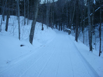
The bike path adjacent to the Whitehouse Trail parking lot
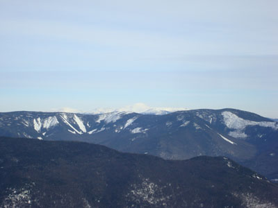
Looking over the Bonds and Twins at the Presidentials from the Mt. Liberty summit
The Franconia Ridge Trail near the summit of Mt. Flume
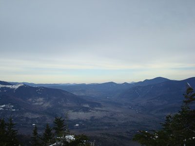
Looking east from the Mt. Flume summit

Directions to trailhead: Take I-93 North to the Flume Visitor Center exit. Take a right at the end of the offramp, then take a right at the hiker parking lot. The Whitehouse Trail trailhead is at the back of the parking lot.
Back to Mt. Liberty Profile
Back to Mt. Flume Profile
|