Home
States
Colorado
Connecticut
Maine
Massachusetts
New Hampshire
New York
Rhode Island
Utah
Vermont
View All
Lists
NE 4,000 Footers
NE 100 Highest
NH 4,000 Footers
NH 100 Highest
NH 52 With A View
NH Belknap Range
NH Ossipee 10
Links
Trail Conditions
Trip Log
Sunrises
Sunsets
About
|
Mt. Liberty, Mt. Flume
Lincoln, NH
Trailheads, measurements, times, distances, and maps are all approximate and relative to the hike(s) as shown below.
Looking up the Franconia Ridge Trail en route to Mt. Liberty
Route: Bike path, bushwhack, Liberty Spring Trail, Franconia Ridge Trail, (Mt. Liberty), Franconia Ridge Trail, (Mt. Flume) Franconia Ridge Trail, (Mt. Liberty), Franconia Ridge Trail, Liberty Spring Trail, bushwhack, bike path
Having some hours coming back to me after some long days at work, I decided to take advantage of the nice morning forecast and headup to the southern Franconias.
After walking down the still-somewhat-snow-and-ice-covered-bike-path from the Basin, I barebooted up the bushwhack route to the Liberty Spring Trail. After easily rockhopping the water crossings, I put on Microspikes for the balance of the ascent.
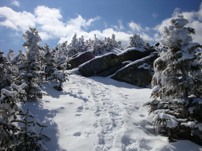
Nearing the Franconia Ridge Trail, the trees were filled with icicles - a neat sight, especially this time of year!
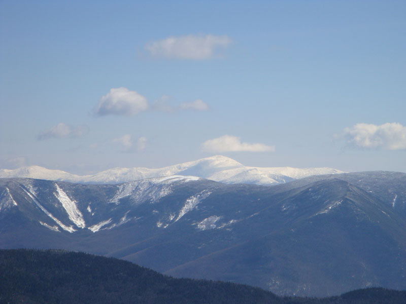
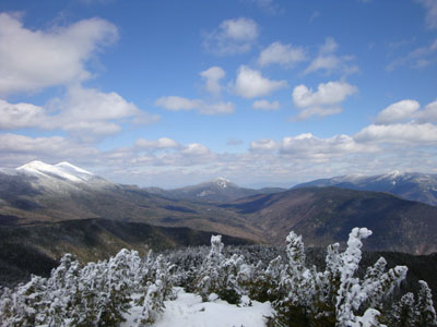
Though the short section of the Franconia Ridge Trail was a bit wind, the summit of Mt. Liberty was quite calm. The views from the top were quite good - the Presidentials were particularly striking.
The descent from Liberty into the col was spring-like - sticky snow and monorail. The ascent thereafter was more winter like - an inch of powder on top of a solid base.
The views from Mt. Flume were quite good too, though it was apparent that the clouds were slowly working their way in. Nonetheless, it was a beautiful day.
The descent went somewhat slowly, as I felt obligated to cut up a bunch of blowdowns. Nonetheless, it was nice to be out in the beautiful spring weather.
| Hike Ratings |
|
Getting To Trailhead: |
Moderate |
| Destination: |
Mt. Liberty |
|
Length: |
Moderate |
|
Steepness: |
Difficult |
|
Navigation: |
Easy |
|
Views: |
Excellent |
|
Crowds: |
Minimal |
| Destination: |
Mt. Flume |
|
Length: |
Moderate |
|
Steepness: |
Difficult |
|
Navigation: |
Easy |
|
Views: |
Excellent |
|
Crowds: |
Minimal |
|
| Hike Stats |
|
Date Hiked: |
Friday, April 10, 2009 |
| Hike Commenced: |
8:43 AM |
| Parking Elevation: |
1,520' |
| Destination: |
Mt. Liberty |
| Ascent Commenced: |
8:49 AM |
| Summit Reached: |
10:25 AM |
| Time Elapsed: |
01:36 |
| Trailhead Elevation: |
1,470' |
| Summit Elevation: |
4,459' |
| Vertical Gain: |
3,049' |
| Destination: |
Mt. Flume |
| Ascent Commenced: |
10:27 AM |
| Summit Reached: |
11:06 AM |
| Time Elapsed: |
00:39 |
| Trailhead Elevation: |
4,459' |
| Summit Elevation: |
4,328' |
| Vertical Gain: |
438' |
|
|
| Hike Ended: |
1:59 PM |
| Hike Time Elapsed: |
05:16 |
| Hike Vertical Gain: |
4,206' |
|
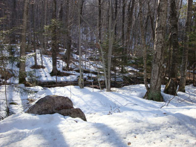
The start of the bushwhack to the Liberty Spring Trail from the bike path

Looking over Mt. Guyot at the Presidentials from the Mt. Liberty summit
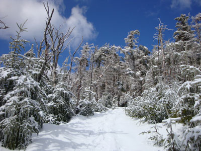
The Franconia Ridge Trail between Mt. Flume and Mt. Liberty
Looking at Mt. Garfield from the Mt. Flume summit
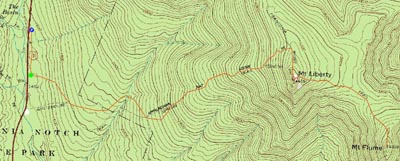

Directions to trailhead: Take Interstate 93 north from Lincoln to the Basin. Walk south down the bike path - just prior to reaching a grassy, old road on the right (where the bike path gets close to the highway), start the bushwhack on the left. After crossing a brook, an old logging road can be found a bit to the left, eventually meeting up with the hairpin turn in the Liberty Spring Trail
Back to Mt. Liberty Profile
Back to Mt. Flume Profile
|