Home
States
Colorado
Connecticut
Maine
Massachusetts
New Hampshire
New York
Rhode Island
Utah
Vermont
View All
Lists
NE 4,000 Footers
NE 100 Highest
NH 4,000 Footers
NH 100 Highest
NH 52 With A View
NH Belknap Range
NH Ossipee 10
Links
Trail Conditions
Trip Log
Sunrises
Sunsets
About
|
Mt. Liberty, Mt. Flume
Lincoln, NH
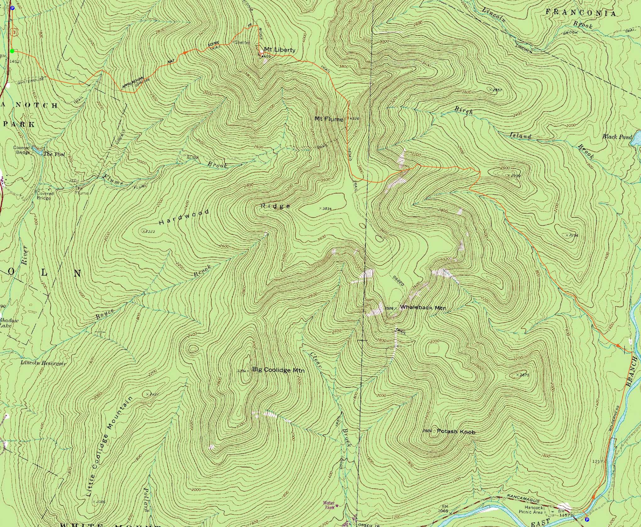
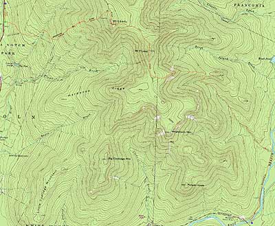
Trailheads, measurements, times, distances, and maps are all approximate and relative to the hike(s) as shown below.
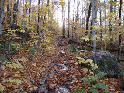
Looking up the wet Liberty Spring Trail en route to Mt. Liberty
Route: Bike path, bushwhack, Liberty Spring Trail, Franconia Ridge Trail, (Mt. Liberty), Franconia Ridge Trail, (Mt. Flume) Franconia Ridge Trail, Osseo Trail, Lincoln Woods Trail
After a day of multiple inches of rain, it was time for an initially damp hike.
Starting at the Basin, we headed down the bike path, then jumped into the woods at a distinct boulder. Working our way uphill, we hit the old logging road and were soon at the sharp turn on the Liberty Spring Trail.
The Liberty Spring Trail had water running down it, as well as mud in places. Though high, the water crossings were rock hoppable. Reaching the campsite, we could the winds whipping above.
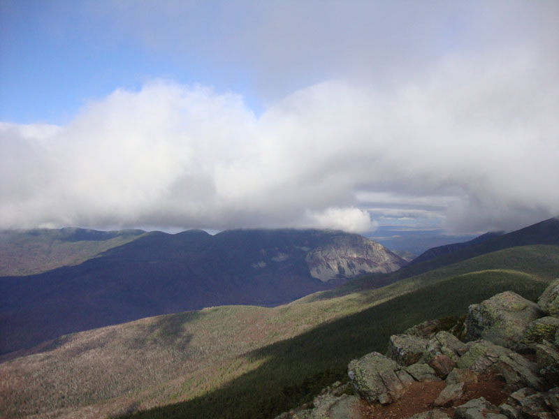
We entered the clouds just prior to reaching the Franconia Ridge Trail. Upon summiting, we added some layers and decided to wait out the clouds a bit. Sure enough, after about 5 minutes, the clouds blew through, revealing some nice views (though nearby peaks were still hidden).
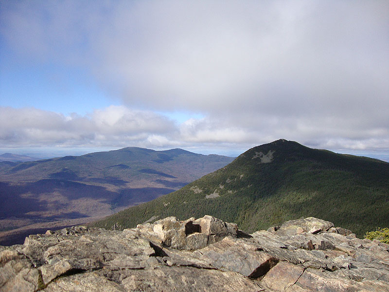
The second peak of the day was Mt. Flume. As usual, the somewhat steep ascent was a workout. The views from the top, though, were quite rewarding. After having lunch there, we headed down, as I eyeballed the slides for perhaps a future trip. The lower elevations of the Osseo Trail were quite scenic with the last colors of the fall hanging on. Reaching Lincoln Woods, the Pemi was roaring - glad we didn't do anything with significant water crossings!
| Hike Ratings |
|
Getting To Trailhead: |
Moderate |
| Destination: |
Mt. Liberty |
|
Length: |
Moderate |
|
Steepness: |
Difficult |
|
Navigation: |
Easy |
|
Views: |
Excellent |
|
Crowds: |
Minimal |
| Destination: |
Mt. Flume |
|
Length: |
Moderate |
|
Steepness: |
Difficult |
|
Navigation: |
Easy |
|
Views: |
Excellent |
|
Crowds: |
Minimal |
|
| Hike Stats |
|
Date Hiked: |
Sunday, October 25, 2009 |
| Hike Commenced: |
8:12 AM |
| Parking Elevation: |
1,520' |
| Destination: |
Mt. Liberty |
| Ascent Commenced: |
8:19 AM |
| Summit Reached: |
10:16 AM |
| Time Elapsed: |
01:57 |
| Trailhead Elevation: |
1,470' |
| Summit Elevation: |
4,459' |
| Vertical Gain: |
3,049' |
| Destination: |
Mt. Flume |
| Ascent Commenced: |
10:42 AM |
| Summit Reached: |
11:25 AM |
| Time Elapsed: |
00:43 |
| Trailhead Elevation: |
4,459' |
| Summit Elevation: |
4,328' |
| Vertical Gain: |
438' |
|
|
| Hike Ended: |
2:16 PM |
| Hike Time Elapsed: |
06:04 |
| Hike Vertical Gain: |
3,667' |
|
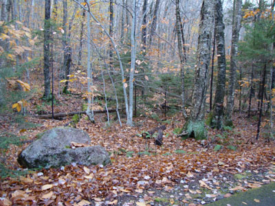
The start of the bushwhack to the Liberty Spring Trail from the bike path
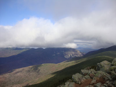
Looking at the Kinsman Ridge from the Mt. Liberty summit
The Franconia Ridge Trail between Mt. Flume and Mt. Liberty

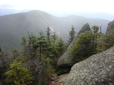
Looking at the Kinsmans and Mt. Liberty from the Mt. Flume summit
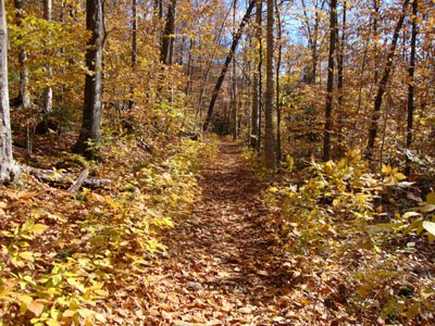
The Osseo Trail

Directions to trailhead: Take Interstate 93 north from Lincoln to the Basin. Walk south down the bike path - just prior to reaching a grassy, old road on the right (where the bike path gets close to the highway), start the bushwhack on the left. After crossing a brook, an old logging road can be found a bit to the left, eventually meeting up with the hairpin turn in the Liberty Spring Trail. The Lincoln Woods WMNF fee parking area is located east of Loon ski area on Route 112.
Back to Mt. Liberty Profile
Back to Mt. Flume Profile
|