Home
States
Colorado
Connecticut
Maine
Massachusetts
New Hampshire
New York
Rhode Island
Utah
Vermont
View All
Lists
NE 4,000 Footers
NE 100 Highest
NH 4,000 Footers
NH 100 Highest
NH 52 With A View
NH Belknap Range
NH Ossipee 10
Links
Trail Conditions
Trip Log
Sunrises
Sunsets
About
|
Mt. Liberty, Mt. Flume
Lincoln, NH
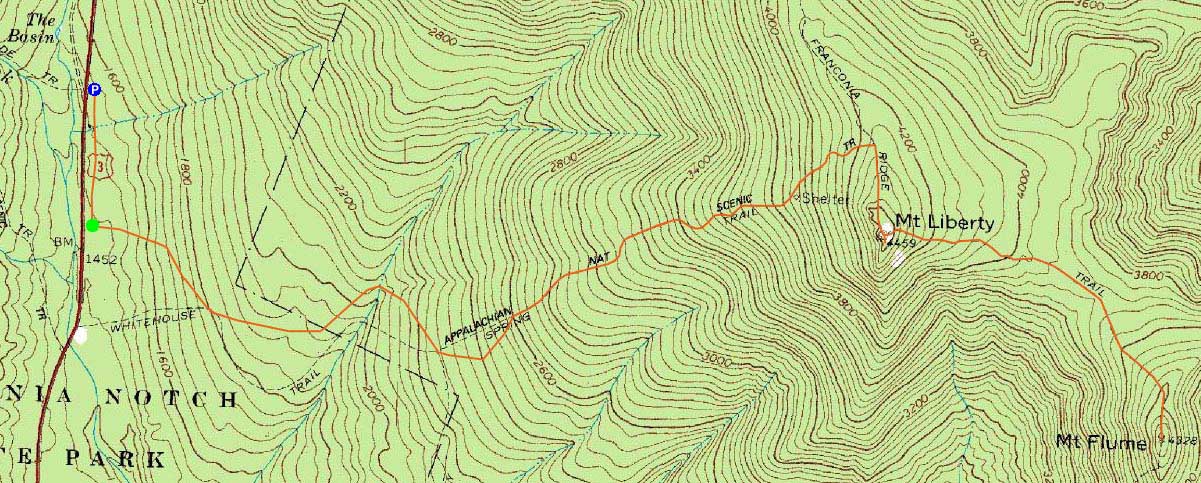
Trailheads, measurements, times, distances, and maps are all approximate and relative to the hike(s) as shown below.
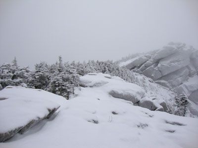
Looking up the Franconia Ridge Trail near Mt. Liberty
Route: Bike path, bushwhack, Liberty Spring Trail, Franconia Ridge Trail, (Mt. Liberty), Franconia Ridge Trail, (Mt. Flume) Franconia Ridge Trail, (Mt. Liberty), Franconia Ridge Trail, Liberty Spring Trail, bushwhack, bike path
While the forecast was for snow, it was also for warmer temperatures and minimal winds. Thus, the southern Franconia Ridge seemed like a good destination.
After parking at the Basin, we headed south on the snowmobile trail, looking for the entrance to the old trail to the Liberty Spring Trail. Normally looking for a tree stump, the new snow obscured it a bit. Nonetheless, we found the boulder near it and were on our way.
The Liberty Spring Trail was a bit beat up for barebooting, however we were able to pack it out with our snowshoes. Reaching Mt. Liberty, we had minimal winds - and minimal views.
Near the lowpoint of the Franconia Ridge between the peaks, we stopped for lunch. Beyond there, we dealt with some snowdrifts as we worked out way to Mt. Flume - once again, no views.
For the return trip, we did some trail maintenance, as to clean things up prior to the potential weekend snowfall. Once back on the snowmobile trail, we found ourselves stepping aside to let dozens of sleds pass by.
| Hike Ratings |
|
Getting To Trailhead: |
Moderate |
| Destination: |
Mt. Liberty |
|
Length: |
Moderate |
|
Steepness: |
Difficult |
|
Navigation: |
Easy |
|
Views: |
Minimal (due to weather) |
|
Crowds: |
Minimal |
| Destination: |
Mt. Flume |
|
Length: |
Moderate |
|
Steepness: |
Difficult |
|
Navigation: |
Easy |
|
Views: |
Minimal (due to weather) |
|
Crowds: |
Minimal |
|
| Hike Stats |
|
Date Hiked: |
Friday, January 1, 2010 |
| Hike Commenced: |
8:12 AM |
| Parking Elevation: |
1,520' |
| Destination: |
Mt. Liberty |
| Ascent Commenced: |
8:19 AM |
| Summit Reached: |
10:59 AM |
| Time Elapsed: |
02:40 |
| Trailhead Elevation: |
1,470' |
| Summit Elevation: |
4,459' |
| Vertical Gain: |
3,049' |
| Destination: |
Mt. Flume |
| Ascent Commenced: |
11:00 AM |
| Summit Reached: |
12:03 PM |
| Time Elapsed: |
01:03 |
| Trailhead Elevation: |
4,459' |
| Summit Elevation: |
4,328' |
| Vertical Gain: |
438' |
|
|
| Hike Ended: |
3:10 PM |
| Hike Time Elapsed: |
06:58 |
| Hike Vertical Gain: |
4,206' |
|
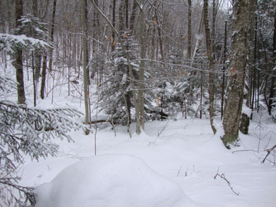
The start of the bushwhack to the Liberty Spring Trail from the bike path
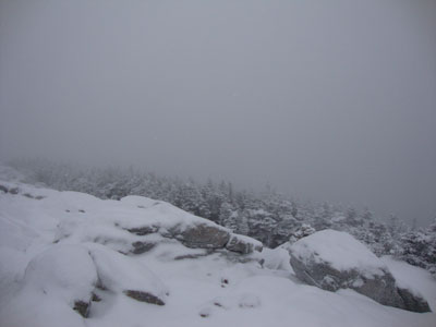
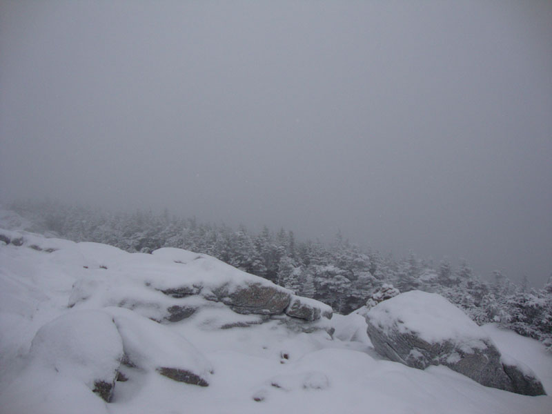
Looking at clouds from the Mt. Liberty summit
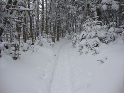
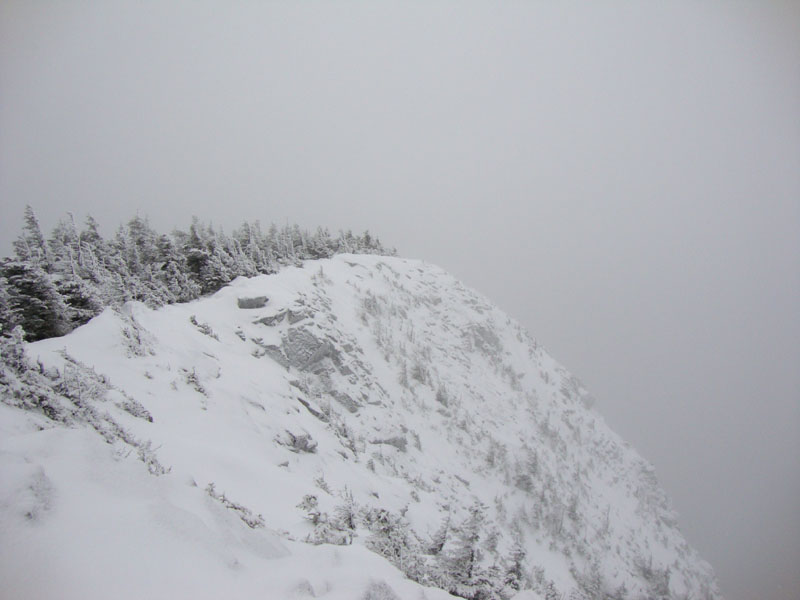
The Franconia Ridge Trail between Mt. Flume and Mt. Liberty
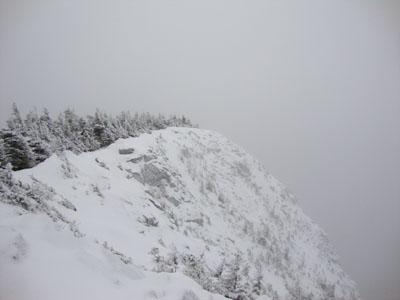
Looking at clouds from the Mt. Flume summit
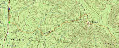

Directions to trailhead: Take Interstate 93 north from Lincoln to the Basin. Walk south down the bike path - just prior to reaching a grassy, old road on the right (where the bike path gets close to the highway), start the bushwhack on the left. After crossing a brook, an old logging road can be found a bit to the left, eventually meeting up with the hairpin turn in the Liberty Spring Trail
Back to Mt. Liberty Profile
Back to Mt. Flume Profile
|