Home
States
Colorado
Connecticut
Maine
Massachusetts
New Hampshire
New York
Rhode Island
Utah
Vermont
View All
Lists
NE 4,000 Footers
NE 100 Highest
NH 4,000 Footers
NH 100 Highest
NH 52 With A View
NH Belknap Range
NH Ossipee 10
Links
Trail Conditions
Trip Log
Sunrises
Sunsets
About
|
Mt. Liberty, Mt. Flume
Lincoln, NH
Trailheads, measurements, times, distances, and maps are all approximate and relative to the hike(s) as shown below.
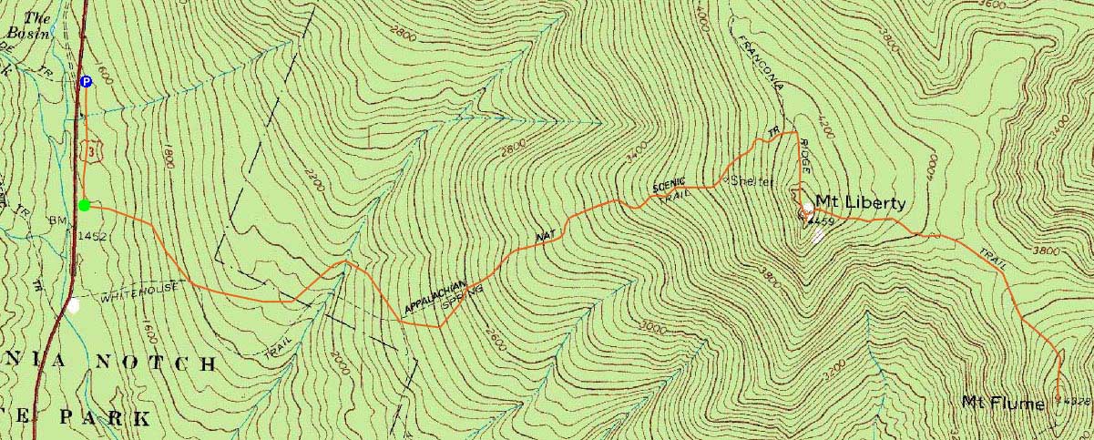
The Liberty Spring Trail
Route: Bike path, bushwhack, Liberty Spring Trail, Franconia Ridge Trail, (Mt. Liberty), Franconia Ridge Trail, (Mt. Flume) Franconia Ridge Trail, (Mt. Liberty), Franconia Ridge Trail, Liberty Spring Trail, bushwhack, bike path
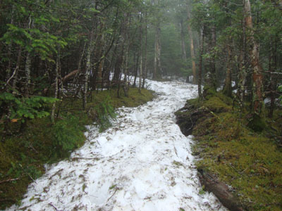
A nasty forecast, but nonetheless a weekend day. Starting at the Basin in light rain, we took the old trail from the bike path up to the Liberty Spring, reaching heavier rain and snow monorail by the campsite. Finally reaching the summit of Liberty, we were pelted with sleet.
Continuing over to Flume, the conditions weren't much fun - wind, rain, deep snow. Upon reaching the summit, we quickly turned around and headed back to Liberty and then down.
| Hike Ratings |
|
Getting To Trailhead: |
Moderate |
| Destination: |
Mt. Liberty |
|
Length: |
Moderate |
|
Steepness: |
Difficult |
|
Navigation: |
Easy |
|
Views: |
Minimal (due to weather) |
|
Crowds: |
Minimal |
| Destination: |
Mt. Flume |
|
Length: |
Moderate |
|
Steepness: |
Difficult |
|
Navigation: |
Easy |
|
Views: |
Minimal (due to weather) |
|
Crowds: |
Minimal |
|
| Hike Stats |
|
Date Hiked: |
Saturday, May 8, 2010 |
| Hike Commenced: |
8:03 AM |
| Parking Elevation: |
1,520' |
| Destination: |
Mt. Liberty |
| Ascent Commenced: |
8:08 AM |
| Summit Reached: |
10:05 AM |
| Time Elapsed: |
01:57 |
| Trailhead Elevation: |
1,470' |
| Summit Elevation: |
4,459' |
| Vertical Gain: |
3,049' |
| Destination: |
Mt. Flume |
| Ascent Commenced: |
10:05 AM |
| Summit Reached: |
10:51 AM |
| Time Elapsed: |
00:46 |
| Trailhead Elevation: |
4,459' |
| Summit Elevation: |
4,328' |
| Vertical Gain: |
438' |
|
|
| Hike Ended: |
1:30 PM |
| Hike Time Elapsed: |
05:27 |
| Hike Vertical Gain: |
4,206' |
|
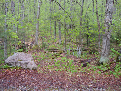
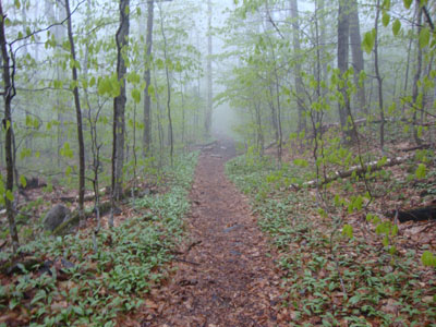
The start of the bushwhack to the Liberty Spring Trail from the bike path
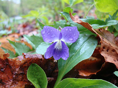
A purple violet along the bike path

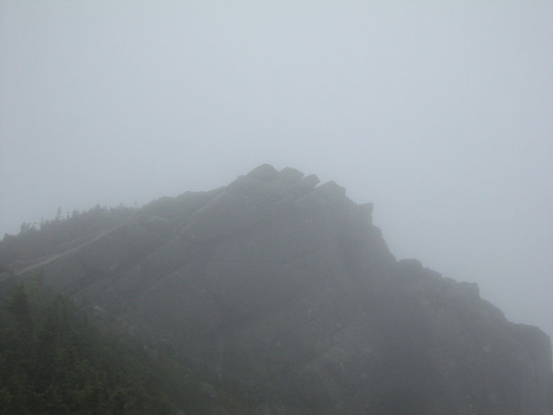
Mt. Liberty in the clouds
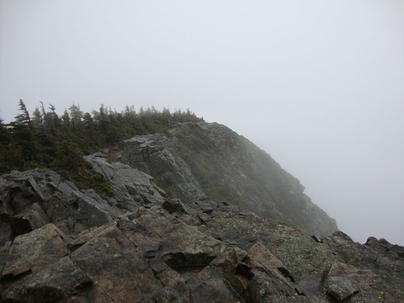
The Franconia Ridge Trail between Mt. Flume and Mt. Liberty

Mt. Flume in the clouds
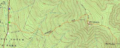

Directions to trailhead: Take Interstate 93 north from Lincoln to the Basin. Walk south down the bike path - just prior to reaching a grassy, old road on the right (where the bike path gets close to the highway), start the bushwhack on the left. After crossing a brook, an old logging road can be found a bit to the left, eventually meeting up with the hairpin turn in the Liberty Spring Trail
Back to Mt. Liberty Profile
Back to Mt. Flume Profile
|