Home
States
Colorado
Connecticut
Maine
Massachusetts
New Hampshire
New York
Rhode Island
Utah
Vermont
View All
Lists
NE 4,000 Footers
NE 100 Highest
NH 4,000 Footers
NH 100 Highest
NH 52 With A View
NH Belknap Range
NH Ossipee 10
Links
Trail Conditions
Trip Log
Sunrises
Sunsets
About
|
Mt. Liberty, Mt. Flume
Lincoln, NH
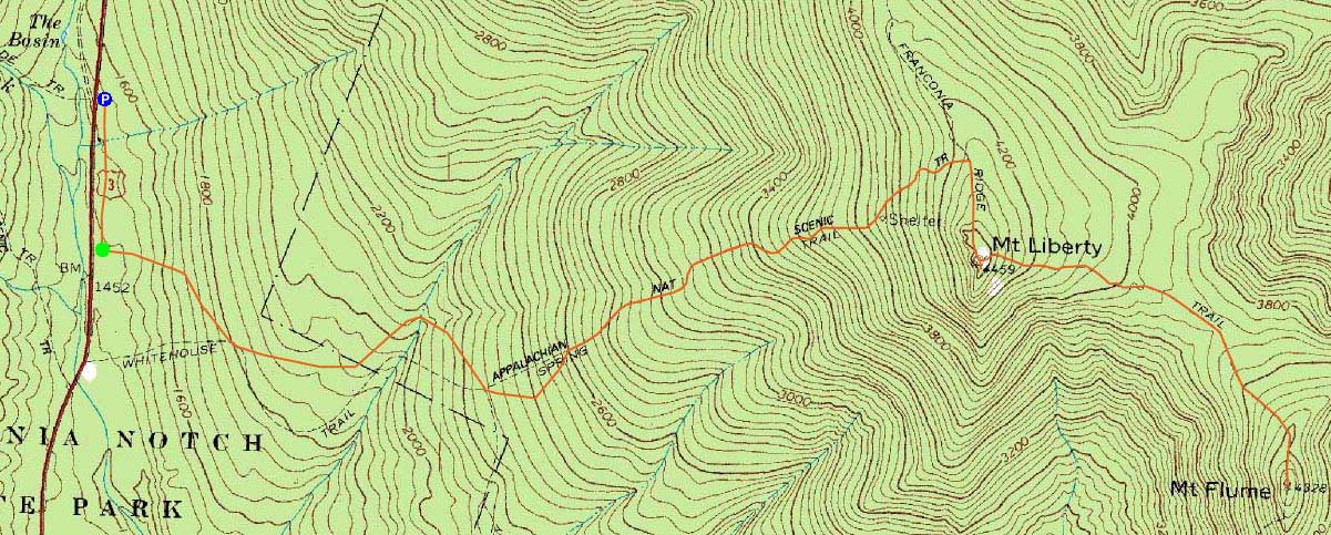
Trailheads, measurements, times, distances, and maps are all approximate and relative to the hike(s) as shown below.
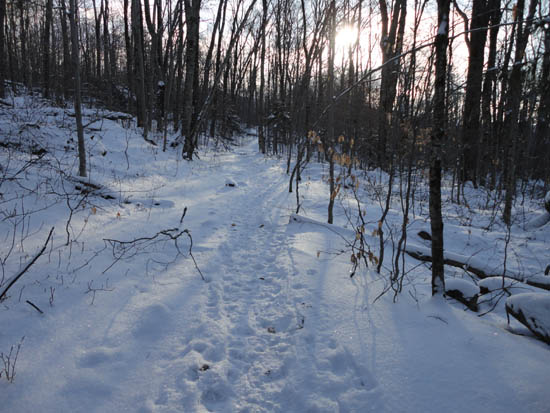
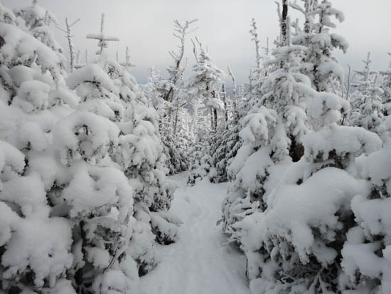
Looking up the Liberty Spring Trail
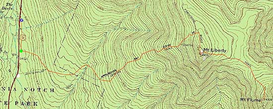
Route: Bike path, bushwhack, Liberty Spring Trail, Franconia Ridge Trail, (Mt. Liberty), Franconia Ridge Trail, (Mt. Flume) Franconia Ridge Trail, (Mt. Liberty), Franconia Ridge Trail, Liberty Spring Trail, bushwhack, bike path
Though it was a Presi Day, we opted to head over to the southern Franconia peaks. Starting at the Basin, we headed south on the bike path, donning Microspikes. A few minutes later, we headed into the woods, across a small creek, and up the old trail to the hairpin turn on the Liberty Spring Trail.
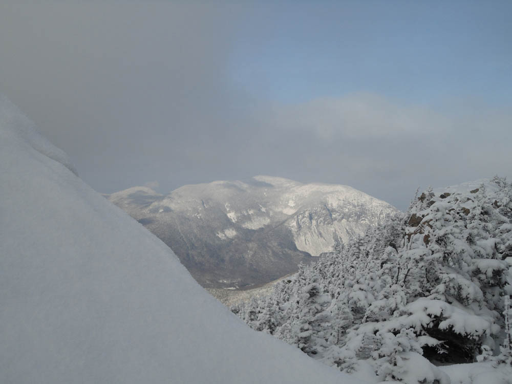
Microspikes proved to be sufficient for the climb up to Mt. Liberty, as 1-2" of powder coated hardpack granular and blue ice. Reaching Liberty, we had decent views of Cannon and elevations lower, but other views were restricted due to undercast conditions - had we been on one of the northern Franconia peaks, we would have had spectacular upper elevation views most likely.
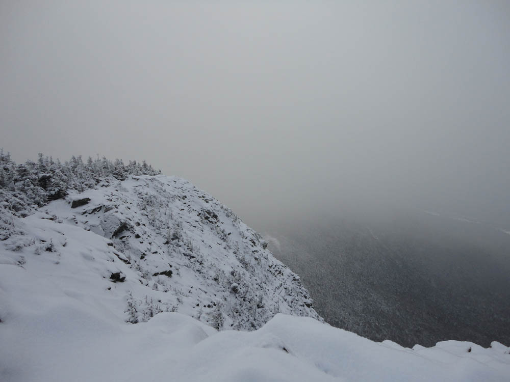
Microspikes were adequate for the out and back to Flume as well. Unfortunately, the undercast had engulfed this summit a bit, resulting in limited views.
After reclimbing Liberty, we headed back down the route we had ascended.
| Hike Ratings |
|
Getting To Trailhead: |
Moderate |
| Destination: |
Mt. Liberty |
|
Length: |
Moderate |
|
Steepness: |
Difficult |
|
Navigation: |
Easy |
|
Views: |
Excellent |
|
Crowds: |
Minimal |
| Destination: |
Mt. Flume |
|
Length: |
Moderate |
|
Steepness: |
Difficult |
|
Navigation: |
Easy |
|
Views: |
Moderate (due to weather) |
|
Crowds: |
Minimal |
|
| Hike Stats |
|
Date Hiked: |
Sunday, December 19, 2010 |
| Hike Commenced: |
8:43 AM |
| Parking Elevation: |
1,520' |
| Destination: |
Mt. Liberty |
| Ascent Commenced: |
8:49 AM |
| Summit Reached: |
11:08 AM |
| Time Elapsed: |
02:19 |
| Trailhead Elevation: |
1,470' |
| Summit Elevation: |
4,459' |
| Vertical Gain: |
3,049' |
| Destination: |
Mt. Flume |
| Ascent Commenced: |
11:12 AM |
| Summit Reached: |
11:56 AM |
| Time Elapsed: |
00:44 |
| Trailhead Elevation: |
4,459' |
| Summit Elevation: |
4,328' |
| Vertical Gain: |
438' |
|
|
| Hike Ended: |
2:50 PM |
| Hike Time Elapsed: |
06:07 |
| Hike Vertical Gain: |
4,206' |
|
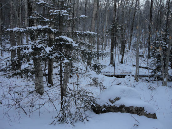
The start of the bushwhack to the Liberty Spring Trail from the bike path

Looking at Cannon Mountain from Mt. Liberty
The Franconia Ridge Trail between Mt. Flume and Mt. Liberty
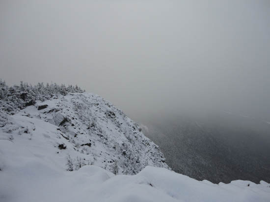
Limited views from Mt. Flume

Directions to trailhead: Take Interstate 93 north from Lincoln to the Basin. Walk south down the bike path - just prior to reaching a grassy, old road on the right (where the bike path gets close to the highway), start the bushwhack on the left. After crossing a brook, an old logging road can be found a bit to the left, eventually meeting up with the hairpin turn in the Liberty Spring Trail
Back to Mt. Liberty Profile
Back to Mt. Flume Profile
|