Home
States
Colorado
Connecticut
Maine
Massachusetts
New Hampshire
New York
Rhode Island
Utah
Vermont
View All
Lists
NE 4,000 Footers
NE 100 Highest
NH 4,000 Footers
NH 100 Highest
NH 52 With A View
NH Belknap Range
NH Ossipee 10
Links
Trail Conditions
Trip Log
Sunrises
Sunsets
About
|
Mt. Liberty, Mt. Flume
Lincoln, NH
Trailheads, measurements, times, distances, and maps are all approximate and relative to the hike(s) as shown below.
The Franconia Ridge Trail to Mt. Liberty
Route: Bike path, herd path, Liberty Spring Trail, Franconia Ridge Trail, (Mt. Liberty), Franconia Ridge Trail, (Mt. Flume) Franconia Ridge Trail, (Mt. Liberty), Franconia Ridge Trail, Liberty Spring Trail, herd path, bike path
Winter conditions have returned. I brought snowshoes more as a safety item, but ended up using them early on, and would not have made it to Flume without them.
Bike path is snow free with a few inches in the woods. Herd path up to the turn had a couple of inches of snow, but is melting quickly since the ground isn't frozen. A few yellow violets and bellwort in bloom with trout lily trying to break through.
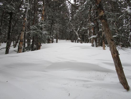
Liberty Spring Trail was bony past the water crossings and into the softwood. A couple of inches down low, increasing to six inches further up. Shortly after reaching the softwoods, there was residual snow/ice underneath the new powder. Microspikes would not have been useful due to the amount of powder and the consistency of the ice under it. I was working a lot more than needed by booting, so the snowshoes went on at this point. By the time I reached the camp site, there was 6-8" of powder (actual powder this morning, not wet stuff) on top of the existing snowpack, and it was flurrying. Up on the ridge, a few drifts were closer to 2 feet of powder. A couple of blazes were at ankle/shin height above the snowpack. A few random gotcha postholes hiding from postholers of yore. The ledgy areas are fairly clear.
Mid-winter powder conditions between the peaks as well, generally 6-12 inches on top of the existing snowpack of multiple feet. Not too far from the summit of Flume, I hit a few drifts that were more than knee deep with snowshoes. I couldn't imagine trying to bareboot through these, as the powder was probably 3-4 feet deep, on top of the existing snowpack.
I only encountered three other hikers on my descent, all of whom were well prepared with snowshoes. Thanks to this, the descent in the upper elevations was about the smoothest I've had on these peaks in many years.
Things got a little sticky below 3,000 feet, and one could tell the powder on top of previous bare ground (below the soft woods) was going quickly in the sun.
Conditions will change quickly, but the moral of the story is that, particularly in these circumstances, snowshoes should be at least carried when heading into the higher elevations. The colder than average spring, along with this recent powder, may result in the snowpack hanging on longer than normal at elevation.
| Hike Ratings |
|
Getting To Trailhead: |
Moderate |
| Destination: |
Mt. Liberty |
|
Length: |
Moderate |
|
Steepness: |
Difficult |
|
Navigation: |
Easy |
|
Views: |
Excellent |
|
Crowds: |
Minimal |
| Destination: |
Mt. Flume |
|
Length: |
Moderate |
|
Steepness: |
Difficult |
|
Navigation: |
Easy |
|
Views: |
Excellent |
|
Crowds: |
Minimal |
|
| Hike Stats |
|
Date Hiked: |
Sunday, May 10, 2020 |
| Time to Trailhead: |
00:06 |
| Parking Elevation: |
1,520' |
| Destination: |
Mt. Liberty |
| Time Elapsed: |
02:40 |
| Trailhead Elevation: |
1,470' |
| Summit Elevation: |
4,459' |
| Vertical Gain: |
3,049' |
| Destination: |
Mt. Flume |
| Time Elapsed: |
00:49 |
| Trailhead Elevation: |
4,459' |
| Summit Elevation: |
4,328' |
| Vertical Gain: |
438' |
|
|
| Hike Time Elapsed: |
06:17 |
| Hike Vertical Gain: |
4,206' |
|
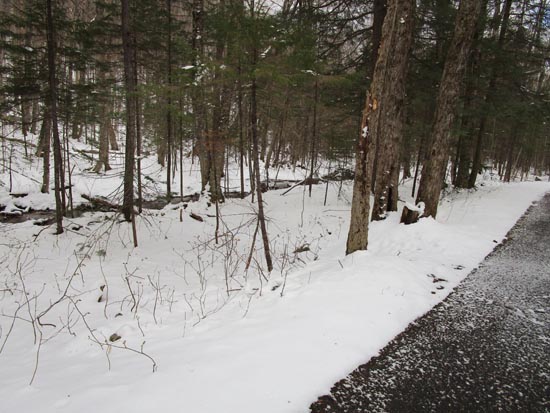
The start of the herd path to the Liberty Spring Trail from the bike path
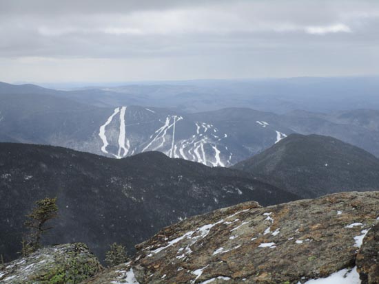
Looking south from Mt. Liberty
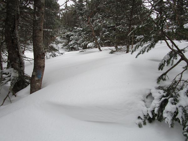
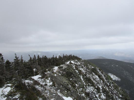
The Franconia Ridge Trail between Mt. Flume and Mt. Liberty
Looking south from Mt. Flume
Directions to trailhead: Take Interstate 93 north from Lincoln to the Basin. Walk south down the bike path - just prior to reaching a grassy, old road on the right (where the bike path gets close to the highway), start the bushwhack on the left. After crossing a brook, an old logging road can be found a bit to the left, eventually meeting up with the hairpin turn in the Liberty Spring Trail
Back to Mt. Liberty Profile
Back to Mt. Flume Profile
|


