Home
States
Colorado
Connecticut
Maine
Massachusetts
New Hampshire
New York
Rhode Island
Utah
Vermont
View All
Lists
NE 4,000 Footers
NE 100 Highest
NH 4,000 Footers
NH 100 Highest
NH 52 With A View
NH Belknap Range
NH Ossipee 10
Links
Trail Conditions
Trip Log
Sunrises
Sunsets
About
|
Mt. Mack
Gilmanton, NH, Gilford, NH
Trailheads, measurements, times, distances, and maps are all approximate and relative to the hike(s) as shown below.

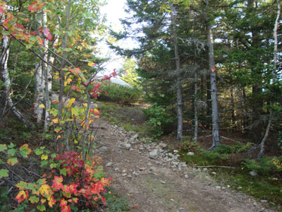
Looking up the Orange Trail on the Mack Ridge
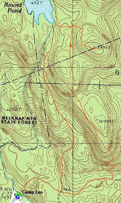
Route: Red/Blue Trail, Orange Trail, Red/Orange Trail, (Mt. Mack), Red/Orange Trail, snowmobile trail, Red Trail, Red/Blue Trail
Having previously hiked this in the rain and fog, I wanted to check out the Round Pond area from the south in better weather. While I had planned to hike both Mack and Klem, a few missed turns on the drive down ended that notion.
Starting at the scout camp, I jogged across the wooden bridge and up the dirt road, following signs for "Logging Camp" at junctions. Awhile after passing the Red Trail junction, I arrived at the unsigned Orange Trail junction (faded wood blazes visible on both sides of the dirt road).
The Orange Trail climbed almost right away, working its way through some rocky areas. Upon reaching the ridge, there were multiple nice ledgy viewpoints. The stretch across the ridge to the Red/Orange Trail is a very nice walk.
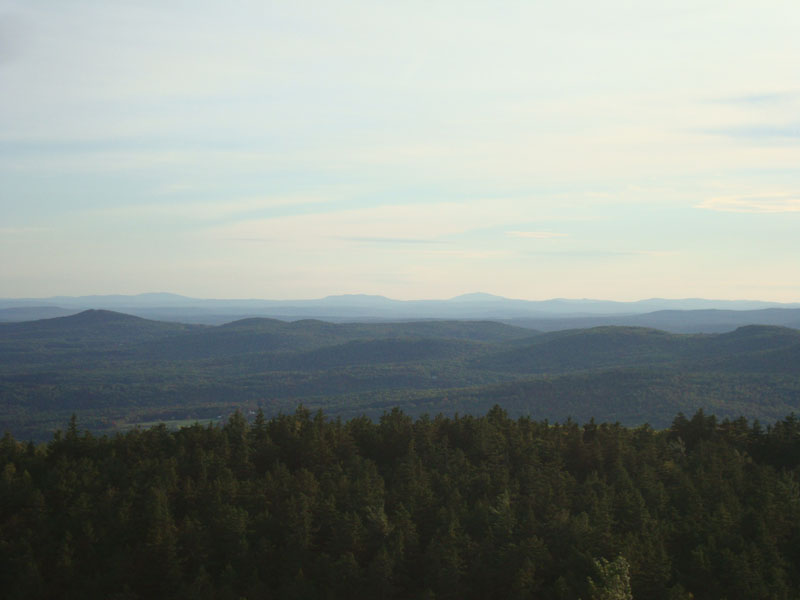
Once at the Red/Orange Trail junction, I took a right and worked my way up the access road to Mt. Mack. Though there is no spectacular view per se, there are multiple decent directional views to the east, south, and southwest.
After poking around the summit area a bit, I turned around and jogged down the access road to the Round Pond area, then down the dirt roads back to the scout camp - generally pretty good footing for jogging purposes.
| Hike Ratings |
|
Getting To Trailhead: |
Easy |
| Destination: |
Mt. Mack |
|
Length: |
Moderate |
|
Steepness: |
Difficult |
|
Navigation: |
Moderate |
|
Views: |
Excellent |
|
Crowds: |
Minimal |
|
| Hike Stats |
|
Date Hiked: |
Thursday, September 23, 2010 |
| Hike Commenced: |
4:28 PM |
| Parking Elevation: |
740' |
| Destination: |
Mt. Mack |
| Ascent Commenced: |
4:28 PM |
| Summit Reached: |
5:32 PM |
| Time Elapsed: |
01:04 |
| Trailhead Elevation: |
740' |
| Summit Elevation: |
1,945' |
| Vertical Gain: |
1,365' |
|
|
| Hike Ended: |
6:16 PM |
| Hike Time Elapsed: |
01:48 |
| Hike Vertical Gain: |
1,445' |
|
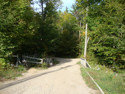
The Red-Blue Trail trailhead at Camp Bell
Looking up the Red-Orange Trail on the Mack Ridge
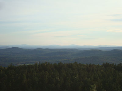
Looking at Crotched and Monadnock from near the Mt. Mack summit


Directions to trailhead: From Route 107, take Route 140 east into Gilmanton. Take a left onto Crystal Lake Road, bearing left to stay on it (when Mountain Road goes straight). After passing Crystal Lake, the road turns into Guinea Ridge Road. Take a right next to some cabins onto Manning Lake Road (this is inaccurately labelled as Camp Leo Road and Moulton Road on some maps...the current road sign says Manning Lake Road). There is a small parking area on the left just before reaching the area with the camp buildings. The Red-Blue Trail starts at the bridge just beyond the main building, in the form of a dirt road.
Back to Mt. Mack Profile
|