Home
States
Colorado
Connecticut
Maine
Massachusetts
New Hampshire
New York
Rhode Island
Utah
Vermont
View All
Lists
NE 4,000 Footers
NE 100 Highest
NH 4,000 Footers
NH 100 Highest
NH 52 With A View
NH Belknap Range
NH Ossipee 10
Links
Trail Conditions
Trip Log
Sunrises
Sunsets
About
|
Mt. Mack, Mt. Klem
Gilmanton, NH, Gilford, NH
Trailheads, measurements, times, distances, and maps are all approximate and relative to the hike(s) as shown below.
Looking up Orange Trail on the Mack Ridge
Route: Red/Blue Trail, Orange Trail, Red/Orange Trail, (Mt. Mack), Red Trail, herd path, (Mt. Klem), herd path, Red Trail, Round Pond Road, Red/Blue Trail
Trails were generally dry with a few puddles from recent rain. A decent amount of recent logging on the upper end of the Mack Ridge (Orange) Trail, though the operation did not log the actual trail. On the bright side, a tremendous viewpoint of Belknap Mountain, Round Pond, etc. opened up on the Orange-Red Trail near Mt. Mack as a result.
Also as a result of the logging, the upper mile or so of the road to Round Pond has been rebuilt, using lots of moderate sized stone. As a result, it's a bit awkward for running.
Nonetheless, a very nice loop with excellent views.
A few decent blueberries near Mt. Klem, otherwise there weren't many directly on trail.
| Hike Ratings |
|
Getting To Trailhead: |
Easy |
| Destination: |
Mt. Mack |
|
Length: |
Moderate |
|
Steepness: |
Difficult |
|
Navigation: |
Moderate |
|
Views: |
Excellent |
|
Crowds: |
Minimal |
| Destination: |
Mt. Klem |
|
Length: |
Moderate |
|
Steepness: |
Difficult |
|
Navigation: |
Moderate |
|
Views: |
Excellent |
|
Crowds: |
Minimal |
|
| Hike Stats |
|
Date Hiked: |
Wednesday, August 14, 2013 |
| Parking Elevation: |
740' |
| Destination: |
Mt. Mack |
| Time Elapsed: |
00:52 |
| Trailhead Elevation: |
740' |
| Summit Elevation: |
1,945' |
| Distance: |
3.2 miles |
| Vertical Gain: |
1,365' |
| Destination: |
Mt. Klem |
| Time Elapsed: |
00:15 |
| Trailhead Elevation: |
1,945' |
| Summit Elevation: |
2,001' |
| Distance: |
0.8 mile |
| Vertical Gain: |
266' |
|
|
| Hike Time Elapsed: |
01:58 |
| Hike Distance: |
7.5 miles |
| Hike Vertical Gain: |
1,741' |
|
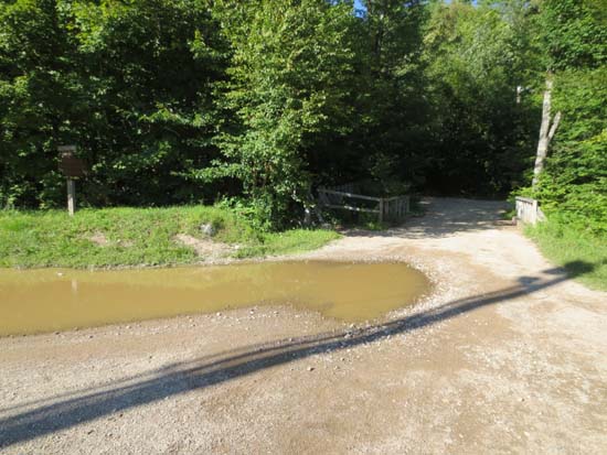
The Red-Blue Trail trailhead at Camp Bell

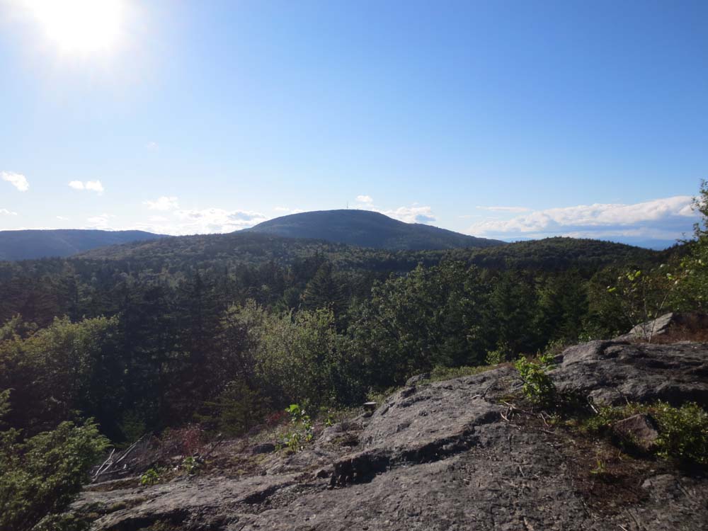
Looking at Belknap Mountain from near the Mt. Mack summit
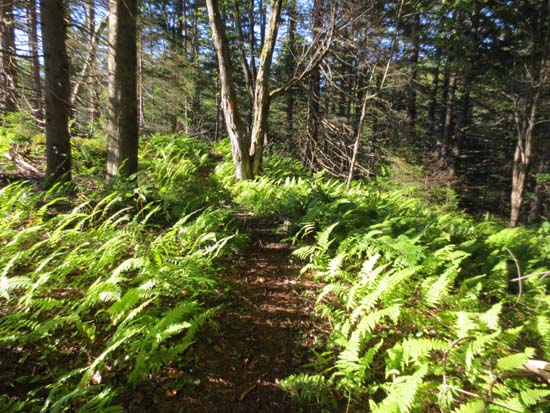
Looking down the trail between Mt. Mack and Mt. Klem
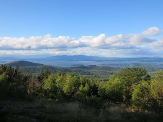
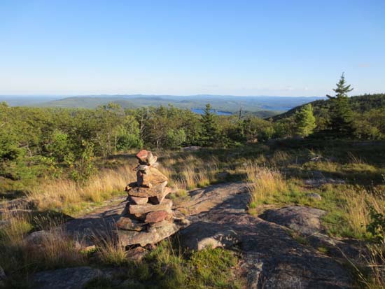
Looking at Lake Winnipesaukee and the Ossipees near the Mt. Klem summit
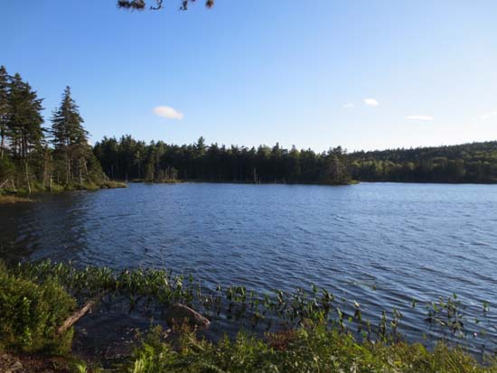
Round Pond
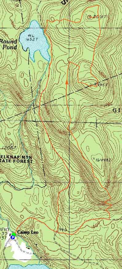

Directions to trailhead: From Route 107, take Route 140 east into Gilmanton. Take a left onto Crystal Lake Road, bearing left to stay on it (when Mountain Road goes straight). After passing Crystal Lake, the road turns into Guinea Ridge Road. Take a right next to some cabins onto Manning Lake Road (this is inaccurately labelled as Camp Leo Road and Moulton Road on some maps...the current road sign says Manning Lake Road). There is a small parking area on the left just before reaching the area with the camp buildings. The Red-Blue Trail starts at the bridge just beyond the main building, in the form of a dirt road. When camp is in session, visitors should sign in at the main building.
Back to Mt. Mack Profile
Back to Mt. Klem Profile
|