Home
States
Colorado
Connecticut
Maine
Massachusetts
New Hampshire
New York
Rhode Island
Utah
Vermont
View All
Lists
NE 4,000 Footers
NE 100 Highest
NH 4,000 Footers
NH 100 Highest
NH 52 With A View
NH Belknap Range
NH Ossipee 10
Links
Trail Conditions
Trip Log
Sunrises
Sunsets
About
|
Mt. Mack
Gilford, NH
Trailheads, measurements, times, distances, and maps are all approximate and relative to the hike(s) as shown below.
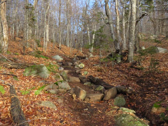
The Round Pond Trail
Route: Fire Road, Round Pond Trail, Round Pond-Piper Link, Red Trail, Red-Orange Trail
Some mud in places from the rain/thaw, however nothing too bad up to the pond. Normal puddles to contend with on the east side of the pond. Ascent to Mack was also muddy in places. Nice warm conditions, with temperatures in the 50s.
| Hike Ratings |
|
Getting To Trailhead: |
Easy |
| Destination: |
Mt. Mack |
|
Length: |
Moderate |
|
Steepness: |
Moderate |
|
Navigation: |
Easy |
|
Views: |
Excellent |
|
Crowds: |
Minimal |
|
| Hike Stats |
|
Date Hiked: |
Friday, December 25, 2015 |
| Parking Elevation: |
1,100' |
| Destination: |
Mt. Mack |
| Trailhead Elevation: |
1,100' |
| Summit Elevation: |
2,001' |
| Vertical Gain: |
976' |
|
|
| Hike Vertical Gain: |
1,107' |
|
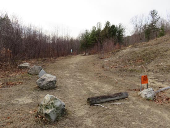
The East Gilford-Fire Road trailhead at the end of Wood Road
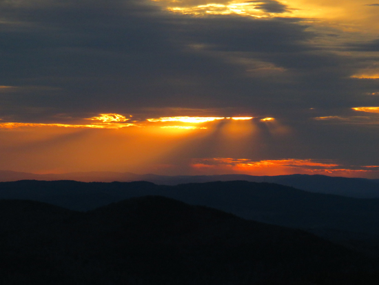
The sunset from near the summit of Mt. Mack
Directions to trailhead: From Route 11A East past Gunstock, then take a right onto Bickford Road, then take a left onto Wood Road, soon bearing left to go uphill around the last house. The Fire Road-East Gilford Trail trailhead will be at the back of the 5 car parking lot at the end of the road.
Back to Mt. Mack Profile
|

