Home
States
Colorado
Connecticut
Maine
Massachusetts
New Hampshire
New York
Rhode Island
Utah
Vermont
View All
Lists
NE 4,000 Footers
NE 100 Highest
NH 4,000 Footers
NH 100 Highest
NH 52 With A View
NH Belknap Range
NH Ossipee 10
Links
Trail Conditions
Trip Log
Sunrises
Sunsets
About
|
Mt. Madison
Bean's Grant, NH, Chandler's Purchase, NH
Trailheads, measurements, times, distances, and maps are all approximate and relative to the hike(s) as shown below.
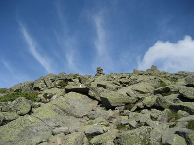
Looking up the Osgood Trail
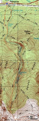
Route: Valley Way, Osgood Trail, (Mt. Madison), Osgood Trail, Valley Way, Beechwood Way, Air Line
The weather was pretty lousy and the forecast not too promising. Nonetheless, looking at the radar and webcams (when visible), it seemed like the Northern Presidentials weren't getting hit with rain. The drive up wasn't too encouraging, as a dark cloud blocked views past Kearsarge North from Conway. However, reaching Glen, it looked like things weren't too bad to the north.
Not a big fan of Valley Way, I was tempted to cross over to Air Line or Watson, however I was concerned about exposure with the possibility of thunderstorms. Reaching the hut, there were blue skies overhead - a great sign. Arriving at an empty Mt. Madison summit, I had great views, enhanced by a strong cool breeze.
Back at the hut during the dinner hour, I bought a lemonade and brownie before setting off for the base. Nearing the bottom, I decided to try the Beechwood crossover for the heck of it (pretty gradual with decent footing), prior to taking the Air Line for the balance of the descent.
| Hike Ratings |
|
Getting To Trailhead: |
Easy |
| Destination: |
Mt. Madison |
|
Length: |
Moderate |
|
Steepness: |
Difficult |
|
Navigation: |
Moderate |
|
Views: |
Excellent |
|
Crowds: |
Moderate |
|
| Hike Stats |
|
Date Hiked: |
Monday, July 27, 2009 |
| Hike Commenced: |
3:27 PM |
| Parking Elevation: |
1,311' |
| Destination: |
Mt. Madison |
| Ascent Commenced: |
3:27 PM |
| Summit Reached: |
5:38 PM |
| Time Elapsed: |
02:11 |
| Trailhead Elevation: |
1,311' |
| Summit Elevation: |
5,367' |
| Vertical Gain: |
4,186' |
|
|
| Hike Ended: |
8:22 PM |
| Hike Time Elapsed: |
4:55 |
| Hike Vertical Gain: |
4,316' |
|
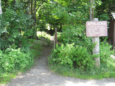
Valley Way Trail trailhead at Appalachia
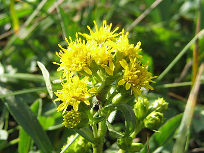
Flowers near the Madison Spring Hut
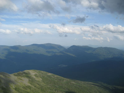
Looking at the Carters and Wildcats from Mt. Madison

Directions to trailhead: Take US 2 West from Gorham to the Appalachia parking lot.
Back to Mt. Madison Profile
|


