Home
States
Colorado
Connecticut
Maine
Massachusetts
New Hampshire
New York
Rhode Island
Utah
Vermont
View All
Lists
NE 4,000 Footers
NE 100 Highest
NH 4,000 Footers
NH 100 Highest
NH 52 With A View
NH Belknap Range
NH Ossipee 10
Links
Trail Conditions
Trip Log
Sunrises
Sunsets
About
|
Mt. Madison
Bean's Grant, NH, Chandler's Purchase, NH
Trailheads, measurements, times, distances, and maps are all approximate and relative to the hike(s) as shown below.
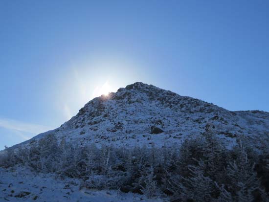
Looking up the Osgood Trail
Route: Valley Way, Scar Trail, Scar Loop, Watson Path, Valley Way, Osgood Trail, (Mt. Madison), Osgood Trail, Valley Way
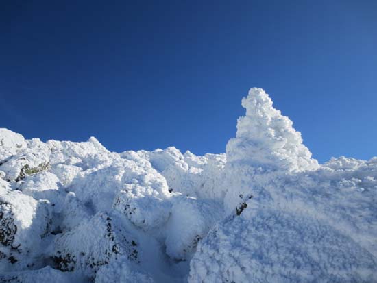
Dusting of snow started not far into the woods. Never increased to more than an inch or two below the hut. Took a side trip out to the Durand Scar, where there were a few directional views. Probably easier to ascend than to descend due to quasi scramble.
Valley Way was a mix of mud, packed snow, and ice down low, transitioning to packed snow higher up. Nowhere near enough snow for snowshoes yet. Some used Microspikes, but I was able to carefully pick my way through the icy areas.
Hut is closed for the winter.
Some drifting on Osgood Trail, up to a foot or so. In today's conditions, it was easier to bareboot this stretch than to wear light traction.
Winds decreased as the day progressed and the clouds lifted, resulting in hundred mile views and bluebird skies. Wind was cold climbing up from the hut, but not powerful enough to cause any balance issues. Once slabbing on that trail, wind was no issue, except at the very top (and easily ducked out of thereafter), thanks to the wind direction.
| Hike Ratings |
|
Getting To Trailhead: |
Easy |
| Destination: |
Mt. Madison |
|
Length: |
Moderate |
|
Steepness: |
Difficult |
|
Navigation: |
Moderate |
|
Views: |
Excellent |
|
Crowds: |
Minimal |
|
| Hike Stats |
|
Date Hiked: |
Saturday, November 10, 2012 |
| Parking Elevation: |
1,311' |
| Destination: |
Mt. Madison |
| Time Elapsed: |
04:56 |
| Trailhead Elevation: |
1,311' |
| Summit Elevation: |
5,367' |
| Vertical Gain: |
4,286' |
|
|
| Hike Time Elapsed: |
8:52 |
| Hike Vertical Gain: |
4,416' |
|
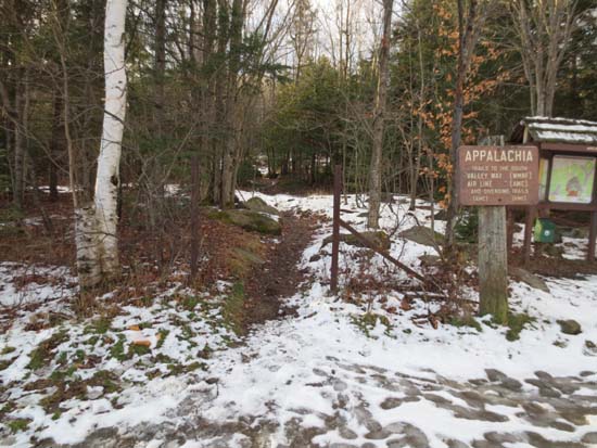
Valley Way Trail trailhead at Appalachia
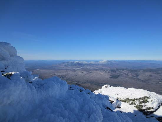
Looking at the Kilkenny region from Mt. Madison
The sun sets over the shoulder of Mt. Adams
Directions to trailhead: Take US 2 West from Gorham to the Appalachia parking lot.
Back to Mt. Madison Profile
|

