Home
States
Colorado
Connecticut
Maine
Massachusetts
New Hampshire
New York
Rhode Island
Utah
Vermont
View All
Lists
NE 4,000 Footers
NE 100 Highest
NH 4,000 Footers
NH 100 Highest
NH 52 With A View
NH Belknap Range
NH Ossipee 10
Links
Trail Conditions
Trip Log
Sunrises
Sunsets
About
|
Mt. Major
Alton, NH
Trailheads, measurements, times, distances, and maps are all approximate and relative to the hike(s) as shown below.
Boulder Loop Trail
On my way home after Thanksgiving, I decided to stop by Mt. Major for a quick hike. The weather was perfect for this time of year - just a bit above freezing, low winds, blue sky.
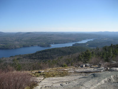
The Boulder Loop Trail (looking up the parking lot, it's the one to the left), is a on the whole a fairly easy hike with a steep section about two thirds of the way up. The last part of the trail is a gradual stroll along ledges overlooking the lake and mountains to the north.
| Hike Ratings |
|
Getting To Trailhead: |
Easy |
| Destination: |
Mt. Major |
|
Length: |
Moderate |
|
Steepness: |
Difficult |
|
Navigation: |
Moderate |
|
Views: |
Excellent |
|
Crowds: |
Heavy |
|
| Hike Stats |
|
Date Hiked: |
Friday, November 24, 2006 |
| Hike Commenced: |
11:01 AM |
| Parking Elevation: |
585' |
| Destination: |
Mt. Major |
| Ascent Commenced: |
11:02 AM at E trailhead |
| Summit Reached: |
11:38 AM |
| Time Elapsed: |
00:36 |
| Trailhead Elevation: |
600' |
| Summit Elevation: |
1,786' |
| Vertical Gain: |
1,201' |
|
|
| Hike Ended: |
12:30 PM |
| Hike Time Elapsed: |
01:29 |
| Hike Vertical Gain: |
1,231' |
|
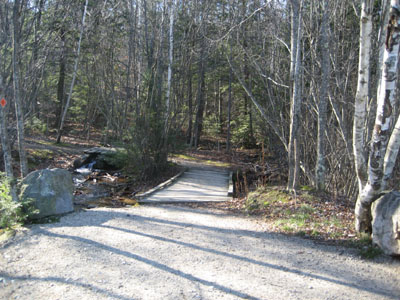
Trailhead at the Route 11 parking lot
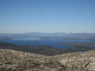
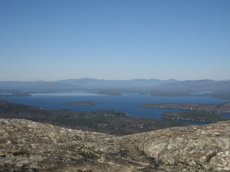
Looking over Lake Winnipesaukee at the White Mountains from the Mt. Major summit
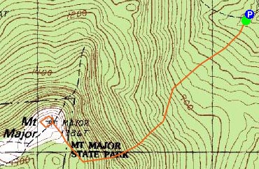

Directions to trailhead: Take Route 11 West (north in reality) from Alton Bay. Parking lot and trailhead are on the left after the blasted out section of Route 11.
Back to Mt. Major Profile
|