Home
States
Colorado
Connecticut
Maine
Massachusetts
New Hampshire
New York
Rhode Island
Utah
Vermont
View All
Lists
NE 4,000 Footers
NE 100 Highest
NH 4,000 Footers
NH 100 Highest
NH 52 With A View
NH Belknap Range
NH Ossipee 10
Links
Trail Conditions
Trip Log
Sunrises
Sunsets
About
|
Mt. Major
Alton, NH
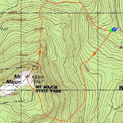
Trailheads, measurements, times, distances, and maps are all approximate and relative to the hike(s) as shown below.
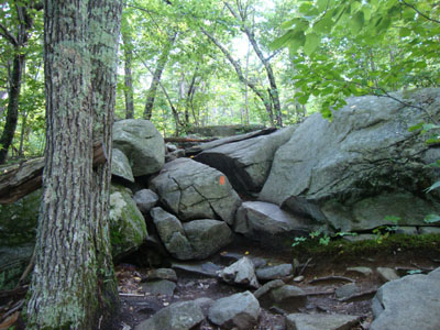
Looking up the Boulder Loop Trail
Route: Boulder Loop, (Mt. Major), Mt. Major Trail
While I had planned to hike in the Sandwich Range, the looming clouds and showers pushed me south to Mt. Major for the first time in awhile.
Jogging the lower parts of the Boulder Loop, I then hiked as I reached the rocky portions of the trail. Reaching the ridge, my pace was slowed even more due to hoards of fresh blueberries. While there had been a fire reported in the newspapers recently, I didn't see any evidence of it.
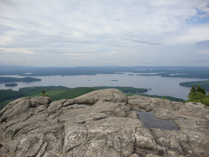
I had excellent views from the summit - and seeing that the Sandwich Range and Ossipees had clouds covering their higher peaks, I was glad I had headed south.
For the descent I opted to take the Mt. Major Trail (Main Trail). A few ledges were slippery due to the recent rain, however it was generally good going.
| Hike Ratings |
|
Getting To Trailhead: |
Easy |
| Destination: |
Mt. Major |
|
Length: |
Moderate |
|
Steepness: |
Difficult |
|
Navigation: |
Easy |
|
Views: |
Excellent |
|
Crowds: |
Moderate |
|
| Hike Stats |
|
Date Hiked: |
Wednesday, July 14, 2010 |
| Hike Commenced: |
4:14 PM |
| Parking Elevation: |
590' |
| Destination: |
Mt. Major |
| Ascent Commenced: |
4:14 PM at E trailhead |
| Summit Reached: |
4:51 PM |
| Time Elapsed: |
00:37 |
| Trailhead Elevation: |
600' |
| Summit Elevation: |
1,786' |
| Vertical Gain: |
1,201' |
|
|
| Hike Ended: |
5:37 PM |
| Hike Time Elapsed: |
01:23 |
| Hike Vertical Gain: |
1,241' |
|
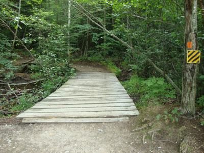
The Boulder Loop trailhead at the back of the Route 11 parking lot

Looking at Green Mountain from Mt. Major

Directions to trailhead: Take Route 11 West (north in reality) from Alton Bay. Parking lot and trailhead are on the left after the blasted out section of Route 11.
Back to Mt. Major Profile
|