Home
States
Colorado
Connecticut
Maine
Massachusetts
New Hampshire
New York
Rhode Island
Utah
Vermont
View All
Lists
NE 4,000 Footers
NE 100 Highest
NH 4,000 Footers
NH 100 Highest
NH 52 With A View
NH Belknap Range
NH Ossipee 10
Links
Trail Conditions
Trip Log
Sunrises
Sunsets
About
|
Mt. Major
Alton, NH
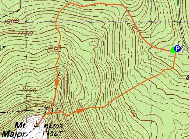
Trailheads, measurements, times, distances, and maps are all approximate and relative to the hike(s) as shown below.
Looking up the Mt. Major Trail
Route: Mt. Major Trail, (Mt. Major), Mt. Major Trail, Beeline Trail, Boulder Loop
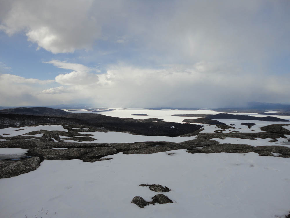
While the lower elevations were starting to melt out, I was able to snowshoe to the summit without much difficulty. Above the woods road portion of the Mt. Major Trail (only a few inches of base in the lower elevations), there was still a good foot or two of base, with some blue ice lurking in the ledgy areas.
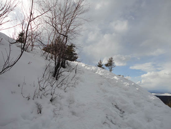
For the descent, I followed some tracks off the Mt. Major Trail ledge bypass, knowing they were likely the unmarked Beeline Trail. This trail dropped steeply into the woods below, then went fairly directly to the Boulder Loop. Now that I know where it is, I may need to check it out again after the snow melts to see what the footbed is like.
| Hike Ratings |
|
Getting To Trailhead: |
Easy |
| Destination: |
Mt. Major |
|
Length: |
Moderate |
|
Steepness: |
Difficult |
|
Navigation: |
Easy |
|
Views: |
Excellent |
|
Crowds: |
Minimal |
|
| Hike Stats |
|
Date Hiked: |
Friday, March 25, 2011 |
| Parking Elevation: |
590' |
| Destination: |
Mt. Major |
| Time Elapsed: |
00:41 |
| Trailhead Elevation: |
600' |
| Summit Elevation: |
1,786' |
| Distance: |
1.75 miles |
| Vertical Gain: |
1,211' |
|
|
| Hike Time Elapsed: |
01:17 |
| Hike Vertical Gain: |
1,221' |
|
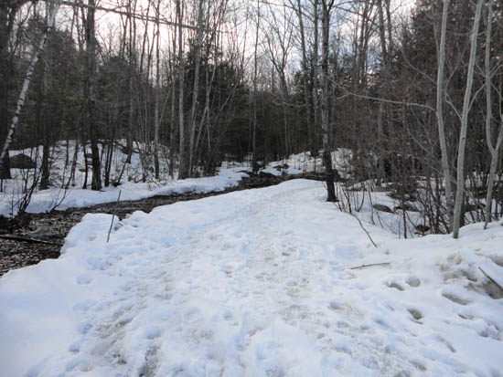
The Mt. Major Trail trailhead at the back of the Route 11 parking lot

Looking at Lake Winnipesaukee from the Mt. Major summit

Directions to trailhead: Take Route 11 West (north in reality) from Alton Bay. Parking lot and trailhead are on the left after the blasted out section of Route 11.
Back to Mt. Major Profile
|