Home
States
Colorado
Connecticut
Maine
Massachusetts
New Hampshire
New York
Rhode Island
Utah
Vermont
View All
Lists
NE 4,000 Footers
NE 100 Highest
NH 4,000 Footers
NH 100 Highest
NH 52 With A View
NH Belknap Range
NH Ossipee 10
Links
Trail Conditions
Trip Log
Sunrises
Sunsets
About
|
Mt. Major
Alton, NH
Trailheads, measurements, times, distances, and maps are all approximate and relative to the hike(s) as shown below.
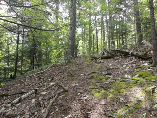
Looking up the Rock Cave Trail
Route: Mt. Major Trail, Brook Trail, Rock Cave Trail, (Mt. Major), Brook Trail
Trails were generally dry with the exception of one large puddle remaining on Brook Trail.
Rock Cave Trail has become even more vague than it was a few years ago. Trail leaves the Brook Trail where it first approaches the brook, opposite a tree with a red and yellow blaze. It eventually straddles the state park boundary, but otherwise is herd pathy at best. Nice route to avoid weekend crowds, though.
Lots of blueberries on the upper Rock Cave Trail, as well as in the open areas heading toward the back of Mt. Major.
Very nice morning weatherwise (though hot) - much nicer than the forecasted weather apocalypse. Steady breeze made things bearable.
| Hike Ratings |
|
Getting To Trailhead: |
Easy |
| Destination: |
Mt. Major |
|
Length: |
Moderate |
|
Steepness: |
Difficult |
|
Navigation: |
Difficult |
|
Views: |
Excellent |
|
Crowds: |
Heavy |
|
| Hike Stats |
|
Date Hiked: |
Saturday, July 20, 2013 |
| Parking Elevation: |
590' |
| Destination: |
Mt. Major |
| Time Elapsed: |
00:40 |
| Trailhead Elevation: |
600' |
| Summit Elevation: |
1,786' |
| Vertical Gain: |
1,241' |
|
|
| Hike Time Elapsed: |
01:20 |
| Hike Vertical Gain: |
1,336' |
|
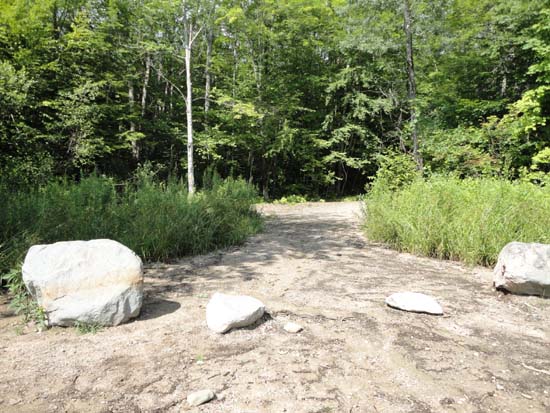
The Mt. Major Trail trailhead at the back of the Route 11 parking lot
Looking up the Rock Cave Trail

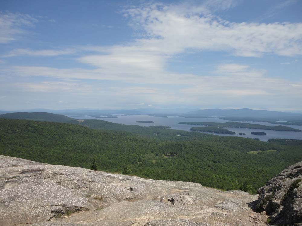
Looking at Lake Winnipesaukee from Mt. Major
Directions to trailhead: Take Route 11 West (north in reality) from Alton Bay. Parking lot and trailhead are on the left after the blasted out section of Route 11.
Back to Mt. Major Profile
|