Home
States
Colorado
Connecticut
Maine
Massachusetts
New Hampshire
New York
Rhode Island
Utah
Vermont
View All
Lists
NE 4,000 Footers
NE 100 Highest
NH 4,000 Footers
NH 100 Highest
NH 52 With A View
NH Belknap Range
NH Ossipee 10
Links
Trail Conditions
Trip Log
Sunrises
Sunsets
About
|
Mt. Major
Alton, NH
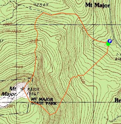
Trailheads, measurements, times, distances, and maps are all approximate and relative to the hike(s) as shown below.
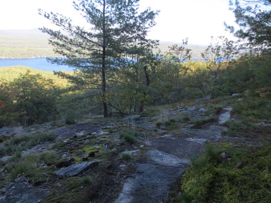
Looking down the Bay View Trail with Alton Bay in the background
Route: Boulder Loop, Bay View Trail, Boulder Loop, (Mt. Major), Mt. Major Trail
Trails were mostly dry and in good shape. Some minor mud on the Bay View Trail and the Mt. Major Trail.
Found the unmarked Bay View Trail on the Boulder Loop, just past a pair of logging road junctions (left one being the Beaver Pond Trail, the right one being just beyond that). Trail was generally easy to follow, except in a few places in the vicinity of the fire a few years back. Nice lake views from the upper switchback. Trail emerged on the Boulder Loop at a ledge where there are two blazes (one angled, one straight).
Descended via the Mt. Major Trail, intending to find the Bypass Trail. Found a few possibilities, but nothing obvious, so it'll have to wait for another time, ie following it from the lower junction.
Temperatures in the lower 50s with some wind stood in start contrast to the upper 70s we had just a few days ago, confirming that fall is indeed here. Some fall colors on the trail, but not as much as in Franconia Notch/Waterville Valley/Twin Mountain this weekend.
| Hike Ratings |
|
Getting To Trailhead: |
Easy |
| Destination: |
Mt. Major |
|
Length: |
Moderate |
|
Steepness: |
Difficult |
|
Navigation: |
Moderate |
|
Views: |
Excellent |
|
Crowds: |
Minimal |
|
| Hike Stats |
|
Date Hiked: |
Monday, September 23, 2013 |
| Parking Elevation: |
590' |
| Destination: |
Mt. Major |
| Time Elapsed: |
00:35 |
| Trailhead Elevation: |
600' |
| Summit Elevation: |
1,786' |
| Vertical Gain: |
1,196' |
|
|
| Hike Time Elapsed: |
01:19 |
| Hike Vertical Gain: |
1,211' |
|
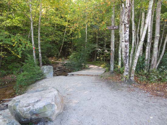
The Boulder Loop Trail trailhead at the back of the Route 11 parking lot
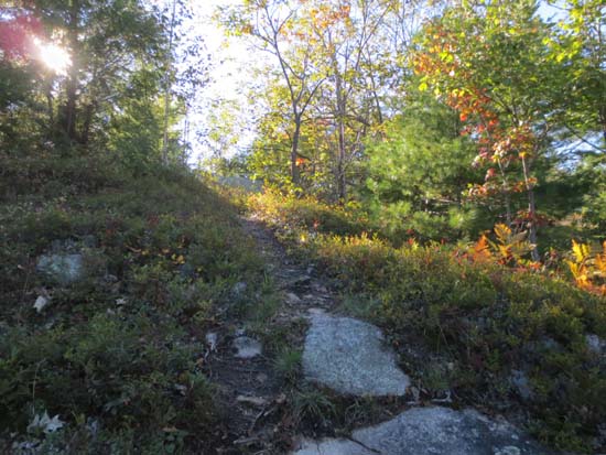
Nearing the top of the Bay View Trail
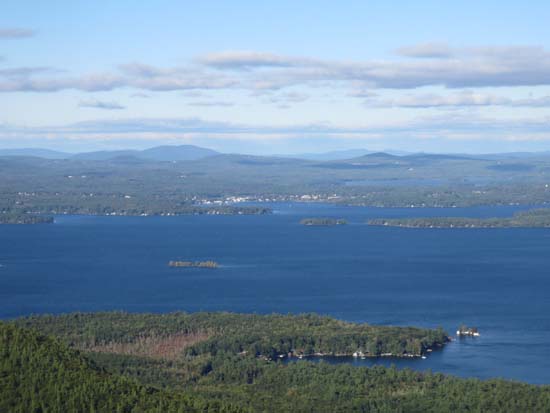
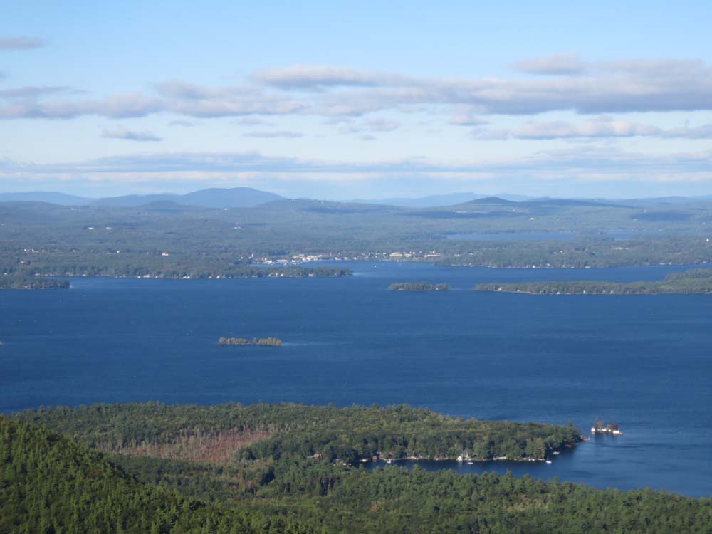
Looking at Lake Winnipesaukee from Mt. Major

Directions to trailhead: Take Route 11 West (north in reality) from Alton Bay. Parking lot and trailhead are on the left after the blasted out section of Route 11.
Back to Mt. Major Profile
|