Home
States
Colorado
Connecticut
Maine
Massachusetts
New Hampshire
New York
Rhode Island
Utah
Vermont
View All
Lists
NE 4,000 Footers
NE 100 Highest
NH 4,000 Footers
NH 100 Highest
NH 52 With A View
NH Belknap Range
NH Ossipee 10
Links
Trail Conditions
Trip Log
Sunrises
Sunsets
About
|
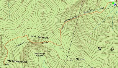
Mt. Moosilauke
Woodstock, NH, Benton, NH
Trailheads, measurements, times, distances, and maps are all approximate and relative to the hike(s) as shown below.
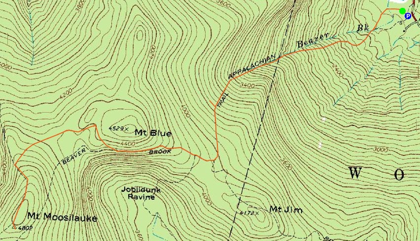
Looking up the Appalachian Trail and Beaver Brook
Route: Appalachian Trail (Beaver Brook Trail)
Mt. Moosilauke was going to be a summer hike until I saw a favorable conditions report on the Views From The Top conditions forum. Since it declared that I could make it without snowshoes, I was game.
The Beaver Pond parking area was rather empty - and it appeared the vehicles there were for rock climbers going in the opposite direction.
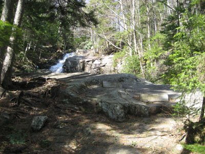
The Beaver Brook (Appalachian) trail started off flat and dry, before starting a moderate ascent up next to the brook. Not too long thereafter, the trail steepened and turned into snow and ice. After sliding around for a bit, I decided it was time for my Stablicers - with a trail this steep next to raging cascades, it's not a place to take gambles when hiking alone.
The trail is very steep - so steep that there are steps inserted into the ledges, along with the occasional railing for the extra difficult sections. Nonetheless, the awesome cascades made this part of the trail go rather fast. Soon, I was up near the Beaver Brook shelter. I was a bit confused here, as it seemed that the Beaver Brook trail went to the shelter (I didn't recall this from the maps). There was an arrow on the sign pointing toward it, as well as the only fresh pair of footprints.
Postholing my way to the shelter, I realized I was at a dead-end. I later came to the (duh) realization that it wasn't an arrow on the sign that I saw, but rather the AT logo. Oh well, stupider things have been said in Congress.
Back on the AT, things gradually grew less steep - one would find this easier on the legs, however for the first time, postholing was an issue. So long as you stayed on the center ridge, you were safe...however, the center ridge was single file at best (and 6" wide on the flats exposed to the sun), making this portion of the hike the equivalent of walking on a balance beam about 2 feet off the ground for two miles. Due to the ridge, snowshoes would be no help, as you'd be sliding in either direction with every step.
Quite frankly, the trail is boring for a good mile or so, as it meanders through flat terrain. If it weren't between awesome cascades and an even more awesome (awesomer?) summit area, it wouldn't be so bad, but that's beyond the point. My guess is that this was a little more interesting before the trail was rerouted toward the Benton Trail.
Reaching the alpine zone was neat, as the four foot or so snow depth went to bare ground in literally about a step. The summit was windy, cold, and abandoned...that is, until I found a friendly group of people sitting just on the other side of the old foundation.
The views were really strong - stretching to the Presidentials, the Sugarbush Range, Killington, Mt. Sunapee, and beyond. I had a quick lunch consisting of trail mix and some trail mix part two without the mix (M&Ms).
The descent was pretty dull until I reached the cascades. From here, controlled bootslides were critical, since there...well wasn't much of an other option for the steeps.
Interestingly enough, other than the group at the summit, I did not see a single person on the trail.
| Hike Ratings |
|
Getting To Trailhead: |
Easy |
| Destination: |
Mt. Moosilauke |
|
Length: |
Moderate |
|
Steepness: |
Very Difficult |
|
Navigation: |
Easy |
|
Views: |
Excellent |
|
Crowds: |
Minimal |
|
| Hike Stats |
|
Date Hiked: |
Saturday, May 5, 2007 |
| Hike Commenced: |
9:37 AM |
| Parking Elevation: |
1,870' |
| Destination: |
Mt. Moosilauke |
| Ascent Commenced: |
9:38 AM |
| Summit Reached: |
11:58 AM |
| Time Elapsed: |
2:20 |
| Trailhead Elevation: |
1,870' |
| Summit Elevation: |
4,802' |
| Distance: |
3.8 miles |
| Vertical Gain: |
3,122' |
|
|
| Hike Ended: |
2:51 PM |
| Hike Time Elapsed: |
05:14 |
| Hike Distance: |
7.6 miles |
| Hike Vertical Gain: |
3,282' |
|
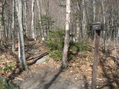
Appalachian (Beaver Brook) Trail trailhead next to the Route 112 parking area.
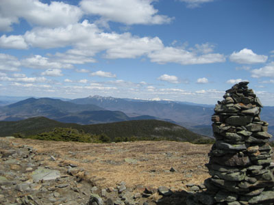
Looking at the Franconia Ridge and the Presidentials from the Mt. Moosilauke summit

Directions to trailhead: Take Route 112 West from Lincoln to the Lost River area. WMNF fee parking lot just after Lost River parking, on the left side of the road.
Back to Mt. Moosilauke Profile
|