Home
States
Colorado
Connecticut
Maine
Massachusetts
New Hampshire
New York
Rhode Island
Utah
Vermont
View All
Lists
NE 4,000 Footers
NE 100 Highest
NH 4,000 Footers
NH 100 Highest
NH 52 With A View
NH Belknap Range
NH Ossipee 10
Links
Trail Conditions
Trip Log
Sunrises
Sunsets
About
|
Mt. Moosilauke
Benton, NH
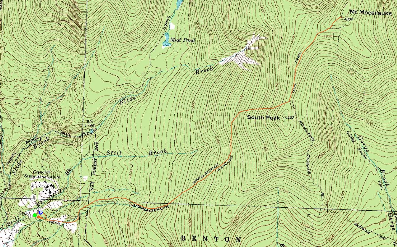
Trailheads, measurements, times, distances, and maps are all approximate and relative to the hike(s) as shown below.
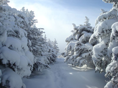
Looking down the Moosilauke Carriage Road on the way to the Mt. Moosilauke summit
Route: Glencliff Trail, Moosilauke Carriage Road, (Mt. Moosilauke), Moosilauke Carriage Road, Glencliff Trail
With a good weather forecast, I decided to head over to Mt. Moosilauke and try the Glencliff Trail. Upon arriving at the parking lot, I could tell the immediate area was in the midst of a small snow storm - not quite the mostly sunny forecast I had seen.
After putting on my Stablicers, I headed down High Street to the proper Glencliff Trail trailhead and was on my way. On this particular portion of trail, I was the first person to make tracks since the 1-3" of fresh powder fell. Soon, I met up with the parking lot shortcut and was on a pretty well packed trail.
Most of the Glencliff Trail is moderate at best in terms of steepness - and fortunately the only water crossings of any volume were bridged by wood and/or snow.
Though my Stablicers were being a pain in the neck (I've never had them fall off on my so many times as I did on this hike, not quite sure why), I elected to keep them on as I passed the first group of the day and headed up the steeps of the trail. Though there was some slick stuff underneath the untracked powder, I was able to make it in just my Stablicers, with the aid of my ice axe. After this steep, the trail empties out on the Moosilauke Carriage Road for a gradual ascent to the summit.
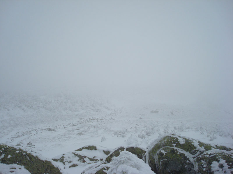
While there had been glimpses of sunshine and blue sky, it was all clouds once I cleared the treeline - visibility of a few hundred feet, high winds, etc. I found the trail a bit hard to follow in a few places, as some cairns had likely been covered in snow drifts. Nonetheless, I was able to find the summit without losing the trail.
After looking at the non-view for a minute or so, I put on my goggles and headed back downhill to get out of the winds. Upon arriving at the Glencliff Trail, I was able to make decent time back to the summit (with a few pauses to allow an increasing amount of hikers by), thanks to the snow/ice/pitch of the trail.
Though I didn't have any views, the exercise and few seconds of blue sky just before the treeline made the hike worthwhile.
| Hike Ratings |
|
Getting To Trailhead: |
Easy |
| Destination: |
Mt. Moosilauke |
|
Length: |
Moderate |
|
Steepness: |
Difficult |
|
Navigation: |
Moderate |
|
Views: |
Minimal due to weather |
|
Crowds: |
Moderate |
|
| Hike Stats |
|
Date Hiked: |
Saturday, January 26, 2008 |
| Hike Commenced: |
8:39 AM |
| Parking Elevation: |
1,530' |
| Destination: |
Mt. Moosilauke |
| Ascent Commenced: |
8:40 AM |
| Summit Reached: |
10:53 AM |
| Time Elapsed: |
02:13 |
| Trailhead Elevation: |
1,490' |
| Summit Elevation: |
4,802' |
| Distance: |
4.1 miles |
| Vertical Gain: |
3,357' |
|
|
| Hike Ended: |
12:30 PM |
| Hike Time Elapsed: |
03:51 |
| Hike Distance: |
8 miles |
| Hike Vertical Gain: |
3,402' |
|
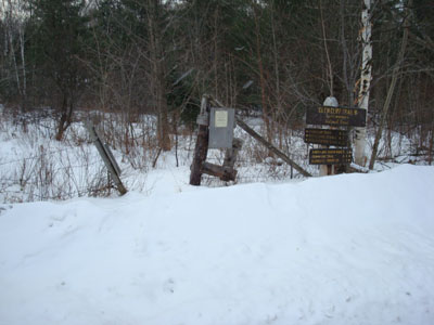
The Glencliff Trail trailhead on High Street
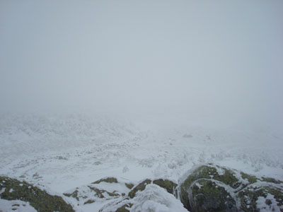
The view into the clouds at the Mt. Moosilauke summit
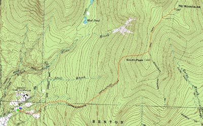

Directions to trailhead: Take Route 25 West from Plymouth to Glencliff. Take a right onto High Street. The Glencliff Trail parking area will be a few minutes up this road on the right. The trail can be accessed either from the back of the parking lot or a few hundred feet downhill.
Back to Mt. Moosilauke Profile
|