Home
States
Colorado
Connecticut
Maine
Massachusetts
New Hampshire
New York
Rhode Island
Utah
Vermont
View All
Lists
NE 4,000 Footers
NE 100 Highest
NH 4,000 Footers
NH 100 Highest
NH 52 With A View
NH Belknap Range
NH Ossipee 10
Links
Trail Conditions
Trip Log
Sunrises
Sunsets
About
|
Mt. Moosilauke
Benton, NH
Trailheads, measurements, times, distances, and maps are all approximate and relative to the hike(s) as shown below.
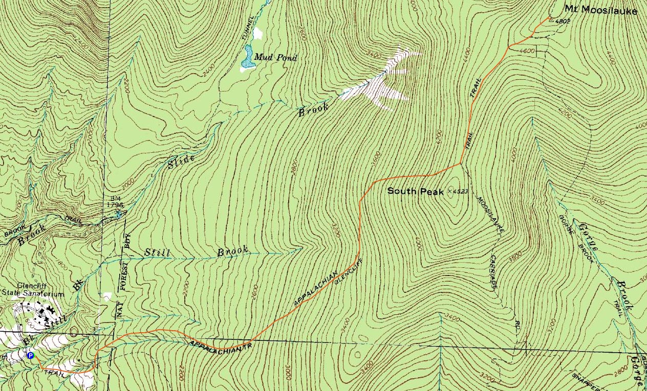
Looking down the Moosilauke Carriage Road on the way to the Mt. Moosilauke summit
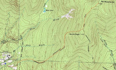
Route: Glencliff Trail, Moosilauke Carriage Road, (Mt. Moosilauke), Moosilauke Carriage Road, Glencliff Trail
While I had been hoping to take the day off work and head up to the Presidentials, the evening forecast update didn't look too favorable - mostly cloudy, higher winds than before, and summit fog. Not quite worth taking a whole day off. As the day progressed, however, I saw blue sky and low wind speeds. Thus, I decided to take the afternoon off and head over to Moosilauke.
Arriving at the Glencliff parking area, I decided to ascend wearing snowshoes, despite seeing a trail packed enough for barebooting. Since my foot was still injured, I decided the different landing/weighting of snowshoes was a better idea.
The hike seemed to drag on a bit as I gradually ascended up the Glencliff Trail. I was slightly concerned down low, as I could hear and feel some halfway decent winds. I was packed for the Presidentials, however, so I wasn't overly concerned.
After passing through the fairly flat traverse section of trail, I soon reached the steeper portions - and then reached the south peak spur junction and subsequent Carriage Road junction. Here, I swapped out my base layer and geared up for the alpine zone.
With blue skies overhead, I soon was making my way over the ridge to the exposed summit of Moosilauke. While the winds were a bit cold, they didn't seem to be as strong as at the base. Face protection was needed, though I never ended up using goggles.
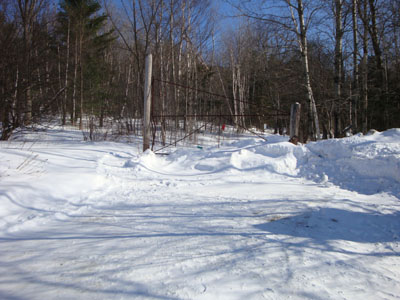
The views from the summit, though hazy to the south and west, were nonetheless quite strong - quite a different from my first winter ascent of Moosilauke! Seeing that some of the Presidentials had some fog still hanging on, I was glad I had made this decision. After loitering a bit, I decided to get going, stopping again at the junction to delayer.
Not a bad afternoon hike!
| Hike Ratings |
|
Getting To Trailhead: |
Easy |
| Destination: |
Mt. Moosilauke |
|
Length: |
Moderate |
|
Steepness: |
Difficult |
|
Navigation: |
Easy |
|
Views: |
Excellent |
|
Crowds: |
Minimal |
|
| Hike Stats |
|
Date Hiked: |
Wednesday, February 4, 2009 |
| Hike Commenced: |
12:28 PM |
| Parking Elevation: |
1,530' |
| Destination: |
Mt. Moosilauke |
| Ascent Commenced: |
12:28 PM |
| Summit Reached: |
2:31 PM |
| Time Elapsed: |
02:03 |
| Trailhead Elevation: |
1,490' |
| Summit Elevation: |
4,802' |
| Distance: |
3.9 miles |
| Vertical Gain: |
3,317' |
|
|
| Hike Ended: |
4:19 PM |
| Hike Time Elapsed: |
03:51 |
| Hike Vertical Gain: |
3,362' |
|
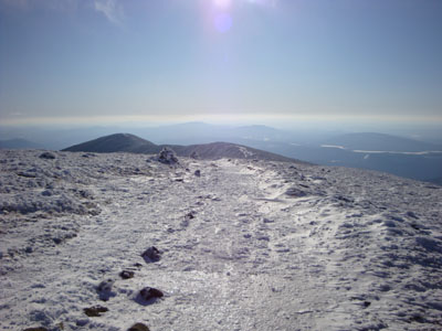
The Glencliff Trail trailhead at the edge of the parking area
Looking over the Franconias and Bonds at the Presidentials from the Mt. Moosilauke summit

Directions to trailhead: Take Route 25 West from Plymouth to Glencliff. Take a right onto High Street. The Glencliff Trail parking area will be a few minutes up this road on the right. The trail can be accessed either from the back of the parking lot or a few hundred feet downhill.
Back to Mt. Moosilauke Profile
|