Home
States
Colorado
Connecticut
Maine
Massachusetts
New Hampshire
New York
Rhode Island
Utah
Vermont
View All
Lists
NE 4,000 Footers
NE 100 Highest
NH 4,000 Footers
NH 100 Highest
NH 52 With A View
NH Belknap Range
NH Ossipee 10
Links
Trail Conditions
Trip Log
Sunrises
Sunsets
About
|
Mt. Moosilauke
Warren, NH, Woodstock, NH, Benton, NH
Trailheads, measurements, times, distances, and maps are all approximate and relative to the hike(s) as shown below.
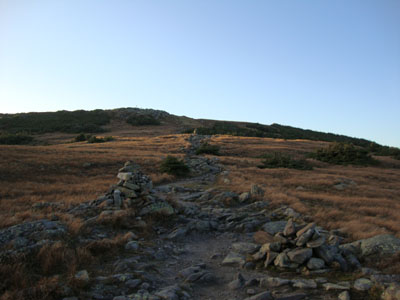
Looking up the Gorge Brook Trail near the Mt. Moosilauke summit
Route: Gorge Brook Trail
Once again, it looked like the optimistic weather forecast wasn't quite coming true. Nonetheless, I decided to head up to Mt. Moosilauke and give it a go.
For the purposes of time (driving and hiking), I took the Gorge Brook Trail. While relatively short and tame, the rocky footing always seems to slow me down. Reaching treeline, I could see that the summit was in the clear, but some fog was rolling over to the south. Once at the summit, I quickly snapped some photos - and then, in a matter of minutes, the summit was swallowed in fog.
Donning my light winter gear, I headed back down, headlamp on after only about 30 minutes. The rocky nature of the trail further impeded my descent, as I seem to slow down with a headlamp on.
The lights of the ravine lodge were a welcome sight - had I been able to take in a sunset, it would have felt like a more worthwhile hike, however it wasn't in the cards.
| Hike Ratings |
|
Getting To Trailhead: |
Easy |
| Destination: |
Mt. Moosilauke |
|
Length: |
Moderate |
|
Steepness: |
Moderate |
|
Navigation: |
Easy |
|
Views: |
Excellent |
|
Crowds: |
Minimal |
|
| Hike Stats |
|
Date Hiked: |
Thursday, September 17, 2009 |
| Hike Commenced: |
4:46 PM |
| Parking Elevation: |
2,500' |
| Destination: |
Mt. Moosilauke |
| Ascent Commenced: |
4:50 PM |
| Summit Reached: |
6:23 PM |
| Time Elapsed: |
1:33 |
| Trailhead Elevation: |
2,340' |
| Summit Elevation: |
4,802' |
| Distance: |
3.6 miles |
| Vertical Gain: |
2,512' |
|
|
| Hike Ended: |
8:18 PM |
| Hike Time Elapsed: |
03:32 |
| Hike Vertical Gain: |
2,722' |
|
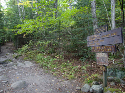
The Gorge Brook Trail trailhead at the end of the Class of 1982 Bridge
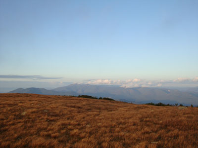
Looking at the Franconia Ridge from the Mt. Moosilauke summit
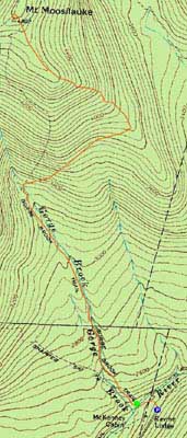

Directions to trailhead: Take Route 112 West to Route 118 south/west. Ravine Road will be on the right shortly after the height of land. Go down this dirt road and bear right. Limited parking available on the side of the road. Walk straight ahead past the kiosk, then take the first left, go left again, then go right across the bridge. The Gorge Brook Trail starts on the left thereafter.
Back to Mt. Moosilauke Profile
|