Home
States
Colorado
Connecticut
Maine
Massachusetts
New Hampshire
New York
Rhode Island
Utah
Vermont
View All
Lists
NE 4,000 Footers
NE 100 Highest
NH 4,000 Footers
NH 100 Highest
NH 52 With A View
NH Belknap Range
NH Ossipee 10
Links
Trail Conditions
Trip Log
Sunrises
Sunsets
About
|
Mt. Moosilauke
Benton, NH
Trailheads, measurements, times, distances, and maps are all approximate and relative to the hike(s) as shown below.
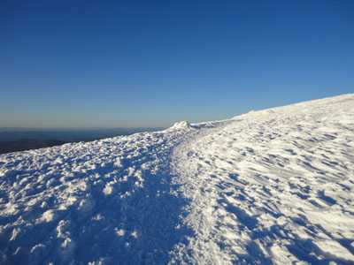
Looking up the Moosilauke Carriage Road on the way to the Mt. Moosilauke summit
Route: Glencliff Trail, Moosilauke Carriage Road, (Mt. Moosilauke), Moosilauke Carriage Road, Glencliff Trail
The winds sounded a bit stonger than forecasted. Nonetheless, I started in warm temperatures and worked my way up the Glencliff Trail. While the first mile or so was spring snow, I soon arrived in packed powder conditions. Nearing the top of the trail, the snowpack was staggering - blazes were just barely visible.
After layering up, I worked my way up the Carriage Road - I was amazed to see a cornice on the east side of the peak, something I had never observed in my three previous winter ascents. Reaching the summit, the winds were a bit chilly, but bearable. The Presidentials were in the clear, and views stretched beyond Jay Peak to the northwest and the Uncanooonucs to the south.
Waiting for the sunset, the colors started to pop all around. Just as the sun started to set, the Adirondacks suddenly appeared behind the Green Mountains, in striking clarity - amazing!
After taking a bunch of photos, we retreated off the summit and back to the springlike temperatures in the woods. A nice night for Moosilauke.
| Hike Ratings |
|
Getting To Trailhead: |
Easy |
| Destination: |
Mt. Moosilauke |
|
Length: |
Moderate |
|
Steepness: |
Difficult |
|
Navigation: |
Easy |
|
Views: |
Excellent |
|
Crowds: |
Moderate |
|
| Hike Stats |
|
Date Hiked: |
Friday, March 5, 2010 |
| Hike Commenced: |
3:02 PM |
| Parking Elevation: |
1,530' |
| Destination: |
Mt. Moosilauke |
| Ascent Commenced: |
3:02 PM |
| Summit Reached: |
5:03 PM |
| Time Elapsed: |
02:01 |
| Trailhead Elevation: |
1,490' |
| Summit Elevation: |
4,802' |
| Distance: |
3.9 miles |
| Vertical Gain: |
3,317' |
|
|
| Hike Ended: |
7:52 PM |
| Hike Time Elapsed: |
04:50 |
| Hike Vertical Gain: |
3,362' |
|
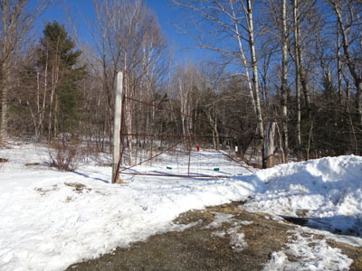
The Glencliff Trail trailhead at the edge of the parking area
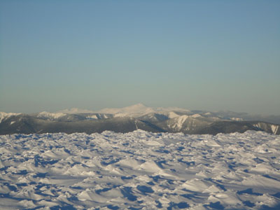
Looking at Mt. Washington from Mt. Moosilauke
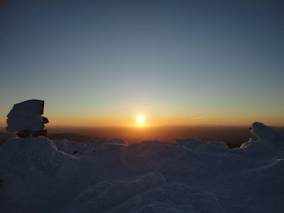
The sunset as seen from Mt. Moosilauke
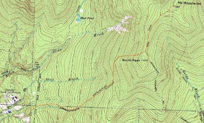

Directions to trailhead: Take Route 25 West from Plymouth to Glencliff. Take a right onto High Street. The Glencliff Trail parking area will be a few minutes up this road on the right. The trail can be accessed either from the back of the parking lot or a few hundred feet downhill.
Back to Mt. Moosilauke Profile
|