Home
States
Colorado
Connecticut
Maine
Massachusetts
New Hampshire
New York
Rhode Island
Utah
Vermont
View All
Lists
NE 4,000 Footers
NE 100 Highest
NH 4,000 Footers
NH 100 Highest
NH 52 With A View
NH Belknap Range
NH Ossipee 10
Links
Trail Conditions
Trip Log
Sunrises
Sunsets
About
|
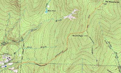
Mt. Moosilauke
Benton, NH
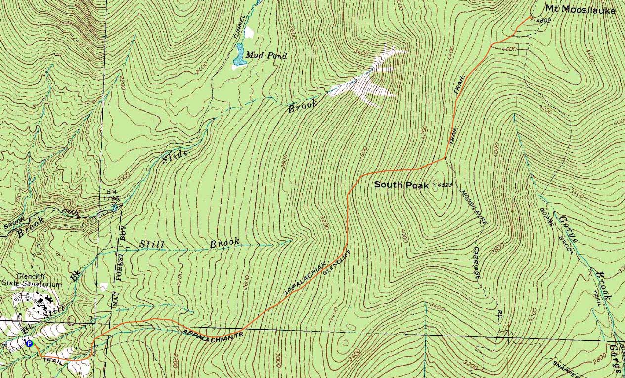
Trailheads, measurements, times, distances, and maps are all approximate and relative to the hike(s) as shown below.
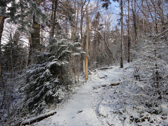
Looking up the Glencliff Trail
Route: Glencliff Trail, Moosilauke Carriage Road, (Mt. Moosilauke), Moosilauke Carriage Road, Glencliff Trail
Though the weather forecast was subpar, the wind forecast was low enough to make a run at Mt. Moosilauke. Starting at the trailhead, the trail was bare for the first half mile or so. Thereafter, there was a dusting of snow on the trail, as well as on the sides of the trees from heavy winds the previous night. My progress was slowed a bit due to the winds, as multiple blowdowns had been deposited in the trail. In a few of the instances, it was easier to just cut the blowdown out, rather than try to walk around it.
Climbing higher, I opted to put on my Microspikes, as a layer of black ice had crept up beneath the dusting of snow. Reaching the steeps, I noticed my Microspikes were not biting the ice as well as I would want - thusly, I switched over to crampons. With black and blue ice all over the place on the trail, they were the perfect choice, as a loss of traction with anything less could have resulted in injury.
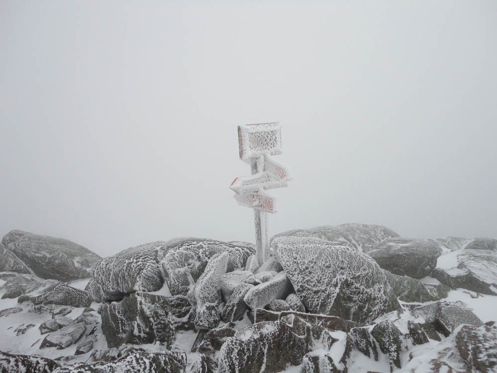
Upon reaching the carriage road, I prepared for the jaunt above treeline. While it had been relatively tame and snow free at the trailhead, the alpine zone was rough - chilly moderate winds, blowing rime ice, snow drifts, and limited visibility. As a result, my stay at the summit was more of a stop.
Once below the steeps on the Glencliff Trail, I switched back to Micros and continued my way out. Reaching the lower elevations, there was a halfway decent sunset in the distance, which briefly cast a nice red glow throughout the woods.
| Hike Ratings |
|
Getting To Trailhead: |
Easy |
| Destination: |
Mt. Moosilauke |
|
Length: |
Moderate |
|
Steepness: |
Difficult |
|
Navigation: |
Easy |
|
Views: |
Minimal (due to weather) |
|
Crowds: |
Minimal |
|
| Hike Stats |
|
Date Hiked: |
Thursday, December 2, 2010 |
| Hike Commenced: |
11:54 AM |
| Parking Elevation: |
1,530' |
| Destination: |
Mt. Moosilauke |
| Ascent Commenced: |
11:54 AM |
| Summit Reached: |
2:23 PM |
| Time Elapsed: |
02:27 |
| Trailhead Elevation: |
1,490' |
| Summit Elevation: |
4,802' |
| Distance: |
3.9 miles |
| Vertical Gain: |
3,317' |
|
|
| Hike Ended: |
4:42 PM |
| Hike Time Elapsed: |
04:48 |
| Hike Vertical Gain: |
3,362' |
|
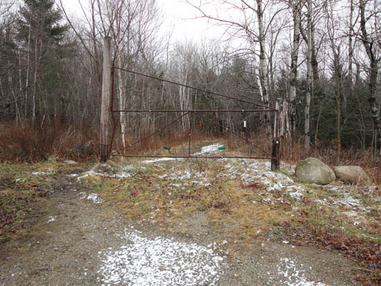
The Glencliff Trail trailhead at the edge of the parking area
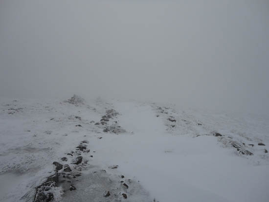
Looking down the Moosilauke Carriage Road near the Mt. Moosilauke summit
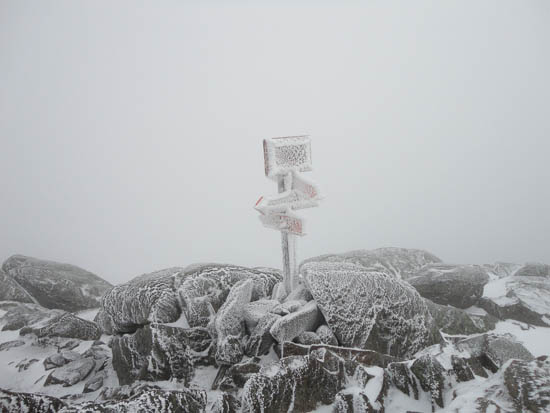
A lack of views from Mt. Moosilauke
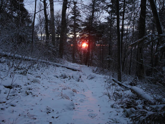
The sunset from the Glencliff Trail

Directions to trailhead: Take Route 25 West from Plymouth to Glencliff. Take a right onto High Street. The Glencliff Trail parking area will be a few minutes up this road on the right. The trail can be accessed either from the back of the parking lot or a few hundred feet downhill.
Back to Mt. Moosilauke Profile
|