Home
States
Colorado
Connecticut
Maine
Massachusetts
New Hampshire
New York
Rhode Island
Utah
Vermont
View All
Lists
NE 4,000 Footers
NE 100 Highest
NH 4,000 Footers
NH 100 Highest
NH 52 With A View
NH Belknap Range
NH Ossipee 10
Links
Trail Conditions
Trip Log
Sunrises
Sunsets
About
|
Mt. Moosilauke
Benton, NH
Trailheads, measurements, times, distances, and maps are all approximate and relative to the hike(s) as shown below.
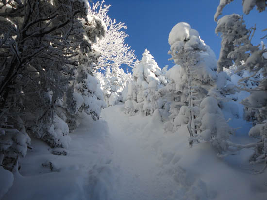
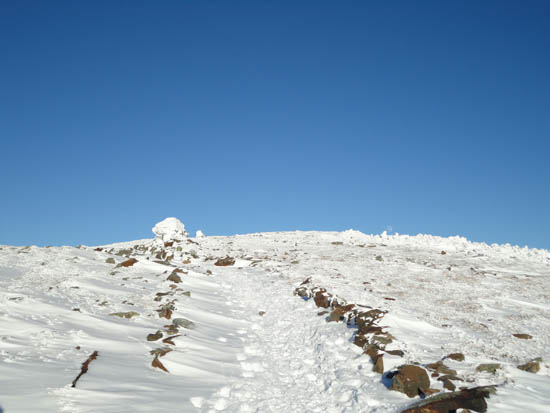
Looking up the Glencliff Trail
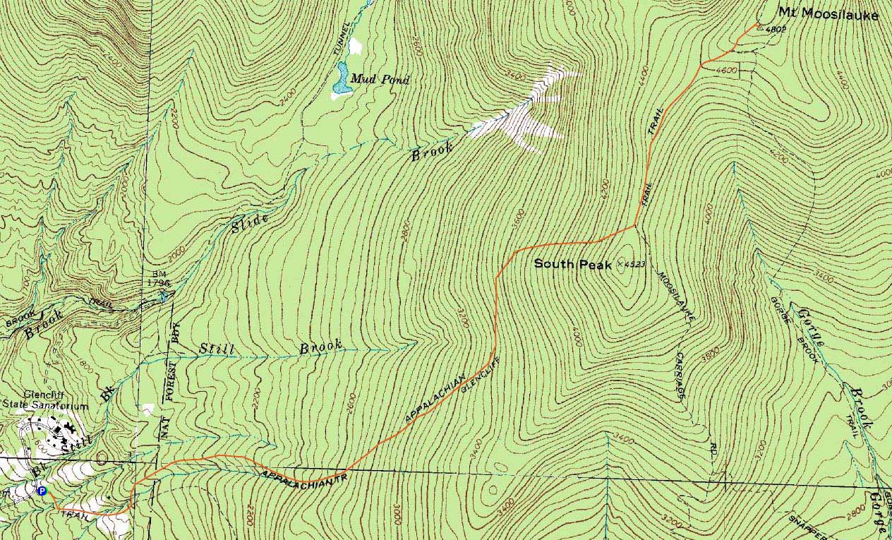
Route: Glencliff Trail, Moosilauke Carriage Road, (Mt. Moosilauke), Moosilauke Carriage Road, Glencliff Trail
With a bluebird day with light to moderate winds, Moosilauke seemed like a good afternoon possibility. Starting around the warmest part of the day, the trailhead temperature was a balmy 9 degrees.
The Glencliff Trail was nicely packed, making for smooth snowshoeing all the way to the Carriage Road. Upon reaching the Carriage Road, I added some layers and started to ascend toward the summit. A minute or two later, I stopped and added a larger jacket and facemask, as the sub zero temperatures and light, but chilly wind were frigid, to say the least.
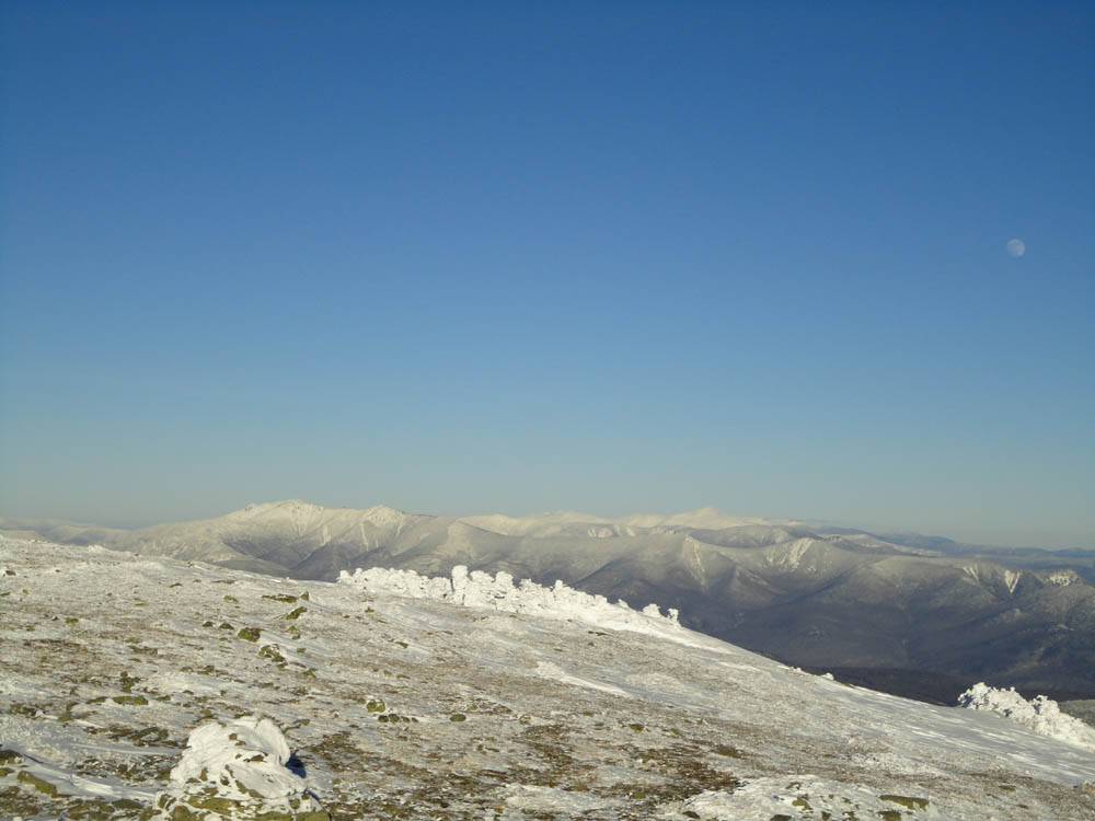
Popping out of the trees, a near full hung near the white summit, while the Adirondacks creeped up behind the Greens in the other direction. Reaching the summit, I took as many photos as my hand could bear, then turned around and retreated back to the trees.
It was fairly smooth sailing on the way back down. The end of the hike was enhanced by a nice sunset, which turned the snow in the woods pink. The temperature at the trailhead, over 3,000 vertical feet below the summit, was now 2 degrees.
| Hike Ratings |
|
Getting To Trailhead: |
Easy |
| Destination: |
Mt. Moosilauke |
|
Length: |
Moderate |
|
Steepness: |
Difficult |
|
Navigation: |
Moderate |
|
Views: |
Excellent |
|
Crowds: |
Minimal |
|
| Hike Stats |
|
Date Hiked: |
Monday, January 17, 2011 |
| Hike Commenced: |
12:52 PM |
| Parking Elevation: |
1,530' |
| Destination: |
Mt. Moosilauke |
| Ascent Commenced: |
12:52 PM |
| Summit Reached: |
3:14 PM |
| Time Elapsed: |
02:22 |
| Trailhead Elevation: |
1,490' |
| Summit Elevation: |
4,802' |
| Distance: |
3.9 miles |
| Vertical Gain: |
3,317' |
|
|
| Hike Ended: |
5:00 PM |
| Hike Time Elapsed: |
04:08 |
| Hike Vertical Gain: |
3,362' |
|
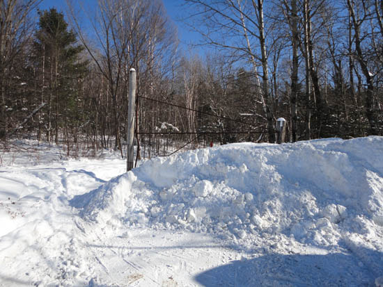
The Glencliff Trail trailhead at the edge of the parking area
Looking up the Moosilauke Carriage Road with a near-full moon rising near the Mt. Moosilauke summit

Looking at the Franconia Ridge, Bonds, and Presidentials from Mt. Moosilauke
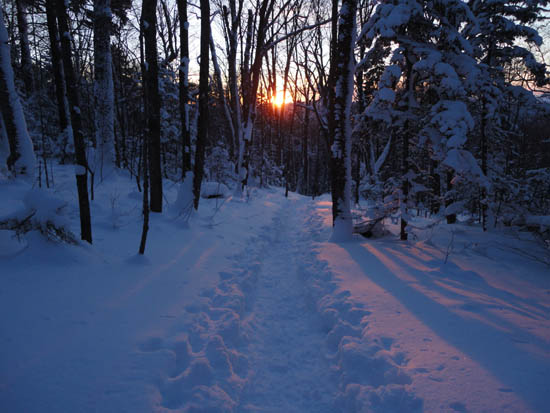
The sunset from the Glencliff Trail
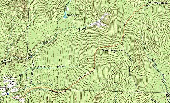

Directions to trailhead: Take Route 25 West from Plymouth to Glencliff. Take a right onto High Street. The Glencliff Trail parking area will be a few minutes up this road on the right. The trail can be accessed either from the back of the parking lot or a few hundred feet downhill.
Back to Mt. Moosilauke Profile
|