Home
States
Colorado
Connecticut
Maine
Massachusetts
New Hampshire
New York
Rhode Island
Utah
Vermont
View All
Lists
NE 4,000 Footers
NE 100 Highest
NH 4,000 Footers
NH 100 Highest
NH 52 With A View
NH Belknap Range
NH Ossipee 10
Links
Trail Conditions
Trip Log
Sunrises
Sunsets
About
|
Mt. Moosilauke, Mt. Moosilauke - South Peak
Warren, NH, Woodstock, NH, Benton, NH
Trailheads, measurements, times, distances, and maps are all approximate and relative to the hike(s) as shown below.
Looking up the Gorge Brook Trail
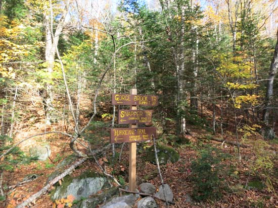
Route: Gorge Brook Trail, Gorge Brook Slide Trail, Moosilauke Carriage Road, (Mt. Moosilauke), Moosilauke Carriage Road, South Peak Spur, (Mt. Moosilauke - South Peak), South Peak Spur, Moosilauke Carriage Road, abandoned Snapper Trail, Snapper Trail, Gorge Brook Trail
Open trails were generally dry and in good shape.
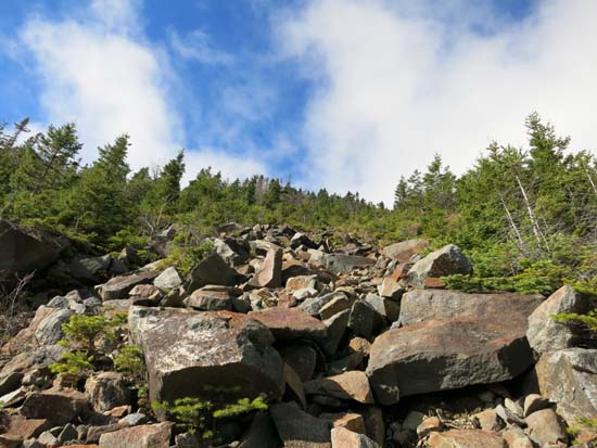
From the last sure water sign on the Gorge Brook Trail, we crossed the brook, then bushwhacked through generally open woods to the bottom of the headwall. There are a few old slides, so at the moment it can be tough to pick up the right one. A very old axe blaze helped us out.
Once on the slide, there are some old orange-black-orange DOC blazes on some rocks. It's not a terribly open slide, but there are some extended areas of dirt/ledge with views. Above the slide, the trail is fairly easy to follow up to the Carriage Road (it pops onto the Carriage Road at an otherwise easy to miss waterbar, below the gateway).
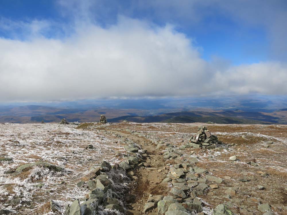
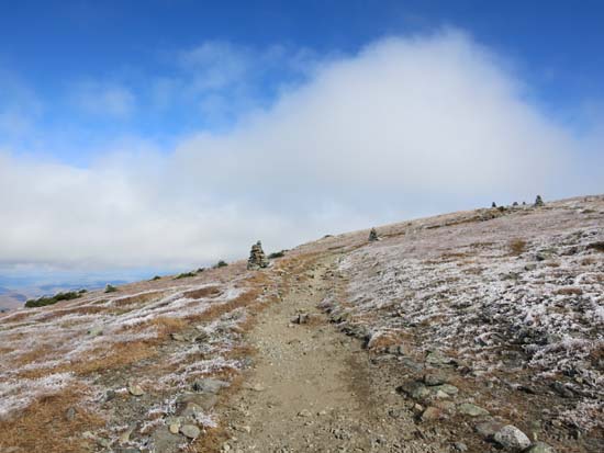
Vegetation above treeline was coated in rime ice this morning, but there was no ice on the actual footbed, so no traction was needed. Cold winds up top!
On the descent, we took the old Snapper Trail (there's a wide area of the Carriage Road with a boulder like bench on the opposite side), which was easy to follow and had halfway decent footing.
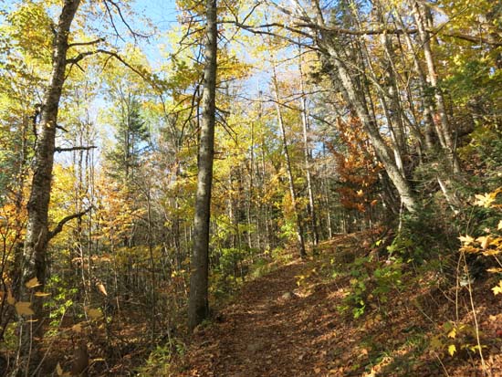
Still some foliage in the lower elevations.
Ravine Lodge and related facilities were signed as closed to the hoi polloi due to an 'exclusive event.' Yet I didn't see John Kerry's motorcade there.
| Hike Ratings |
|
Getting To Trailhead: |
Easy |
| Destination: |
Mt. Moosilauke |
|
Length: |
Moderate |
|
Steepness: |
Very Difficult |
|
Navigation: |
Difficult |
|
Views: |
Excellent |
|
Crowds: |
Heavy |
| Destination: |
Mt. Moosilauke (South Peak) |
|
Length: |
Moderate |
|
Steepness: |
Difficult |
|
Navigation: |
Easy |
|
Views: |
Excellent |
|
Crowds: |
Heavy |
|
| Hike Stats |
|
Date Hiked: |
Sunday, October 12, 2014 |
| Parking Elevation: |
2,500' |
| Destination: |
Mt. Moosilauke |
| Time Elapsed: |
2:26 |
| Trailhead Elevation: |
2,340' |
| Summit Elevation: |
4,802' |
| Vertical Gain: |
2,512' |
| Destination: |
Mt. Moosilauke (South Peak) |
| Time Elapsed: |
00:28 |
| Trailhead Elevation: |
1,490' |
| Summit Elevation: |
4,802' |
| Vertical Gain: |
103' |
|
|
| Hike Time Elapsed: |
04:39 |
| Hike Vertical Gain: |
2,690' |
|
The Gorge Brook Trail trailhead at the end of the Class of 1982 Bridge
Looking up the abandoned Gorge Brook Slide Trail
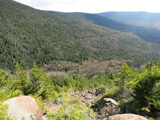
Looking down the abandoned Gorge Brook Slide Trail

Looking southwest from near the Mt. Moosilauke summit
The Carriage Road between the peaks
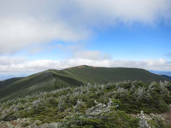
Looking at Moosilauke from South Peak
Directions to trailhead: Take Route 112 West to Route 118 south/west. Ravine Road will be on the right shortly after the height of land. Go down this dirt road and bear right. Limited parking available on the side of the road. Walk straight ahead past the kiosk, then take the first left, go left again, then go right across the bridge. The Gorge Brook Trail starts on the left thereafter.
Back to Mt. Moosilauke Profile
Back to Mt. Moosilauke (South Peak) Profile
|