Home
States
Colorado
Connecticut
Maine
Massachusetts
New Hampshire
New York
Rhode Island
Utah
Vermont
View All
Lists
NE 4,000 Footers
NE 100 Highest
NH 4,000 Footers
NH 100 Highest
NH 52 With A View
NH Belknap Range
NH Ossipee 10
Links
Trail Conditions
Trip Log
Sunrises
Sunsets
About
|
Mt. Moosilauke
Warren, NH, Woodstock, NH, Benton, NH
Trailheads, measurements, times, distances, and maps are all approximate and relative to the hike(s) as shown below.
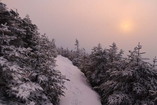
The Gorge Brook Trail after sunrise
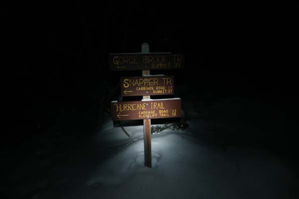
Route: Gorge Brook Trail
Ravine Lodge Road walk was a little icy, but barebootable.
I booted Gorge Brook Trail in the vicinity of the brook, but switched to snowshoes at last water. About 1 to 2 feet of snowpack down low. Firm footbed with a half inch of powder on top, garnished with postholes.
Above last water, snowpack increased to 3 to 4 feet. The inch of powder over hardpack made snowshoes the best traction choice. Ridiculous number of postholes, many of which were concealed by the drifted powder. Some so bad that the footbed as moved into the woods to get around them. Thank you barebooters for your sacrifice.
Above treeline, lots of exposed rock with a little snow and ice mixed in. I kept my snowshoes on because I didn't want to swap out of them in the cold/wind at sunrise, but otherwise would have Microspiked that section. Still some hardpack drifts.
Cold, windy morning with the summit engulfed in a cloud, but was able to get pre and post sunrise colors from just below treeline.
| Hike Ratings |
|
Getting To Trailhead: |
Moderate |
| Destination: |
Mt. Moosilauke |
|
Length: |
Moderate |
|
Steepness: |
Moderate |
|
Navigation: |
Difficult |
|
Views: |
Excellent |
|
Crowds: |
Minimal |
|
| Hike Stats |
|
Date Hiked: |
Friday, March 3, 2017 |
| Time to Trailhead: |
00:14 |
| Distance: |
0.8 mile |
| Parking Elevation: |
2,400' |
| Destination: |
Mt. Moosilauke |
| Time Elapsed: |
01:49 |
| Trailhead Elevation: |
2,340' |
| Summit Elevation: |
4,802' |
| Distance: |
3.6 miles |
| Vertical Gain: |
2,512' |
|
|
| Hike Time Elapsed: |
03:54 |
| Hike Vertical Gain: |
2,822' |
|
The Gorge Brook Trail trailhead at the end of the Class of 1982 Bridge
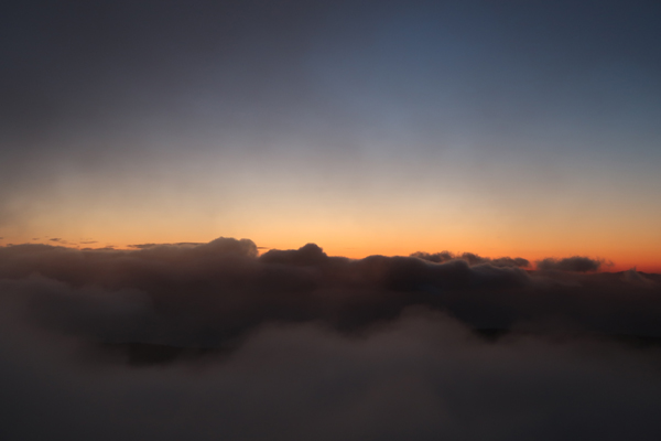
Sunrise colors below the Mt. Moosilauke summit
Directions to trailhead: Take Route 112 West to Route 118 south/west. Ravine Road will be on the right shortly after the height of land. Due to lodge construction in winter 2016-17, Ravine Lodge Road was open to within 0.8 miles of the summer trailhead.
Back to Mt. Moosilauke Profile
|

