Home
States
Colorado
Connecticut
Maine
Massachusetts
New Hampshire
New York
Rhode Island
Utah
Vermont
View All
Lists
NE 4,000 Footers
NE 100 Highest
NH 4,000 Footers
NH 100 Highest
NH 52 With A View
NH Belknap Range
NH Ossipee 10
Links
Trail Conditions
Trip Log
Sunrises
Sunsets
About
|
Mt. Moosilauke
Warren, NH, Woodstock, NH, Benton, NH
Trailheads, measurements, times, distances, and maps are all approximate and relative to the hike(s) as shown below.

The eroded Gorge Brook Trail
Route: Gorge Brook Trail, Carriage Road, Snapper Trail
Started before 7, but still encountered quite a few hikers this morning. Trails were generally dry with some mud and running water in the usual places. Lots of white flowers of various types in bloom up high. Sad to see the continued erosion, but good to see some new steps and waterbars being constructed on the Carriage Road. Temperatures weren't too bad for the ascent, though it looks to be another scorcher today.
| Hike Ratings |
|
Getting To Trailhead: |
Easy |
| Destination: |
Mt. Moosilauke |
|
Length: |
Moderate |
|
Steepness: |
Moderate |
|
Navigation: |
Easy |
|
Views: |
Excellent |
|
Crowds: |
Moderate |
|
| Hike Stats |
|
Date Hiked: |
Wednesday, July 4, 2018 |
| Parking Elevation: |
2,500' |
| Destination: |
Mt. Moosilauke |
| Time Elapsed: |
01:18 |
| Trailhead Elevation: |
2,340' |
| Summit Elevation: |
4,802' |
| Vertical Gain: |
2,512' |
|
|
| Hike Time Elapsed: |
02:40 |
| Hike Vertical Gain: |
2,822' |
|

The Gorge Brook Trail trailhead at the end of the Class of 1982 Bridge

Looking down the Gorge Brook Trail near the Mt. Moosilauke summit
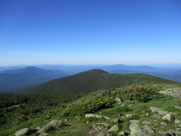
Looking at South Peak from the Mt. Moosilauke summit
Directions to trailhead: Take Route 112 West to Route 118 south/west. Ravine Road will be on the right shortly after the height of land. Go down this dirt road and bear right. Limited parking available on the side of the road. Walk straight ahead past the kiosk, then take the first left, go left again, then go right across the bridge. The Gorge Brook Trail starts on the left thereafter.
Back to Mt. Moosilauke Profile
|

