Home
States
Colorado
Connecticut
Maine
Massachusetts
New Hampshire
New York
Rhode Island
Utah
Vermont
View All
Lists
NE 4,000 Footers
NE 100 Highest
NH 4,000 Footers
NH 100 Highest
NH 52 With A View
NH Belknap Range
NH Ossipee 10
Links
Trail Conditions
Trip Log
Sunrises
Sunsets
About
|
Mt. Moosilauke
Warren, NH, Woodstock, NH, Benton, NH
Trailheads, measurements, times, distances, and maps are all approximate and relative to the hike(s) as shown below.
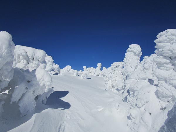
The Gorge Brook Trail near treeline
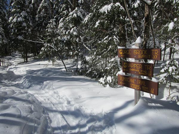
Route: Gorge Brook Trail
A quick survey of the parking lot on the return revealed the source of footbed damage: Connecticut and Massachusetts plates. Please don't play into the stereotype; come bearing snowshoes!
Gorge Brook Trail had a few inches of untouched powder on it this morning (in addition to the powder from the previous few storms this week). The footbed underneath the powder is not firm. Snowshoes were ideal. Plenty of snow from the get go, with no bony sections. Perhaps 2 feet down low, increasing to 4 feet higher up. Only saw ski tracks heading up Snapper.
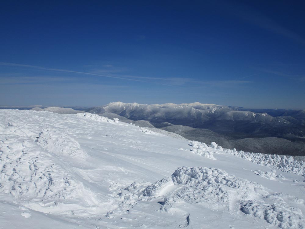
Near treeline, snowpack had drifted to perhaps 5 feet in places. One of the signs is at the same level as the snowpack. Above treeline on this side had full snow cover, with skiers partaking. Not at all bony either. Still some active snow drifting.
Clear skies this morning with temperatures rising from below zero to the 20s. Frigid wind above treeline, but not particularly strong.
| Hike Ratings |
|
Getting To Trailhead: |
Moderate |
| Destination: |
Mt. Moosilauke |
|
Length: |
Moderate |
|
Steepness: |
Moderate |
|
Navigation: |
Difficult |
|
Views: |
Excellent |
|
Crowds: |
Minimal |
|
| Hike Stats |
|
Date Hiked: |
Saturday, February 15, 2020 |
| Time to Trailhead: |
00:23 |
| Distance: |
0.8 mile |
| Parking Elevation: |
2,400' |
| Destination: |
Mt. Moosilauke |
| Time Elapsed: |
01:57 |
| Trailhead Elevation: |
2,340' |
| Summit Elevation: |
4,802' |
| Distance: |
3.6 miles |
| Vertical Gain: |
2,512' |
|
|
| Hike Time Elapsed: |
03:59 |
| Hike Vertical Gain: |
2,822' |
|
The Gorge Brook Trail trailhead at the end of the Class of 1982 Bridge
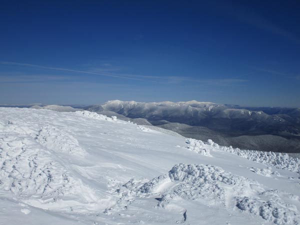
Looking at the Franconia Ridge and Presidential Range from the Mt. Moosilauke summit
Directions to trailhead: Take Route 112 West to Route 118 south/west. Ravine Road will be on the right shortly after the height of land. In winter 2019-20, Ravine Lodge Road was open to within 0.8 miles of the summer trailhead.
Back to Mt. Moosilauke Profile
|