Home
States
Colorado
Connecticut
Maine
Massachusetts
New Hampshire
New York
Rhode Island
Utah
Vermont
View All
Lists
NE 4,000 Footers
NE 100 Highest
NH 4,000 Footers
NH 100 Highest
NH 52 With A View
NH Belknap Range
NH Ossipee 10
Links
Trail Conditions
Trip Log
Sunrises
Sunsets
About
|
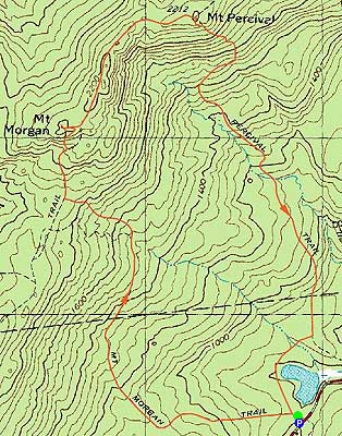
Mt. Morgan, Mt. Percival
Campton, NH, Holderness, NH
Trailheads, measurements, times, distances, and maps are all approximate and relative to the hike(s) as shown below.
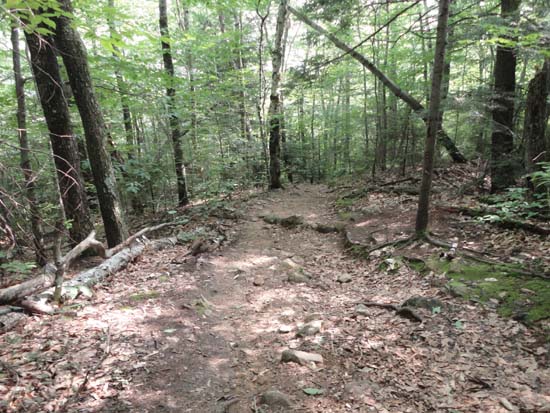
Looking down the Mt. Morgan Trail
Route: Mt. Morgan Trail, Crawford-Ridgepole Trail, Mt. Percival Trail, Morse Trail
Mt. Morgan Trail was mostly dry, but rather muddy in a few places. There are usually stepping stones to help go around the mud.
Crawford Ridgepole Trail between the peaks was mostly dry, as were the Mt. Percival and Morse Trails.
Blueberries between the peaks and on Mt. Percival. Temperatures in the 90s, but a little bit of wind to make things somewhat bearable.
| Hike Ratings |
|
Getting To Trailhead: |
Easy |
| Destination: |
Mt. Morgan |
|
Length: |
Moderate |
|
Steepness: |
Difficult |
|
Navigation: |
Easy |
|
Views: |
Excellent |
|
Crowds: |
Minimal |
| Destination: |
Mt. Percival |
|
Length: |
Moderate |
|
Steepness: |
Difficult |
|
Navigation: |
Easy |
|
Views: |
Excellent |
|
Crowds: |
Minimal |
|
| Hike Stats |
|
Date Hiked: |
Friday, July 19, 2013 |
| Parking Elevation: |
810' |
| Destination: |
Mt. Morgan |
| Time Elapsed: |
00:44 |
| Trailhead Elevation: |
820' |
| Summit Elevation: |
2,220' |
| Distance: |
2.1 miles |
| Vertical Gain: |
1,440' |
| Destination: |
Mt. Percival |
| Time Elapsed: |
00:21 |
| Trailhead Elevation: |
2,220' |
| Summit Elevation: |
2,212' |
| Distance: |
.8 mile |
| Vertical Gain: |
160' |
|
|
| Hike Time Elapsed: |
02:09 |
| Hike Distance: |
5 miles |
| Hike Vertical Gain: |
1,740' |
|
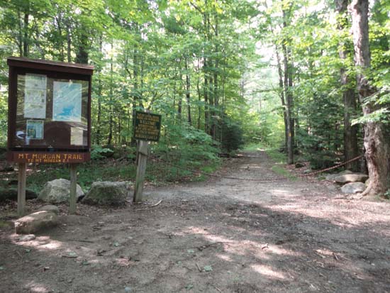
Mt. Morgan Trail trailhead
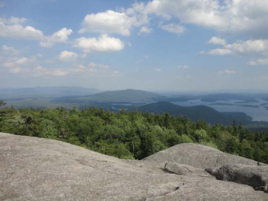
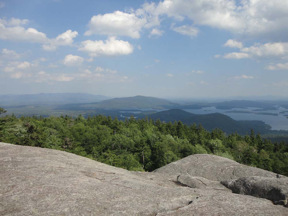
Looking at the Ossipees, Red Hill, and Rattlesnakes from the Mt. Morgan ledges
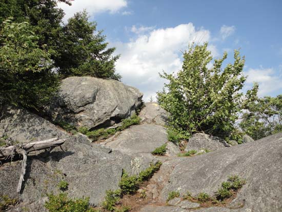
Crawford-Ridgepole trail from Mt. Morgan to Mt. Percival
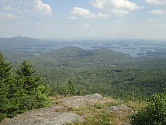
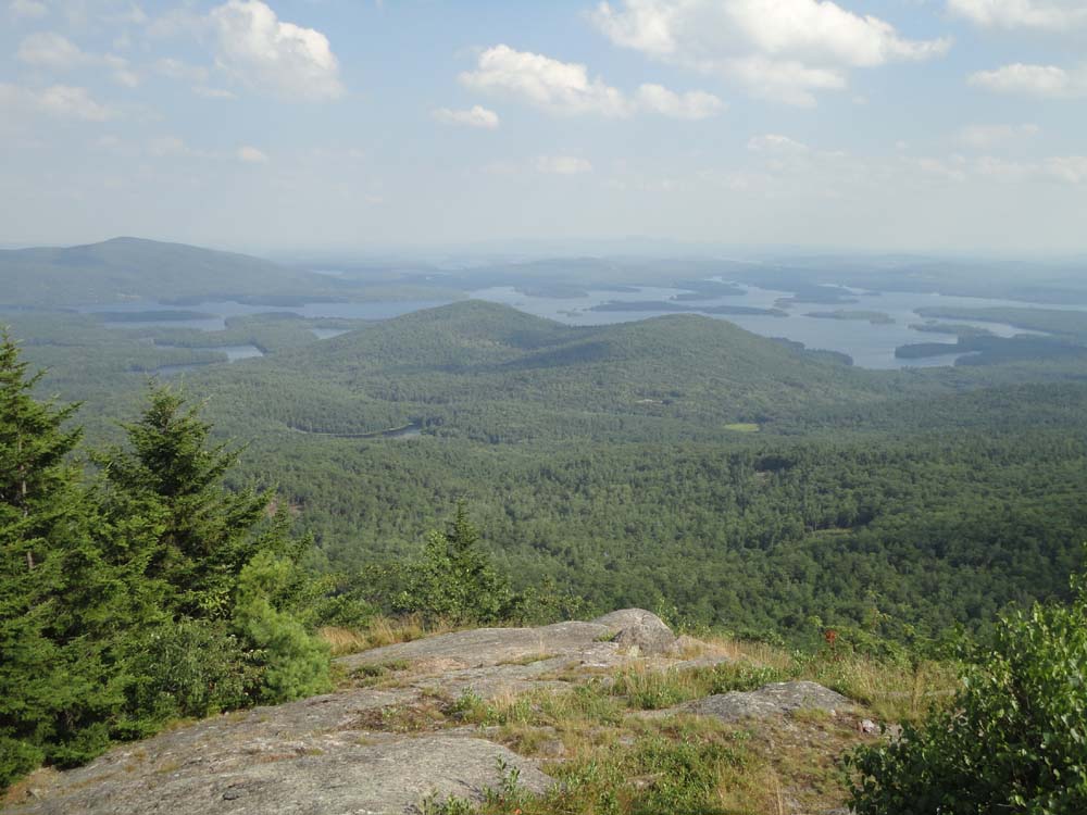
The Rattlesnakes and Squam Lake as seen from Mt. Percival

Directions to trailhead: Mt. Morgan trailhead parking is located on Route 113, west of Sandwich, across from the Old Bridle Path (West Rattlensnake) lot.
Back to Mt. Morgan Profile
Back to Mt. Percival Profile
|