Home
States
Colorado
Connecticut
Maine
Massachusetts
New Hampshire
New York
Rhode Island
Utah
Vermont
View All
Lists
NE 4,000 Footers
NE 100 Highest
NH 4,000 Footers
NH 100 Highest
NH 52 With A View
NH Belknap Range
NH Ossipee 10
Links
Trail Conditions
Trip Log
Sunrises
Sunsets
About
|
Mt. Moriah
Gorham, NH, Bean's Purchase, NH
Trailheads, measurements, times, distances, and maps are all approximate and relative to the hike(s) as shown below.
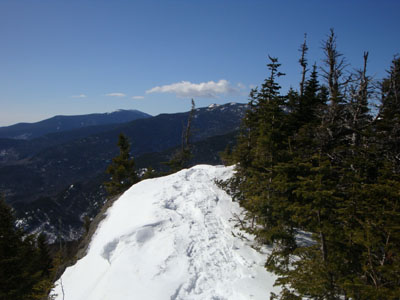
Looking down the Carter-Moriah Trail
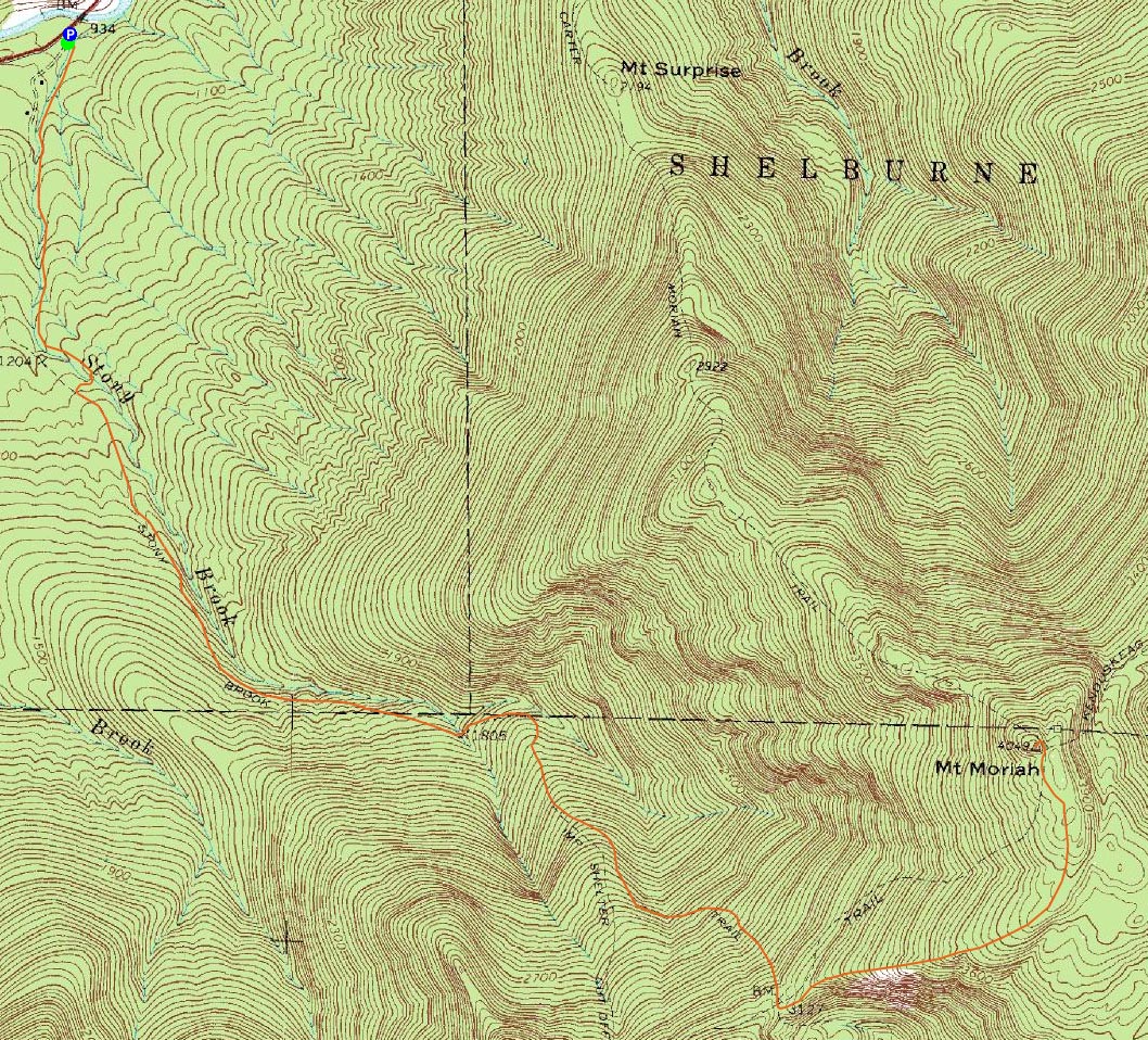
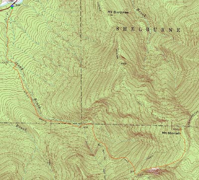
Route: Stony Brook Trail, Carter-Moriah Trail, (Mt. Moriah), Carter-Moriah Trail, Stony Brook Trail
With a beautiful, but slightly windy spring day forecasted, I decided to try out a new-to-me trail, the Stony Brook Trail. Arriving about an hour or so behind schedule, I was surprised to see that I was the first day hiker vehicle in the parking lot (as evidenced by frost on the other one).
Though the trail was rock hard, I decided to wear my snowshoes rather than carry them. The first section of trail was fairly flat. In fact, until reaching the second non-wood-bridged water crossing, the pitch was minimal.
After crossing a small creek, the trail quickly picked up in pitch, though never becoming overly steep. At one point, I reached an apparent three way junction. Not seeing any blazes, I was able to quickly figure out that option 1 was wrong and option 2 and 3 joined back together a few dozen feet later.
Reaching the height of land and thus the Carter-Moriah Trail, I could tell the day was going to be amazing. This section of trail worked its way across the ridge, passing many awesome viewpoints. Though there were some ups and downs, the scenery more than made up for it.
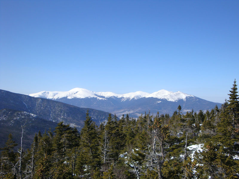
Reaching the summit, I had some lunch and took in the tremendous views - the Presidentials were in the clear and peaks up toward the Rangeley region were visible.
While the trail was softening up a bit for the descent, things still stayed fairly firm, preventing any messy spring conditions. What a beautiful day!
| Hike Ratings |
|
Getting To Trailhead: |
Easy |
| Destination: |
Mt. Moriah |
|
Length: |
Moderate |
|
Steepness: |
Difficult |
|
Navigation: |
Moderate |
|
Views: |
Excellent |
|
Crowds: |
Minimal |
|
| Hike Stats |
|
Date Hiked: |
Saturday, March 14, 2009 |
| Hike Commenced: |
8:56 AM |
| Parking Elevation: |
930' |
| Destination: |
Mt. Moriah |
| Ascent Commenced: |
8:56 AM |
| Summit Reached: |
11:16 AM |
| Time Elapsed: |
02:20 |
| Trailhead Elevation: |
935' |
| Summit Elevation: |
4,049' |
| Distance: |
5 miles |
| Vertical Gain: |
3,329' |
|
|
| Hike Ended: |
1:27 PM |
| Hike Time Elapsed: |
04:31 |
| Hike Vertical Gain: |
3,549' |
|
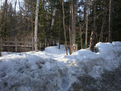
The Stony Brook Trail trailhead

Looking at the Presidentials from the summit of Mt. Moriah

Directions to trailhead: Take Route 16 North from Pinkham Notch. The Stony Brook parking area will be on the right, at the beginning of Mt. Carter Road. The Stony Brook Trail trailhead is a few dozen feet further up Mt. Carter Road, on the left.
Back to Mt. Moriah Profile
|