Home
States
Colorado
Connecticut
Maine
Massachusetts
New Hampshire
New York
Rhode Island
Utah
Vermont
View All
Lists
NE 4,000 Footers
NE 100 Highest
NH 4,000 Footers
NH 100 Highest
NH 52 With A View
NH Belknap Range
NH Ossipee 10
Links
Trail Conditions
Trip Log
Sunrises
Sunsets
About
|
Mt. Moriah
Gorham, NH, Bean's Purchase, NH
Trailheads, measurements, times, distances, and maps are all approximate and relative to the hike(s) as shown below.
The Carter Moriah Trail
Route: Mt. Carter Road, old Stony Brook Trail, Stony Brook Trail, Carter-Moriah Trail, (Mt. Moriah), Carter-Moriah Trail, Stony Brook Trail, old Stony Brook Trail, Mt. Carter Road
The old Stony Brook Trail hadn't seen any activity since the last precip event, so it was a bit crusty. Snowshoes needed.
Upon joining the current trail, it was sort of loose granular. Down low, the snowpack is perhaps 1 foot deep. However, above the top brook crossing, it quickly increases to about 3 feet deep. Had a chuckle from seeing evidence of barebooters postholing up to their nether-regions.
Snowshoes were very useful on the ridge, as the footbed deviates from the trail in a few open areas and postholers were doing a good job at finding spruce traps. The steep chute up to Moriah proper was pretty well filled in with only about a foot of blue ice to step over.
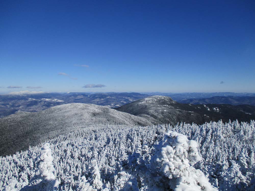
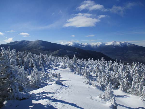
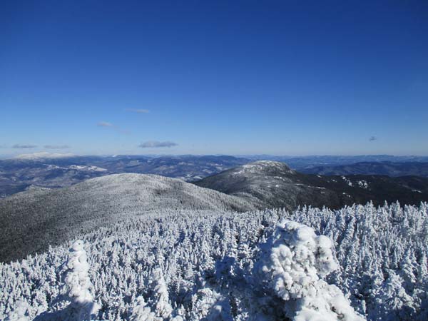
Noted some Microspike tracks from the Bangor Road side. No sign of recent activity heading southbound to Imp, down Moriah Brook, or over on Kenduskeag. Saw no other hikers today. Cold temps, but nice blue skies this morning and views reaching up to the Rangeley 4Ks.
| Hike Ratings |
|
Getting To Trailhead: |
Easy |
| Destination: |
Mt. Moriah |
|
Length: |
Moderate |
|
Steepness: |
Difficult |
|
Navigation: |
Moderate |
|
Views: |
Excellent |
|
Crowds: |
Minimal |
|
| Hike Stats |
|
Date Hiked: |
Sunday, January 8, 2017 |
| Parking Elevation: |
930' |
| Destination: |
Mt. Moriah |
| Time Elapsed: |
02:57 |
| Trailhead Elevation: |
1,195' |
| Summit Elevation: |
4,049' |
| Vertical Gain: |
2,994' |
|
|
| Hike Time Elapsed: |
04:58 |
| Hike Vertical Gain: |
3,399' |
|
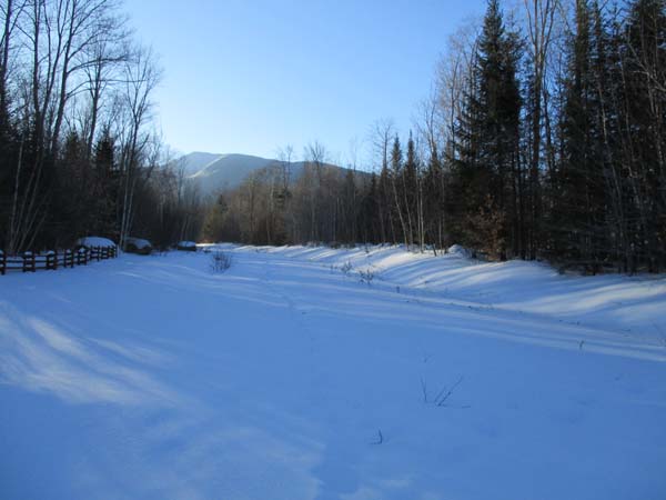
The old Stony Brook Trail trailhead
Looking at Shelburne Moriah from Mt. Moriah
Directions to trailhead: Take Route 16 North from Pinkham Notch. The Stony Brook parking area will be on the right, at the beginning of Mt. Carter Road. To reach the old Stony Brook Trail, not posted as of early fall 2010, continue on foot up Mt. Carter Road, eventually bearing left onto a straight grassy road. The old Stony Brook Trail starts at the end of that road, adjacent to some boulders.
Back to Mt. Moriah Profile
|